TopoQuest Logo
Do you find TopoQuest useful?
Help keep TopoQuest running and adding new maps/features by donating!
Bitcoin:  19c7KJd3qBynnjoSw5npx9KScwjBe4ifkT
Litecoin:  LXs6TkuXGGXo1vDsWCkWVdjQX94eUKd6ui
Home View Maps Find Maps Find Places Resources & Links


Potomac, Illinois Topographic Map

USGS Map Title: Potomac, IL
USGS Map MRC: 40087C7
DRG (GeoTIFF) Download: o40087c7.tif


Neighboring USGS Topographic Map Quads:


  Rankin, IL  
40087D8
 

  East Lynn, IL  
40087D7
 

  Hoopeston, IL  
40087D6
 

  Penfield, IL  
40087C8
 

  Potomac, IL  
40087C7
 

  Henning, IL  
40087C6
 

  Royal, IL  
40087B8
 

  Collison, IL  
40087B7
 

  Danville NW, IL  
40087B6


Map MRC Location:

N41°
W88°
N41°
W87°
H8 H7 H6 H5 H4 H3 H2 H1
G8 G7 G6 G5 G4 G3 G2 G1
F8 F7 F6 F5 F4 F3 F2 F1
E8 E7 E6 E5 E4 E3 E2 E1
D8 D7 D6 D5 D4 D3 D2 D1
C8 C7 C6 C5 C4 C3 C2 C1
B8 B7 B6 B5 B4 B3 B2 B1
A8 A7 A6 A5 A4 A3 A2 A1
N40°
W88°
N40°
W87°

Potomac, IL USGS 1:24K Topographic Map Preview:
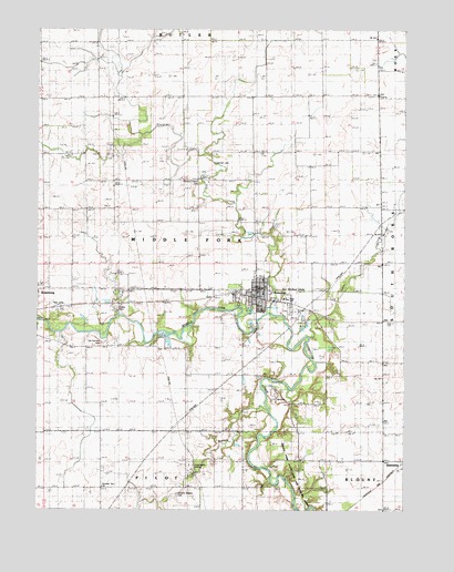
Potomac, IL USGS Topographic Map
Click on map above to begin viewing in our Map Viewer.

This topographic map contains these locations and features:
Feature Name Type Latitude Longitude GNIS ID View Map
Bass FordCrossingN40.2992°W87.8436°1764526View Map
Bean CreekStreamN40.2948°W87.7822°404002View Map
Bean Creek School (historical)SchoolN40.3289°W87.7584°1764527View Map
Biddle School (historical)SchoolN40.3575°W87.7836°1764528View Map
Blue Grass (historical)Populated PlaceN40.3575°W87.8259°1823596View Map
Bluegrass CreekStreamN40.3009°W87.7970°404613View Map
Bluegrass Fire Protection DistrictBuildingN40.3071°W87.8043°2681859View Map
Bluegrass School (historical)SchoolN40.3581°W87.8256°1764529View Map
City ParkParkN40.3050°W87.8067°1764445View Map
Covenant High SchoolSchoolN40.3439°W87.8248°406675View Map
Gray FordCrossingN40.2836°W87.7953°422752View Map
Green Valley School (historical)SchoolN40.3292°W87.7817°1764535View Map
Hawbuck School (historical)SchoolN40.2853°W87.7720°1764536View Map
Ingersoll CemeteryCemeteryN40.3398°W87.8142°410892View Map
Knight's Branch CemeteryCemeteryN40.2541°W87.8269°411578View Map
Knights BranchStreamN40.2761°W87.7970°411577View Map
Knights Branch School (historical)SchoolN40.2567°W87.8242°1764537View Map
Middle Fork State Fish and Wildlife AreasParkN40.2595°W87.7939°1764489View Map
Middlefork Ambulance ServiceBuildingN40.3070°W87.8046°2673910View Map
Number Ten ChurchChurchN40.2559°W87.8528°414736View Map
Old Partlow CemeteryCemeteryN40.2937°W87.8536°415422View Map
PotomacPopulated PlaceN40.3050°W87.8006°416074View Map
Potomac CemeteryCemeteryN40.3017°W87.7892°1966087View Map
Potomac CemeteryCemeteryN40.3024°W87.7889°1951098View Map
Potomac Elementary SchoolSchoolN40.3056°W87.8011°1823635View Map
Potomac Elementary SchoolSchoolN40.3050°W87.7911°1823640View Map
Potomac Post OfficePost OfficeN40.3056°W87.8010°2788491View Map
School Number 10 (historical)SchoolN40.2553°W87.8531°1764548View Map
Selsor FordCrossingN40.2589°W87.7953°1764550View Map
Selsor FordCrossingN40.2589°W87.7950°423174View Map
Tillotson School (historical)SchoolN40.2634°W87.7811°1764551View Map
Township of MiddleforkCivilN40.3210°W87.8441°429359View Map
Village of PotomacCivilN40.3067°W87.7976°2399011View Map
Wallace ChapelChurchN40.3356°W87.8200°420428View Map
Wallace Chapel CemeteryCemeteryN40.3356°W87.8198°1764516View Map
Williams School (historical)SchoolN40.2848°W87.8142°1764553View Map
Wise School (historical)SchoolN40.3359°W87.8561°1764554View Map

Note: Coordinates in the location and feature list above are referenced to NAD83 datum.


Copyright (C) 2008-2024 Ryan Niemi / Sunset Dynamics ... All Rights Reserved