TopoQuest Logo
Do you find TopoQuest useful?
Help keep TopoQuest running and adding new maps/features by donating!
Bitcoin:  19c7KJd3qBynnjoSw5npx9KScwjBe4ifkT
Litecoin:  LXs6TkuXGGXo1vDsWCkWVdjQX94eUKd6ui
Home View Maps Find Maps Find Places Resources & Links


Poskin, Wisconsin Topographic Map

USGS Map Title: Poskin, WI
USGS Map MRC: 45091D8
DRG (GeoTIFF) Download: o45091d8.tif


Neighboring USGS Topographic Map Quads:


  Cumberland, WI  
45092E1
 

  Lower Vermillion Lake, WI  
45091E8
 

  Haugen, WI  
45091E7
 

  Almena, WI  
45092D1
 

  Poskin, WI  
45091D8
 

  Barron, WI  
45091D7
 

  Arland, WI  
45092C1
 

  Dorrity Creek, WI  
45091C8
 

  Dallas, WI  
45091C7


Map MRC Location:

N46°
W92°
N46°
W91°
H8 H7 H6 H5 H4 H3 H2 H1
G8 G7 G6 G5 G4 G3 G2 G1
F8 F7 F6 F5 F4 F3 F2 F1
E8 E7 E6 E5 E4 E3 E2 E1
D8 D7 D6 D5 D4 D3 D2 D1
C8 C7 C6 C5 C4 C3 C2 C1
B8 B7 B6 B5 B4 B3 B2 B1
A8 A7 A6 A5 A4 A3 A2 A1
N45°
W92°
N45°
W91°

Poskin, WI USGS 1:24K Topographic Map Preview:
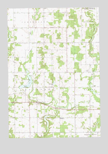
Poskin, WI USGS Topographic Map
Click on map above to begin viewing in our Map Viewer.

This topographic map contains these locations and features:
Feature Name Type Latitude Longitude GNIS ID View Map
Berg FarmsLocaleN45.4967°W91.9858°2664064View Map
Collingwood School (historical)SchoolN45.4805°W91.9291°1837898View Map
Coolidge School (historical)SchoolN45.4530°W91.9757°1837900View Map
Crist Miller SchoolSchoolN45.4678°W91.8997°2713426View Map
Crystal Bay LakeLakeN45.4275°W91.9379°1563577View Map
Ebenezer CemeteryCemeteryN45.4350°W91.9921°1564418View Map
Ebenezer Church (historical)ChurchN45.4386°W91.9916°1837917View Map
Engle CreekStreamN45.4755°W91.8816°1564655View Map
Field School (historical)SchoolN45.4994°W91.8835°1837922View Map
Garfield School (historical)SchoolN45.4236°W91.9355°1837931View Map
La Follette School (historical)SchoolN45.4658°W91.8774°1837957View Map
Lutheran CemeteryCemeteryN45.4055°W91.8896°1568818View Map
Paul Revere Community CenterBuildingN45.3938°W91.9310°1571090View Map
Pine Grove School (historical)SchoolN45.4519°W91.9399°1837980View Map
PoskinPopulated PlaceN45.4091°W91.9616°1571817View Map
Poskin Church (historical)ChurchN45.4236°W91.9452°1837986View Map
Poskin LakeLakeN45.4247°W91.9763°1571819View Map
Poskin Lutheran CemeteryCemeteryN45.4238°W91.9452°1571818View Map
Revere School (historical)SchoolN45.3938°W91.9310°1837994View Map
Saint Lukes CemeteryCemeteryN45.4813°W91.9368°1573224View Map
Saint Lukes Church (historical)ChurchN45.4813°W91.9357°1838009View Map
Silver Sky FarmLocaleN45.4219°W91.9647°2664061View Map
Sweeney Pond 6ReservoirN45.3920°W91.9493°1792752View Map
Sweeny PondStreamN45.4050°W91.9346°1575177View Map
Sweeny Pond Creek 2WP1824 DamDamN45.3950°W91.9485°1792751View Map
Town of ClintonCivilN45.4234°W91.9708°1582982View Map
Vermillion RiverStreamN45.4175°W91.8821°1576060View Map
Yellow River School (historical)SchoolN45.4375°W91.8891°1838038View Map
Yellow River State Public Fishery AreaParkN45.5000°W91.8893°1577091View Map

Note: Coordinates in the location and feature list above are referenced to NAD83 datum.


Copyright (C) 2008-2024 Ryan Niemi / Sunset Dynamics ... All Rights Reserved