TopoQuest Logo
Do you find TopoQuest useful?
Help keep TopoQuest running and adding new maps/features by donating!
Bitcoin:  19c7KJd3qBynnjoSw5npx9KScwjBe4ifkT
Litecoin:  LXs6TkuXGGXo1vDsWCkWVdjQX94eUKd6ui
Home View Maps Find Maps Find Places Resources & Links


Portal, Arizona Topographic Map

USGS Map Title: Portal, AZ
USGS Map MRC: 31109H2
DRG (GeoTIFF) Download: o31109h2.tif


Neighboring USGS Topographic Map Quads:


  Cochise Head, AZ  
32109A3
 

  Blue Mountain, AZ  
32109A2
 

  San Simon Cienega, NM  
32109A1
 

  Rustler Park, AZ  
31109H3
 

  Portal, AZ  
31109H2
 

  Portal NE, AZ  
31109H1
 

  Chiricahua Peak, AZ  
31109G3
 

  Portal Peak, AZ  
31109G2
 

  Rodeo, NM  
31109G1


Map MRC Location:

N32°
W110°
N32°
W109°
H8 H7 H6 H5 H4 H3 H2 H1
G8 G7 G6 G5 G4 G3 G2 G1
F8 F7 F6 F5 F4 F3 F2 F1
E8 E7 E6 E5 E4 E3 E2 E1
D8 D7 D6 D5 D4 D3 D2 D1
C8 C7 C6 C5 C4 C3 C2 C1
B8 B7 B6 B5 B4 B3 B2 B1
A8 A7 A6 A5 A4 A3 A2 A1
N31°
W110°
N31°
W109°

Portal, AZ USGS 1:24K Topographic Map Preview:
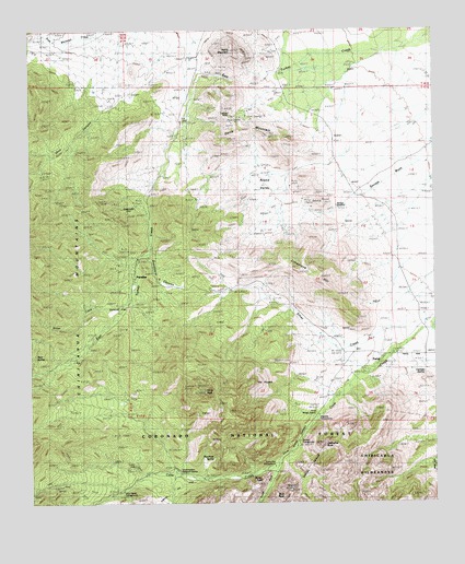
Portal, AZ USGS Topographic Map
Click on map above to begin viewing in our Map Viewer.

This topographic map contains these locations and features:
Feature Name Type Latitude Longitude GNIS ID View Map
Bagwell RanchLocaleN31.9245°W109.1270°21917View Map
Cathedral RockSummitN31.8901°W109.1598°2568View Map
Cave Creek CanyonValleyN31.8962°W109.1637°2588View Map
Cave Creek Regional ParkParkN31.8890°W109.1689°21977View Map
Chiricahua TankReservoirN31.9447°W109.2325°21987View Map
Cienega SpringSpringN31.9093°W109.1289°2937View Map
Cochise MineMineN31.9781°W109.1884°3073View Map
Davis MountainSummitN31.9706°W109.1895°3728View Map
GaleyvillePopulated PlaceN31.9504°W109.2184°24426View Map
Harris MountainSummitN31.9943°W109.1884°5578View Map
Hummingbird SpringSpringN31.9009°W109.1364°6112View Map
Idlewilde Forest CampLocaleN31.8918°W109.1664°6176View Map
Jhus CanyonValleyN31.9818°W109.2223°6409View Map
John Hands Picnic GroundParkN31.8768°W109.2226°6448View Map
Mount SceloporusSummitN31.9020°W109.1903°24260View Map
Onion CreekStreamN31.9273°W109.2220°8995View Map
ParadisePopulated PlaceN31.9348°W109.2190°9192View Map
Paradise CemeteryCemeteryN31.9317°W109.2082°9195View Map
Peach Tree SpringSpringN31.8873°W109.1941°22166View Map
PortalPopulated PlaceN31.9137°W109.1414°9657View Map
Portal Elementary SchoolSchoolN31.9120°W109.1426°22178View Map
Portal Ranger StationLocaleN31.8993°W109.1617°9659View Map
Round ValleyValleyN31.9623°W109.1689°10549View Map
Silver CreekStreamN31.9231°W109.1287°11324View Map
Silver PeakSummitN31.9045°W109.1973°11334View Map
Silver TankReservoirN31.9215°W109.1773°22229View Map
South Fork Cave CreekStreamN31.8848°W109.1756°11593View Map
Southwestern Research StationBuildingN31.8826°W109.2040°11655View Map
Stewart Forest CampLocaleN31.8862°W109.1714°11837View Map
Sunny Flat Picnic GroundParkN31.8815°W109.1756°11967View Map
The PortalArchN31.8786°W109.1728°2629415View Map

Note: Coordinates in the location and feature list above are referenced to NAD83 datum.


Copyright (C) 2008-2024 Ryan Niemi / Sunset Dynamics ... All Rights Reserved