TopoQuest Logo
Do you find TopoQuest useful?
Help keep TopoQuest running and adding new maps/features by donating!
Bitcoin:  19c7KJd3qBynnjoSw5npx9KScwjBe4ifkT
Litecoin:  LXs6TkuXGGXo1vDsWCkWVdjQX94eUKd6ui
Home View Maps Find Maps Find Places Resources & Links


Portal, Georgia Topographic Map

USGS Map Title: Portal, GA
USGS Map MRC: 32081E8
DRG (GeoTIFF) Download: o32081e8.tif


Neighboring USGS Topographic Map Quads:


  Garfield, GA  
32082F1
 

  Four Points, GA  
32081F8
 

  Rocky Ford, GA  
32081F7
 

  Twin City SE, GA  
32082E1
 

  Portal, GA  
32081E8
 

  Hopeulikit, GA  
32081E7
 

  Metter, GA  
32082D1
 

  Pulaski, GA  
32081D8
 

  Statesboro, GA  
32081D7


Map MRC Location:

N33°
W82°
N33°
W81°
H8 H7 H6 H5 H4 H3 H2 H1
G8 G7 G6 G5 G4 G3 G2 G1
F8 F7 F6 F5 F4 F3 F2 F1
E8 E7 E6 E5 E4 E3 E2 E1
D8 D7 D6 D5 D4 D3 D2 D1
C8 C7 C6 C5 C4 C3 C2 C1
B8 B7 B6 B5 B4 B3 B2 B1
A8 A7 A6 A5 A4 A3 A2 A1
N32°
W82°
N32°
W81°

Portal, GA USGS 1:24K Topographic Map Preview:
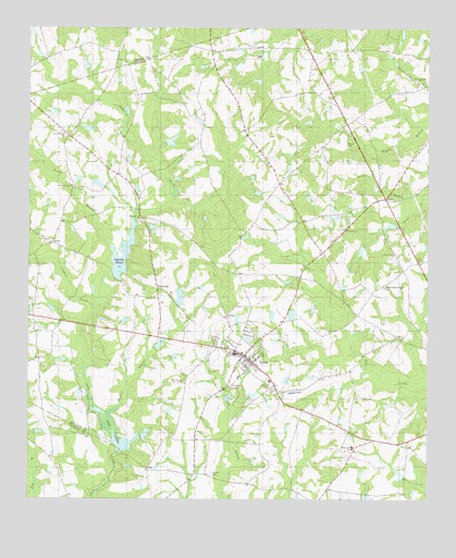
Portal, GA USGS Topographic Map
Click on map above to begin viewing in our Map Viewer.

This topographic map contains these locations and features:
Feature Name Type Latitude Longitude GNIS ID View Map
AaronPopulated PlaceN32.5682°W81.9923°326146View Map
Aaron ChurchChurchN32.5460°W81.9790°350281View Map
Banks Creek ChurchChurchN32.5652°W81.8851°310774View Map
Banks Creek Church CemeteryCemeteryN32.5563°W81.8879°354448View Map
Bland (historical)Populated PlaceN32.5160°W81.8915°350288View Map
Bradwell School (historical)SchoolN32.5588°W81.9148°350293View Map
Bunks BranchStreamN32.5627°W81.9712°312036View Map
Clark Pond (historical)ReservoirN32.5777°W81.9579°350313View Map
Coopers ProngStreamN32.5504°W81.9790°312951View Map
DeLoach Mill (historical)LocaleN32.5118°W81.9715°350327View Map
East Oglesby PondReservoirN32.5533°W81.9523°341526View Map
East Oglesby Pond DamDamN32.5518°W81.9532°341525View Map
Engleside School (historical)SchoolN32.6154°W81.8904°350340View Map
Enterprise School (historical)SchoolN32.5066°W81.9476°350341View Map
Fields PondReservoirN32.5985°W81.9816°341532View Map
Fields Pond DamDamN32.6002°W81.9798°341531View Map
Franklin CemeteryCemeteryN32.5085°W81.9612°350352View Map
Frankville ChurchChurchN32.5716°W81.9009°314356View Map
Hendrix PondReservoirN32.5068°W81.8835°341089View Map
Hendrix Pond DamDamN32.5052°W81.8815°341088View Map
Johnson Grove CemeteryCemeteryN32.6110°W81.8790°350374View Map
Johnson Grove ChurchChurchN32.6113°W81.8782°316170View Map
Kites Spur (historical)Populated PlaceN32.5502°W81.9512°350378View Map
Lake CollinsLakeN32.5146°W81.9706°355245View Map
Lanier PondReservoirN32.5950°W81.9553°341530View Map
Lanier Pond DamDamN32.5952°W81.9565°341529View Map
Mincy CemeteryCemeteryN32.5521°W81.9587°350399View Map
Munlin CemeteryCemeteryN32.5946°W81.9004°319151View Map
Nessmith Pond DamDamN32.5002°W81.8932°341090View Map
Newton Grove ChurchChurchN32.5968°W81.9887°319588View Map
Nichols CemeteryCemeteryN32.5071°W81.9421°319592View Map
Oglesby PondReservoirN32.5649°W81.9702°335964View Map
Oglesby Pond DamDamN32.5588°W81.9726°335963View Map
Panther BranchStreamN32.5224°W81.9748°320183View Map
Parrish LakeReservoirN32.5172°W81.9632°341528View Map
Parrish Lake DamDamN32.5168°W81.9648°341527View Map
PiddlevillePopulated PlaceN32.5557°W81.9596°332659View Map
Pine Grove ChurchChurchN32.5313°W81.9518°320571View Map
Pleasant Hill CemeteryCemeteryN32.5738°W81.9651°350426View Map
Pleasant Hill ChurchChurchN32.5743°W81.9646°320886View Map
Poplar Springs CemeteryCemeteryN32.5832°W81.9854°350427View Map
Poplar Springs ChurchChurchN32.5679°W81.9923°321043View Map
PortalPopulated PlaceN32.5382°W81.9323°332735View Map
Portal CemeteryCemeteryN32.5303°W81.9352°321062View Map
Portal DivisionCivilN32.5675°W81.9048°1936475View Map
Portal High SchoolSchoolN32.5385°W81.9348°350428View Map
Portal Police DepartmentBuildingN32.5376°W81.9324°2733917View Map
Portal Primary SchoolSchoolN32.5388°W81.9357°350429View Map
Portal Volunteer Fire DepartmentBuildingN32.5271°W81.9205°2603803View Map
Rock Hill School (historical)SchoolN32.6077°W81.9609°350438View Map
Scarboro ChurchChurchN32.5491°W81.9373°322620View Map
Scarboro Grove CemeteryCemeteryN32.5496°W81.9379°350443View Map
Town of PortalCivilN32.5382°W81.9297°2407150View Map
Willow Hill SchoolSchoolN32.5138°W81.8979°325403View Map
Womack Airport (historical)AirportN32.5291°W81.9115°351879View Map

Note: Coordinates in the location and feature list above are referenced to NAD83 datum.


Copyright (C) 2008-2024 Ryan Niemi / Sunset Dynamics ... All Rights Reserved