TopoQuest Logo
Do you find TopoQuest useful?
Help keep TopoQuest running and adding new maps/features by donating!
Bitcoin:  19c7KJd3qBynnjoSw5npx9KScwjBe4ifkT
Litecoin:  LXs6TkuXGGXo1vDsWCkWVdjQX94eUKd6ui
Home View Maps Find Maps Find Places Resources & Links


Poolesville, Maryland Topographic Map

USGS Map Title: Poolesville, MD
USGS Map MRC: 39077B4
DRG (GeoTIFF) Download: o39077b4.tif


Neighboring USGS Topographic Map Quads:


  Point of Rocks, MD  
39077C5
 

  Buckeystown, MD  
39077C4
 

  Urbana, MD  
39077C3
 

  Waterford, VA  
39077B5
 

  Poolesville, MD  
39077B4
 

  Germantown, MD  
39077B3
 

  Leesburg, VA  
39077A5
 

  Sterling, VA  
39077A4
 

  Seneca, MD  
39077A3


Map MRC Location:

N40°
W78°
N40°
W77°
H8 H7 H6 H5 H4 H3 H2 H1
G8 G7 G6 G5 G4 G3 G2 G1
F8 F7 F6 F5 F4 F3 F2 F1
E8 E7 E6 E5 E4 E3 E2 E1
D8 D7 D6 D5 D4 D3 D2 D1
C8 C7 C6 C5 C4 C3 C2 C1
B8 B7 B6 B5 B4 B3 B2 B1
A8 A7 A6 A5 A4 A3 A2 A1
N39°
W78°
N39°
W77°

Poolesville, MD USGS 1:24K Topographic Map Preview:
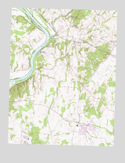
Poolesville, MD USGS Topographic Map
Click on map above to begin viewing in our Map Viewer.

This topographic map contains these locations and features:
Feature Name Type Latitude Longitude GNIS ID View Map
BarnesvillePopulated PlaceN39.2207°W77.3775°589696View Map
Barnesville StationLocaleN39.2093°W77.3819°583031View Map
BeallsvillePopulated PlaceN39.1790°W77.4128°591624View Map
Beallsville Post OfficePost OfficeN39.1793°W77.4133°1712522View Map
Big Woods AcresPopulated PlaceN39.1912°W77.4030°1712523View Map
Birdsaw IslandIslandN39.2393°W77.4742°583249View Map
Brooks ParkParkN39.1432°W77.4047°1712524View Map
Camp Potomac WoodsLocaleN39.2320°W77.4783°1464344View Map
Cherrington Picnic AreaLocaleN39.1948°W77.4692°1712527View Map
Cox IslandIslandN39.2334°W77.4664°583947View Map
DickersonPopulated PlaceN39.2201°W77.4242°584103View Map
Dickerson Conservation ParkParkN39.1982°W77.4628°593383View Map
Dickerson Post OfficePost OfficeN39.2192°W77.4243°1712536View Map
Dickerson Recreation CenterParkN39.2176°W77.4217°1712537View Map
Dickerson United Methodist ChurchChurchN39.2184°W77.4267°1712538View Map
District 3CivilN39.1324°W77.4296°1929573View Map
E E Halmos ParkParkN39.1343°W77.4108°1712540View Map
Elijah United Methodist ChurchChurchN39.1515°W77.4161°593384View Map
Elizabeths DelightPopulated PlaceN39.1651°W77.4178°1712541View Map
ElmerPopulated PlaceN39.1362°W77.4836°588652View Map
Furnace BranchStreamN39.2440°W77.4394°584538View Map
Furnace FordPopulated PlaceN39.2432°W77.4394°590268View Map
JerusalemPopulated PlaceN39.1593°W77.4061°590558View Map
John Poole Middle SchoolSchoolN39.1258°W77.4105°1990360View Map
JonesvillePopulated PlaceN39.1576°W77.3972°590570View Map
L M Stevens ParkParkN39.1426°W77.3964°1712547View Map
Lewis OrchardsLocaleN39.1661°W77.3864°2516979View Map
Little Monocacy RiverStreamN39.2184°W77.4567°585490View Map
Lock 26DamN39.1907°W77.4714°1712548View Map
Lost CornerLocaleN39.2193°W77.4778°1749564View Map
Marble Quarry CampgroundLocaleN39.1795°W77.4928°1712549View Map
MartinsburgPopulated PlaceN39.1643°W77.4755°585719View Map
Maryland City Volunteer Fire Company Company 27BuildingN39.1708°W77.3753°2085708View Map
Meadow IslandIslandN39.2440°W77.4817°585776View Map
Monocacy (historical)Populated PlaceN39.2112°W77.4650°1712550View Map
Monocacy AqueductLocaleN39.2240°W77.4519°592451View Map
Monocacy CemeteryCemeteryN39.1801°W77.4161°593107View Map
Monocacy ChurchChurchN39.1798°W77.4147°585928View Map
Monocacy Elementary SchoolSchoolN39.2243°W77.3929°585932View Map
Monocacy Natural Resources AreaParkN39.2448°W77.4261°585930View Map
Monocacy RiverStreamN39.2229°W77.4542°585931View Map
Mount EphraimPopulated PlaceN39.2459°W77.3986°588701View Map
Mount Pleasant CemeteryCemeteryN39.2270°W77.4167°586026View Map
Mount Zion United Methodist ChurchChurchN39.1995°W77.3953°593408View Map
National Institute of Health Animal FarmLocaleN39.1293°W77.4761°1712803View Map
Natural WoodsPopulated PlaceN39.1695°W77.4150°1712552View Map
Nolands Ferry (historical)CrossingN39.2362°W77.4794°1749573View Map
Owens ParkParkN39.1829°W77.4078°1712553View Map
Pepco Power PlantBuildingN39.2101°W77.4644°1712555View Map
PoolesvillePopulated PlaceN39.1459°W77.4169°593418View Map
Poolesville Baptist ChurchChurchN39.1448°W77.4194°593105View Map
Poolesville ChurchChurchN39.1593°W77.4455°586647View Map
Poolesville Elementary SchoolSchoolN39.1441°W77.4072°1712556View Map
Poolesville High SchoolSchoolN39.1432°W77.4184°1712557View Map
Poolesville LibraryBuildingN39.1440°W77.4094°2043137View Map
Poolesville Post OfficePost OfficeN39.1450°W77.4145°1712558View Map
Poolesville Town HallBuildingN39.1459°W77.4164°1712559View Map
Poolesville United Methodist ChurchChurchN39.1479°W77.4158°593104View Map
Potomac Riverside FarmLocaleN39.1386°W77.4903°2651621View Map
Saint Marys Catholic CemeteryCemeteryN39.2201°W77.3808°593108View Map
Saint Marys Catholic ChurchChurchN39.2207°W77.3808°593106View Map
Saint Peters Episcopal ChurchChurchN39.1462°W77.4194°593103View Map
SellmanPopulated PlaceN39.2084°W77.3783°591246View Map
Sellman Recreation CenterBuildingN39.2001°W77.3953°587267View Map
Sellman School (historical)SchoolN39.1998°W77.3953°1712561View Map
Seneca ChasePopulated PlaceN39.1390°W77.3961°1712562View Map
Spinks Ferry (historical)CrossingN39.2190°W77.4583°1712564View Map
Town of BarnesvilleCivilN39.2211°W77.3798°2390713View Map
Town of PoolesvilleCivilN39.1423°W77.4101°2391366View Map
Tuscarora CreekStreamN39.2434°W77.4753°587924View Map
Tuscarora StationLocaleN39.2490°W77.4703°587926View Map
Two Sisters FarmLocaleN39.1975°W77.3842°2651774View Map
United Warren Methodist ChurchChurchN39.1648°W77.4775°593102View Map
Upper Montgomery County Volunteer Fire Department Station 14 BeallsvilleBuildingN39.1803°W77.4116°2087206View Map
Warren ChurchChurchN39.1640°W77.4742°588054View Map
WesmondPopulated PlaceN39.1409°W77.4017°1712569View Map
WesterlyPopulated PlaceN39.1376°W77.4136°1712570View Map
Whites FordCrossingN39.1943°W77.4739°1712571View Map

Note: Coordinates in the location and feature list above are referenced to NAD83 datum.


Copyright (C) 2008-2024 Ryan Niemi / Sunset Dynamics ... All Rights Reserved