TopoQuest Logo
Do you find TopoQuest useful?
Help keep TopoQuest running and adding new maps/features by donating!
Bitcoin:  19c7KJd3qBynnjoSw5npx9KScwjBe4ifkT
Litecoin:  LXs6TkuXGGXo1vDsWCkWVdjQX94eUKd6ui
Home View Maps Find Maps Find Places Resources & Links


Point Reyes NE, California Topographic Map

USGS Map Title: Point Reyes NE, CA
USGS Map MRC: 38122B7
DRG (GeoTIFF) Download: o38122b7.tif


Neighboring USGS Topographic Map Quads:


  Valley Ford, CA  
38122C8
 

  Two Rock, CA  
38122C7
 

  Cotati, CA  
38122C6
 

  Tomales, CA  
38122B8
 

  Point Reyes NE, CA  
38122B7
 

  Petaluma, CA  
38122B6
 

  Drakes Bay, CA  
38122A8
 

  Inverness, CA  
38122A7
 

  San Geronimo, CA  
38122A6


Map MRC Location:

N39°
W123°
N39°
W122°
H8 H7 H6 H5 H4 H3 H2 H1
G8 G7 G6 G5 G4 G3 G2 G1
F8 F7 F6 F5 F4 F3 F2 F1
E8 E7 E6 E5 E4 E3 E2 E1
D8 D7 D6 D5 D4 D3 D2 D1
C8 C7 C6 C5 C4 C3 C2 C1
B8 B7 B6 B5 B4 B3 B2 B1
A8 A7 A6 A5 A4 A3 A2 A1
N38°
W123°
N38°
W122°

Point Reyes NE, CA USGS 1:24K Topographic Map Preview:
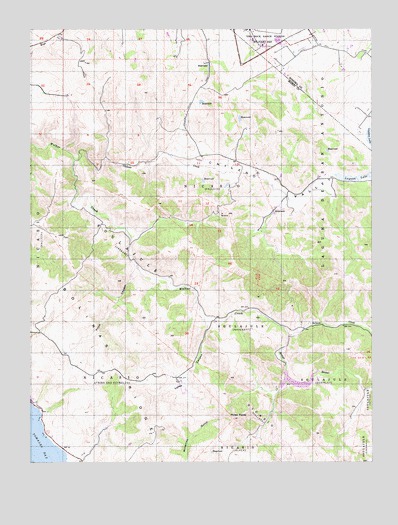
Point Reyes NE, CA USGS Topographic Map
Click on map above to begin viewing in our Map Viewer.

This topographic map contains these locations and features:
Feature Name Type Latitude Longitude GNIS ID View Map
Arroyo SausalStreamN38.1616°W122.7814°254577View Map
Arroyo Sausal ReservoirReservoirN38.1533°W122.7828°1664489View Map
Chileno CreekStreamN38.2121°W122.8597°254740View Map
Chileno School (historical)SchoolN38.2085°W122.7886°1732472View Map
Chileno ValleyValleyN38.2141°W122.8269°220992View Map
Frink CanyonValleyN38.1799°W122.8372°223952View Map
Kahn Alley RanchLocaleN38.1671°W122.8708°1732478View Map
Salmon CreekStreamN38.1616°W122.7811°232280View Map
Salmon Creek School (historical)SchoolN38.1319°W122.8072°1732485View Map
SoulajuleCivilN38.1655°W122.8000°234904View Map
SoulajuleCivilN38.1463°W122.7680°234906View Map
SoulajuleCivilN38.1885°W122.8417°234907View Map
Soulajule 33-009 DamDamN38.1499°W122.7828°1664400View Map
Soulajule Rancho (historical)LocaleN38.1833°W122.8094°1828942View Map
Soulajule ReservoirReservoirN38.1475°W122.7809°1800716View Map
Springhill Jersey DairyLocaleN38.2442°W122.7592°2708498View Map
Three PeaksSummitN38.1371°W122.8014°236311View Map
United States Coast Guard Training Center Petaluma Fire DepartmentBuildingN38.2495°W122.7957°2624280View Map
Verde CanyonValleyN38.1652°W122.8111°237053View Map
Walker Creek RanchLocaleN38.1752°W122.8158°1828940View Map

Note: Coordinates in the location and feature list above are referenced to NAD83 datum.


Copyright (C) 2008-2024 Ryan Niemi / Sunset Dynamics ... All Rights Reserved