TopoQuest Logo
Do you find TopoQuest useful?
Help keep TopoQuest running and adding new maps/features by donating!
Bitcoin:  19c7KJd3qBynnjoSw5npx9KScwjBe4ifkT
Litecoin:  LXs6TkuXGGXo1vDsWCkWVdjQX94eUKd6ui
Home View Maps Find Maps Find Places Resources & Links


Point Mills, Michigan Topographic Map

USGS Map Title: Point Mills, MI
USGS Map MRC: 47088A4
DRG (GeoTIFF) Download: o47088a4.tif


Neighboring USGS Topographic Map Quads:


  Hancock, MI  
47088B5
 

  Laurium, MI  
47088B4
 

  Rice Lake, MI  
47088B3
 

  Chassell, MI  
47088A5
 

  Point Mills, MI  
47088A4
 

  Traverse Island, MI  
47088A3
 

  Otter Lake, MI  
46088H5
 

  Portage Entry, MI  
46088H4
 

  Keweenaw Bay NE, MI  
46088H3


Map MRC Location:

N48°
W89°
N48°
W88°
H8 H7 H6 H5 H4 H3 H2 H1
G8 G7 G6 G5 G4 G3 G2 G1
F8 F7 F6 F5 F4 F3 F2 F1
E8 E7 E6 E5 E4 E3 E2 E1
D8 D7 D6 D5 D4 D3 D2 D1
C8 C7 C6 C5 C4 C3 C2 C1
B8 B7 B6 B5 B4 B3 B2 B1
A8 A7 A6 A5 A4 A3 A2 A1
N47°
W89°
N47°
W88°

Point Mills, MI USGS 1:24K Topographic Map Preview:
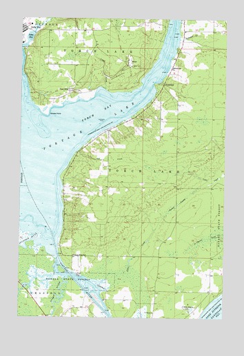
Point Mills, MI USGS Topographic Map
Click on map above to begin viewing in our Map Viewer.

This topographic map contains these locations and features:
Feature Name Type Latitude Longitude GNIS ID View Map
Big CreekStreamN47.0696°W88.4648°621304View Map
Bushel SwampSwampN47.0474°W88.4035°622356View Map
Dollar BayBayN47.1169°W88.4951°624747View Map
DreamlandPopulated PlaceN47.0977°W88.4132°1617531View Map
Dubuque CreekStreamN47.1163°W88.4037°624913View Map
Gooseneck CreekStreamN47.1185°W88.4923°626984View Map
Grosse PointCapeN47.0852°W88.4846°627460View Map
Jacobsville CemeteryCemeteryN47.0020°W88.4179°629193View Map
Julio Contracting CompanyLocaleN47.1144°W88.4996°1618738View Map
Lamirande ShoalBarN47.0813°W88.4498°630102View Map
Lovell CreekStreamN47.0952°W88.4490°631142View Map
Mills Station (historical)LocaleN47.0950°W88.4706°2124032View Map
Old ChannelChannelN47.0133°W88.4540°633989View Map
Point MillsPopulated PlaceN47.0949°W88.4707°635190View Map
Point Mills Post Office (historical)Post OfficeN47.0950°W88.4706°2124033View Map
Portage LakeLakeN47.0663°W88.4967°635281View Map
Portage RiverChannelN47.0122°W88.4604°635289View Map
Princess PointCapeN47.0244°W88.4751°1618740View Map
Princess Point SchoolSchoolN47.0258°W88.4673°635460View Map
Sarazin SchoolSchoolN47.1041°W88.4082°637258View Map
SenterPopulated PlaceN47.1055°W88.4357°637579View Map
Senter Post Office (historical)Post OfficeN47.1056°W88.4356°2124024View Map
Senter Station (historical)LocaleN47.1056°W88.4356°2124023View Map
Silver CreekStreamN47.0149°W88.4501°637909View Map
Snake RiverStreamN47.0172°W88.4704°638192View Map
Stone Quarry LakeLakeN47.0036°W88.3948°638871View Map
Sturgeon RiverStreamN47.0349°W88.4885°1621808View Map
Torch BayLakeN47.0870°W88.4432°1614968View Map
Township of Torch LakeCivilN47.0960°W88.3931°1627170View Map

Note: Coordinates in the location and feature list above are referenced to NAD83 datum.


Copyright (C) 2008-2024 Ryan Niemi / Sunset Dynamics ... All Rights Reserved