TopoQuest Logo
Do you find TopoQuest useful?
Help keep TopoQuest running and adding new maps/features by donating!
Bitcoin:  19c7KJd3qBynnjoSw5npx9KScwjBe4ifkT
Litecoin:  LXs6TkuXGGXo1vDsWCkWVdjQX94eUKd6ui
Home View Maps Find Maps Find Places Resources & Links


Plevna, Montana Topographic Map

USGS Map Title: Plevna, MT
USGS Map MRC: 46104D5
DRG (GeoTIFF) Download: o46104d5.tif


Neighboring USGS Topographic Map Quads:


  Ayer Spring, MT  
46104E6
 

  Lawrence Creek West, MT  
46104E5
 

  Lawrence Creek East, MT  
46104E4
 

  Westmore, MT  
46104D6
 

  Plevna, MT  
46104D5
 

  Baker NW, MT  
46104D4
 

  T G Creek, MT  
46104C6
 

  Little Pine Creek, MT  
46104C5
 

  South Sandstone Reservoir, MT  
46104C4


Map MRC Location:

N47°
W105°
N47°
W104°
H8 H7 H6 H5 H4 H3 H2 H1
G8 G7 G6 G5 G4 G3 G2 G1
F8 F7 F6 F5 F4 F3 F2 F1
E8 E7 E6 E5 E4 E3 E2 E1
D8 D7 D6 D5 D4 D3 D2 D1
C8 C7 C6 C5 C4 C3 C2 C1
B8 B7 B6 B5 B4 B3 B2 B1
A8 A7 A6 A5 A4 A3 A2 A1
N46°
W105°
N46°
W104°

Plevna, MT USGS 1:24K Topographic Map Preview:
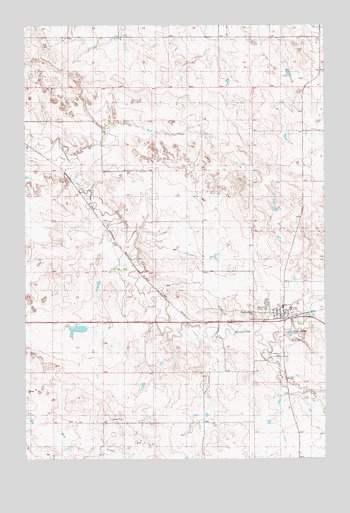
Plevna, MT USGS Topographic Map
Click on map above to begin viewing in our Map Viewer.

This topographic map contains these locations and features:
Feature Name Type Latitude Longitude GNIS ID View Map
07N57E10BC__01 WellWellN46.3792°W104.5908°815877View Map
07N57E10BC__02 WellWellN46.3806°W104.5908°815898View Map
08N57E10CC__01 WellWellN46.4611°W104.5686°816375View Map
08N57E12BA__01 WellWellN46.4889°W104.5408°816496View Map
08N57E14D___01 WellWellN46.4461°W104.5566°816304View Map
08N57E14DA__01 WellWellN46.4556°W104.5533°816353View Map
08N57E14DAD_02 WellWellN46.4514°W104.5533°816334View Map
08N57E23CAAA01 WellWellN46.4353°W104.5619°816259View Map
08N57E23DB__01 WellWellN46.4361°W104.5672°816261View Map
08N58E30ADCA01 WellWellN46.4272°W104.5144°816204View Map
08N58E30BD__01 WellWellN46.4206°W104.5219°816160View Map
08N58E30DBBD01 WellWellN46.4175°W104.5180°816147View Map
08N58E30DD__01 WellWellN46.4133°W104.5113°816112View Map
08N58E31AA__01 WellWellN46.4097°W104.5113°816087View Map
09N56E36ABB_01 WellWellN46.4953°W104.6175°816515View Map
09N57E28CDDC01 WellWellN46.4972°W104.5561°816524View Map
09N57E31AB__01 WellWellN46.4945°W104.5938°816514View Map
Community Union CemeteryCemeteryN46.4181°W104.5294°799229View Map
Emanuel Evangelical Free ChurchChurchN46.4161°W104.5213°1688653View Map
Peace Lutheran CemeteryCemeteryN46.4169°W104.5299°799228View Map
Peace Lutheran ChurchChurchN46.4164°W104.5199°1688652View Map
PlevnaLocaleN46.4153°W104.5177°1688626View Map
PlevnaPopulated PlaceN46.4181°W104.5205°775297View Map
Plevna Baptist ChurchChurchN46.4183°W104.5208°1688651View Map
Plevna City ParkParkN46.4161°W104.5169°1688639View Map
Plevna Post OfficePost OfficeN46.4168°W104.5178°1688663View Map
Plevna SchoolSchoolN46.4186°W104.5180°1688915View Map
Plevna Volunteer Fire DistrictBuildingN46.4177°W104.5178°1688638View Map
Saint Anthony CemeteryCemeteryN46.4042°W104.5205°799230View Map
Saint Anthonys Catholic ChurchChurchN46.4181°W104.5191°1688650View Map
South Fork Sandstone CreekStreamN46.4067°W104.5288°776868View Map
Town of PlevnaCivilN46.4183°W104.5186°2412491View Map

Note: Coordinates in the location and feature list above are referenced to NAD83 datum.


Copyright (C) 2008-2024 Ryan Niemi / Sunset Dynamics ... All Rights Reserved