TopoQuest Logo
Do you find TopoQuest useful?
Help keep TopoQuest running and adding new maps/features by donating!
Bitcoin:  19c7KJd3qBynnjoSw5npx9KScwjBe4ifkT
Litecoin:  LXs6TkuXGGXo1vDsWCkWVdjQX94eUKd6ui
Home View Maps Find Maps Find Places Resources & Links


Pleasantville, Pennsylvania Topographic Map

USGS Map Title: Pleasantville, PA
USGS Map MRC: 41079E5
DRG (GeoTIFF) Download: o41079e5.tif


Neighboring USGS Topographic Map Quads:


  Titusville North, PA  
41079F6
 

  Grand Valley, PA  
41079F5
 

  Tidioute, PA  
41079F4
 

  Titusville South, PA  
41079E6
 

  Pleasantville, PA  
41079E5
 

  West Hickory, PA  
41079E4
 

  Oil City, PA  
41079D6
 

  President, PA  
41079D5
 

  Tionesta, PA  
41079D4


Map MRC Location:

N42°
W80°
N42°
W79°
H8 H7 H6 H5 H4 H3 H2 H1
G8 G7 G6 G5 G4 G3 G2 G1
F8 F7 F6 F5 F4 F3 F2 F1
E8 E7 E6 E5 E4 E3 E2 E1
D8 D7 D6 D5 D4 D3 D2 D1
C8 C7 C6 C5 C4 C3 C2 C1
B8 B7 B6 B5 B4 B3 B2 B1
A8 A7 A6 A5 A4 A3 A2 A1
N41°
W80°
N41°
W79°

Pleasantville, PA USGS 1:24K Topographic Map Preview:
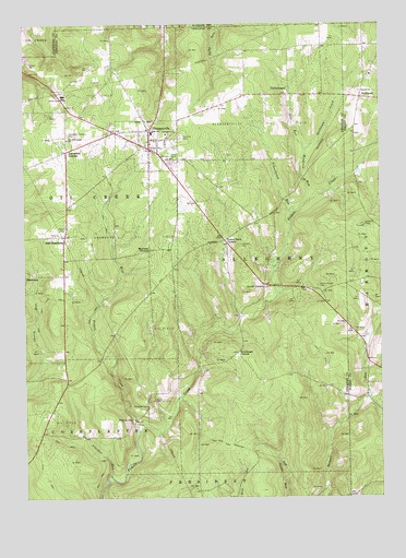
Pleasantville, PA USGS Topographic Map
Click on map above to begin viewing in our Map Viewer.

This topographic map contains these locations and features:
Feature Name Type Latitude Longitude GNIS ID View Map
Allender RunStreamN41.5064°W79.5948°1168194View Map
Asbury Chapel CemeteryCemeteryN41.5559°W79.5206°1168438View Map
Borough of PleasantvilleCivilN41.5935°W79.5808°1215640View Map
CashupLocaleN41.5226°W79.5414°1202270View Map
Concord CemeteryCemeteryN41.5667°W79.5481°1172281View Map
Concord ChurchChurchN41.6073°W79.5059°1172288View Map
East ShamburgPopulated PlaceN41.5692°W79.6103°1203482View Map
Fairview CemeteryCemeteryN41.5953°W79.5681°1174505View Map
Jerusalem CornersLocaleN41.5914°W79.6092°1178067View Map
Jerusalem Corners CemeteryCemeteryN41.5962°W79.6087°1178068View Map
Lovell CornersLocaleN41.5556°W79.5395°1179991View Map
Morrison CornersLocaleN41.5653°W79.5803°1181583View Map
NeilltownPopulated PlaceN41.6056°W79.5056°1204268View Map
Neilltown CreekStreamN41.5928°W79.5245°1182232View Map
Otto RunStreamN41.5928°W79.5245°1183091View Map
Pithole CityPopulated PlaceN41.5209°W79.5870°1204411View Map
Pithole City Historical SiteParkN41.5801°W79.5331°1200756View Map
PleasantvillePopulated PlaceN41.5923°W79.5795°1184100View Map
Pleasantville Oil FieldOilfieldN41.5984°W79.5412°1184102View Map
Pleasantville Post OfficePost OfficeN41.5913°W79.5810°2779607View Map
Pleasantville Volunteer Fire Department 36BuildingN41.5924°W79.5829°2645400View Map
Rumbaugh CornersLocaleN41.5384°W79.5492°1185612View Map
Schoolhouse RunStreamN41.5751°W79.5303°1187118View Map
Shamburg Oil FieldOilfieldN41.5692°W79.5812°1187340View Map
Simonds RunStreamN41.5264°W79.5709°1202269View Map
The Full Gospel ChurchChurchN41.5962°W79.6087°1189400View Map
Township of AlleghenyCivilN41.5652°W79.5412°1217138View Map
Township of Oil CreekCivilN41.5773°W79.6112°1217149View Map
Tyrrel Farm CornersLocaleN41.5681°W79.5534°1190057View Map
West Pithole CreekStreamN41.5192°W79.5859°1191094View Map
Woodcock RunStreamN41.5798°W79.5228°1191729View Map

Note: Coordinates in the location and feature list above are referenced to NAD83 datum.


Copyright (C) 2008-2024 Ryan Niemi / Sunset Dynamics ... All Rights Reserved