TopoQuest Logo
Do you find TopoQuest useful?
Help keep TopoQuest running and adding new maps/features by donating!
Bitcoin:  19c7KJd3qBynnjoSw5npx9KScwjBe4ifkT
Litecoin:  LXs6TkuXGGXo1vDsWCkWVdjQX94eUKd6ui
Home View Maps Find Maps Find Places Resources & Links


Plainfield, Iowa Topographic Map

USGS Map Title: Plainfield, IA
USGS Map MRC: 42092G5
DRG (GeoTIFF) Download: o42092g5.tif


Neighboring USGS Topographic Map Quads:


  Nashua NW, IA  
42092H6
 

  Nashua, IA  
42092H5
 

  Tripoli NW, IA  
42092H4
 

  Clarksville, IA  
42092G6
 

  Plainfield, IA  
42092G5
 

  Bremer, IA  
42092G4
 

  Coster, IA  
42092F6
 

  Shell Rock, IA  
42092F5
 

  Waverly, IA  
42092F4


Map MRC Location:

N43°
W93°
N43°
W92°
H8 H7 H6 H5 H4 H3 H2 H1
G8 G7 G6 G5 G4 G3 G2 G1
F8 F7 F6 F5 F4 F3 F2 F1
E8 E7 E6 E5 E4 E3 E2 E1
D8 D7 D6 D5 D4 D3 D2 D1
C8 C7 C6 C5 C4 C3 C2 C1
B8 B7 B6 B5 B4 B3 B2 B1
A8 A7 A6 A5 A4 A3 A2 A1
N42°
W93°
N42°
W92°

Plainfield, IA USGS 1:24K Topographic Map Preview:
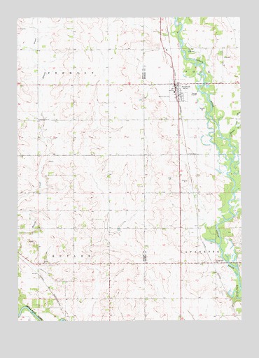
Plainfield, IA USGS Topographic Map
Click on map above to begin viewing in our Map Viewer.

This topographic map contains these locations and features:
Feature Name Type Latitude Longitude GNIS ID View Map
Antioch CemeteryCemeteryN42.7741°W92.6133°1945414View Map
Antioch ChurchChurchN42.7739°W92.6107°454202View Map
Cedar River Green BeltParkN42.8333°W92.5155°1948271View Map
City of PlainfieldCivilN42.8445°W92.5359°2396218View Map
Dry RunStreamN42.8300°W92.5021°456035View Map
First Baptist ChurchChurchN42.8478°W92.5377°1948438View Map
Gallagher ParkParkN42.8475°W92.5371°1948326View Map
Horton CreekStreamN42.8247°W92.5066°457674View Map
Methodist ChurchChurchN42.8466°W92.5352°1948437View Map
Nashua - Plainfield Middle SchoolSchoolN42.8442°W92.5374°1948436View Map
North Cedar ParkParkN42.8478°W92.5227°463885View Map
North Cedar ParkParkN42.8514°W92.5224°1948272View Map
PlainfieldPopulated PlaceN42.8475°W92.5371°460200View Map
PlainfieldLocaleN42.8472°W92.5363°1948432View Map
Plainfield City HallBuildingN42.8466°W92.5371°1948435View Map
Plainfield Post OfficePost OfficeN42.8472°W92.5369°1948433View Map
Plainfield Public LibraryBuildingN42.8472°W92.5371°1948434View Map
Pleasant Valley CemeteryCemeteryN42.8332°W92.6148°1945406View Map
Pleasant Valley ChurchChurchN42.8330°W92.6130°460304View Map
Shell Rock River TrailTrailN42.7555°W92.6035°1945555View Map
Sportsmens ParkParkN42.8475°W92.5371°1948327View Map
Spring LakeLocaleN42.7739°W92.5149°466268View Map
Spring Lake CemeteryCemeteryN42.7740°W92.5151°461904View Map
Spring Lake Post Office (historical)Post OfficeN42.7739°W92.5149°1948277View Map
Township of ButlerCivilN42.7742°W92.6137°467513View Map
Township of FremontCivilN42.8627°W92.6136°467875View Map
Willow Lawn CemeteryCemeteryN42.8433°W92.5393°463094View Map

Note: Coordinates in the location and feature list above are referenced to NAD83 datum.


Copyright (C) 2008-2024 Ryan Niemi / Sunset Dynamics ... All Rights Reserved