TopoQuest Logo
Do you find TopoQuest useful?
Help keep TopoQuest running and adding new maps/features by donating!
Bitcoin:  19c7KJd3qBynnjoSw5npx9KScwjBe4ifkT
Litecoin:  LXs6TkuXGGXo1vDsWCkWVdjQX94eUKd6ui
Home View Maps Find Maps Find Places Resources & Links


Placitas, New Mexico Topographic Map

USGS Map Title: Placitas, NM
USGS Map MRC: 35106C4
DRG (GeoTIFF) Download: o35106c4.tif


Neighboring USGS Topographic Map Quads:


  Santa Ana Pueblo, NM  
35106D5
 

  San Felipe Pueblo, NM  
35106D4
 

  San Felipe Pueblo NE, NM  
35106D3
 

  Bernalillo, NM  
35106C5
 

  Placitas, NM  
35106C4
 

  Hagan, NM  
35106C3
 

  Alameda, NM  
35106B5
 

  Sandia Crest, NM  
35106B4
 

  Sandia Park, NM  
35106B3


Map MRC Location:

N36°
W107°
N36°
W106°
H8 H7 H6 H5 H4 H3 H2 H1
G8 G7 G6 G5 G4 G3 G2 G1
F8 F7 F6 F5 F4 F3 F2 F1
E8 E7 E6 E5 E4 E3 E2 E1
D8 D7 D6 D5 D4 D3 D2 D1
C8 C7 C6 C5 C4 C3 C2 C1
B8 B7 B6 B5 B4 B3 B2 B1
A8 A7 A6 A5 A4 A3 A2 A1
N35°
W107°
N35°
W106°

Placitas, NM USGS 1:24K Topographic Map Preview:
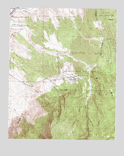
Placitas, NM USGS Topographic Map
Click on map above to begin viewing in our Map Viewer.

This topographic map contains these locations and features:
Feature Name Type Latitude Longitude GNIS ID View Map
Agua Sarca TrailheadLocaleN35.2917°W106.4417°2055717View Map
Algodones CemeteryCemeteryN35.3711°W106.4828°903086View Map
AngosturaPopulated PlaceN35.3742°W106.4934°903168View Map
Apache CanyonValleyN35.2959°W106.4053°903216View Map
Arroyo ColoradoArroyoN35.3084°W106.4372°903371View Map
Arroyo del Ojo del OrnoArroyoN35.3323°W106.4456°903333View Map
Arroyo del OsoArroyoN35.3153°W106.4370°903335View Map
Arroyo SuelaArroyoN35.3123°W106.4367°903426View Map
Arroyo Tierra BlancaArroyoN35.3120°W106.4292°903428View Map
Bernalillo Watershed Research Natural AreaParkN35.2906°W106.4886°2013584View Map
Bernalillo Watershed WithdrawalParkN35.2903°W106.4828°913081View Map
Buckeye ClaimMineN35.2837°W106.4742°916304View Map
Caņon Agua SarcaValleyN35.2964°W106.4572°904611View Map
Caņon OshaValleyN35.2728°W106.4203°905554View Map
Casa AcequiaLocaleN35.3070°W106.4247°933333View Map
Crest of MontezumaRidgeN35.3053°W106.3928°905495View Map
Cuchilla de EscalaRidgeN35.3325°W106.4192°905544View Map
Cuchilla de San FranciscoRidgeN35.3367°W106.3925°905545View Map
Cuchilla LupeRidgeN35.2973°W106.4159°905547View Map
Cueva CanyonValleyN35.2912°W106.4059°1729780View Map
Del Oso SpringSpringN35.3056°W106.4139°902628View Map
Diamond Tail RanchPopulated PlaceN35.3209°W106.3886°2055893View Map
El Rancho de San FranciscoLocaleN35.3459°W106.3945°929681View Map
La Luz MineMineN35.2559°W106.3822°939841View Map
Las ColoniasPopulated PlaceN35.3745°W106.4856°907864View Map
Las Colonias Post Office (historical)Post OfficeN35.3745°W106.4856°937966View Map
Las HuertasPopulated PlaceN35.3028°W106.4064°902767View Map
Las Huertas CreekStreamN35.3706°W106.4939°918227View Map
Las Huertas DepositMineN35.3098°W106.4053°917733View Map
Las Placites Presbyterian ChurchChurchN35.3070°W106.4247°914511View Map
Lomos AltosSummitN35.3100°W106.4489°908140View Map
Los PastoresPopulated PlaceN35.3150°W106.4281°2055894View Map
Montezuma (historical)Populated PlaceN35.3098°W106.4042°902760View Map
Montezuma MineMineN35.3098°W106.4042°902769View Map
Montoya PitMineN35.3123°W106.4989°917706View Map
Ojo Cuchillo Historic SiteLocaleN35.3070°W106.4247°934397View Map
Ojo de las CasaLocaleN35.3070°W106.4136°902771View Map
Osha Spring TrailTrailN35.2634°W106.4170°2015989View Map
Palo Duroso CanyonValleyN35.2712°W106.4086°909451View Map
Palomas TrailTrailN35.2712°W106.4039°2015987View Map
Penasco Blanco TrailTrailN35.2553°W106.4386°2015988View Map
Perdiz CanyonValleyN35.3006°W106.4053°909568View Map
Piedra Lisa SpringSpringN35.2770°W106.4750°913425View Map
Piedra Lisa TrailheadLocaleN35.2789°W106.4784°2055718View Map
PlacitasPopulated PlaceN35.3070°W106.4247°915877View Map
Placitas CemeteryCemeteryN35.3096°W106.4247°931314View Map
Placitas Census Designated PlaceCensusN35.3226°W106.4436°2409080View Map
Placitas Community LibraryLocaleN35.3092°W106.4950°2055715View Map
Placitas Elementary SchoolSchoolN35.3100°W106.4256°2055719View Map
Placitas HomesteadsPopulated PlaceN35.3081°W106.4903°2055889View Map
Placitas MineMineN35.2559°W106.3822°939652View Map
Placitas Post OfficePost OfficeN35.3089°W106.4267°938229View Map
Placitas Volunteer Fire Brigade Station 42BuildingN35.2921°W106.4062°2657975View Map
Puesta Del SolPopulated PlaceN35.3064°W106.4534°2055892View Map
Ranchos des PlacitasPopulated PlaceN35.3053°W106.4647°2055891View Map
RG-38051 Water WellWellN35.3120°W106.4964°921941View Map
San Antonio Catholic MissionChurchN35.3075°W106.4242°2055720View Map
San Antonio De Las Huertas GrantCivilN35.3148°W106.4150°910602View Map
San Felipe Pueblo/Santa Ana Pueblo Joint-Use AreaCensusN35.3627°W106.4945°2419124View Map
San Jose de las Huertas Historic SiteLocaleN35.3070°W106.4247°934440View Map
San Jose GroupMineN35.2878°W106.4389°915603View Map
Sandia MountainsRangeN35.2778°W106.4542°910746View Map
Sandoval County Fire Department Station 41BuildingN35.3079°W106.4577°2657816View Map
Sloan MineMineN35.2623°W106.3922°917599View Map
Strip Mine TrailheadLocaleN35.3000°W106.4803°2055716View Map
Sundance MesaPopulated PlaceN35.3303°W106.4839°2055887View Map
Taraddei ProspectMineN35.3084°W106.4525°916256View Map
TecolotePopulated PlaceN35.3195°W106.4056°911572View Map
The OverlookPopulated PlaceN35.3070°W106.4486°2055888View Map
Tijeras Canyon MineMineN35.2559°W106.3822°939653View Map
Tunnel SpringSpringN35.2909°W106.4395°911856View Map
Tunnel Spring TrailheadLocaleN35.2912°W106.4400°937063View Map
Victo GroupMineN35.2878°W106.4411°916360View Map
Victo-Rovo-Novo-GroupMineN35.2959°W106.4359°916361View Map
Village de las HuertasPopulated PlaceN35.3014°W106.4095°2055895View Map
Vista de Oro de PlacitasPopulated PlaceN35.3023°W106.4714°2055890View Map

Note: Coordinates in the location and feature list above are referenced to NAD83 datum.


Copyright (C) 2008-2024 Ryan Niemi / Sunset Dynamics ... All Rights Reserved