TopoQuest Logo
Do you find TopoQuest useful?
Help keep TopoQuest running and adding new maps/features by donating!
Bitcoin:  19c7KJd3qBynnjoSw5npx9KScwjBe4ifkT
Litecoin:  LXs6TkuXGGXo1vDsWCkWVdjQX94eUKd6ui
Home View Maps Find Maps Find Places Resources & Links


Pioneer, Louisiana Topographic Map

USGS Map Title: Pioneer, LA
USGS Map MRC: 32091F4
DRG (GeoTIFF) Download: o32091f4.tif


Neighboring USGS Topographic Map Quads:


  Goodwill, LA  
32091G5
 

  Oak Grove, LA  
32091G4
 

  Baxter Bayou, LA  
32091G3
 

  Bear Skin, LA  
32091F5
 

  Pioneer, LA  
32091F4
 

  Caraway Lake, LA  
32091F3
 

  Congo Creek, LA  
32091E5
 

  Epps, LA  
32091E4
 

  Panther Lake, LA  
32091E3


Map MRC Location:

N33°
W92°
N33°
W91°
H8 H7 H6 H5 H4 H3 H2 H1
G8 G7 G6 G5 G4 G3 G2 G1
F8 F7 F6 F5 F4 F3 F2 F1
E8 E7 E6 E5 E4 E3 E2 E1
D8 D7 D6 D5 D4 D3 D2 D1
C8 C7 C6 C5 C4 C3 C2 C1
B8 B7 B6 B5 B4 B3 B2 B1
A8 A7 A6 A5 A4 A3 A2 A1
N32°
W92°
N32°
W91°

Pioneer, LA USGS 1:24K Topographic Map Preview:
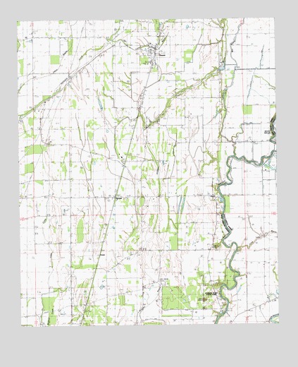
Pioneer, LA USGS Topographic Map
Click on map above to begin viewing in our Map Viewer.

This topographic map contains these locations and features:
Feature Name Type Latitude Longitude GNIS ID View Map
Alligator BayouGutN32.6704°W91.4329°532130View Map
Bayou Macon ChurchChurchN32.6999°W91.4823°532679View Map
Bayou Meadows AirportAirportN32.7000°W91.3863°1632683View Map
Bethany CemeteryCemeteryN32.6660°W91.4021°532965View Map
Boggy BayouStreamN32.7382°W91.4643°533286View Map
Campbell ChurchChurchN32.7099°W91.4187°533668View Map
Caney Glade BayouStreamN32.7415°W91.4565°533751View Map
DarnellPopulated PlaceN32.6776°W91.4532°554188View Map
Darnell Post OfficePost OfficeN32.6771°W91.4490°1630842View Map
Epps Gas FieldOilfieldN32.6482°W91.4032°534831View Map
Evening Star ChurchChurchN32.6301°W91.3890°534856View Map
FloydPopulated PlaceN32.6776°W91.4059°543207View Map
Floyd LandingPopulated PlaceN32.6796°W91.4032°543208View Map
GowenPopulated PlaceN32.6543°W91.4610°554561View Map
Harmony ChurchChurchN32.6771°W91.4740°535532View Map
Little CreekStreamN32.6346°W91.4846°536530View Map
Long Lake BayouStreamN32.6551°W91.3946°536703View Map
Lyon BayouStreamN32.6937°W91.3954°555201View Map
Magnolia ChurchChurchN32.7071°W91.4373°536843View Map
Magnolia SchoolSchoolN32.7087°W91.4359°536847View Map
Midway ChurchChurchN32.6782°W91.4384°537076View Map
Mill BayouStreamN32.7310°W91.3940°555318View Map
Montgomery Ferry (historical)CrossingN32.6307°W91.4004°548870View Map
Mount Pleasant ChurchChurchN32.6254°W91.4715°537395View Map
New Bethany ChurchChurchN32.6896°W91.4482°537551View Map
PioneerPopulated PlaceN32.7362°W91.4334°543581View Map
Pioneer Elementary School (historical)SchoolN32.7083°W91.4360°548783View Map
Pioneer Post OfficePost OfficeN32.7371°W91.4337°1630850View Map
Plum Grove ChurchChurchN32.7137°W91.4912°538272View Map
Poverty PointCapeN32.6368°W91.4162°538371View Map
Poverty Point National MonumentParkN32.6424°W91.4083°1888953View Map
Poverty Point State Historic SiteParkN32.6376°W91.4071°556572View Map
Saint Paul ChurchChurchN32.6251°W91.4579°539027View Map
South Epps Gas FieldOilfieldN32.6299°W91.4257°539492View Map
Village of PioneerCivilN32.7381°W91.4381°2407524View Map
Ward 2 Volunteer Fire DepartmentBuildingN32.7381°W91.4355°2672924View Map
Ward TwoCivilN32.7143°W91.4851°545274View Map
Wilson CemeteryCemeteryN32.6987°W91.4046°540484View Map

Note: Coordinates in the location and feature list above are referenced to NAD83 datum.


Copyright (C) 2008-2024 Ryan Niemi / Sunset Dynamics ... All Rights Reserved