TopoQuest Logo
Do you find TopoQuest useful?
Help keep TopoQuest running and adding new maps/features by donating!
Bitcoin:  19c7KJd3qBynnjoSw5npx9KScwjBe4ifkT
Litecoin:  LXs6TkuXGGXo1vDsWCkWVdjQX94eUKd6ui
Home View Maps Find Maps Find Places Resources & Links


Pinon, New Mexico Topographic Map

USGS Map Title: Pinon, NM
USGS Map MRC: 32105E4
DRG (GeoTIFF) Download: o32105e4.tif


Neighboring USGS Topographic Map Quads:


  Bear Spring, NM  
32105F5
 

  Avis, NM  
32105F4
 

  Chimney Lake, NM  
32105F3
 

  Surveyors Canyon, NM  
32105E5
 

  Pinon, NM  
32105E4
 

  Cornucopia Canyon, NM  
32105E3
 

  Sixteen Canyon, NM  
32105D5
 

  Indian Draw, NM  
32105D4
 

  Cornucopia Ranch, NM  
32105D3


Map MRC Location:

N33°
W106°
N33°
W105°
H8 H7 H6 H5 H4 H3 H2 H1
G8 G7 G6 G5 G4 G3 G2 G1
F8 F7 F6 F5 F4 F3 F2 F1
E8 E7 E6 E5 E4 E3 E2 E1
D8 D7 D6 D5 D4 D3 D2 D1
C8 C7 C6 C5 C4 C3 C2 C1
B8 B7 B6 B5 B4 B3 B2 B1
A8 A7 A6 A5 A4 A3 A2 A1
N32°
W106°
N32°
W105°

Pinon, NM USGS 1:24K Topographic Map Preview:
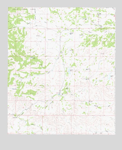
Pinon, NM USGS Topographic Map
Click on map above to begin viewing in our Map Viewer.

This topographic map contains these locations and features:
Feature Name Type Latitude Longitude GNIS ID View Map
Behringer CanyonValleyN32.6218°W105.4964°903721View Map
Blair TankReservoirN32.5324°W105.4062°903909View Map
Bonita DrawValleyN32.6009°W105.4108°903996View Map
Coupland RanchLocaleN32.5457°W105.4297°905440View Map
Danley TankReservoirN32.5449°W105.4947°905591View Map
Dare TankReservoirN32.6056°W105.3901°905593View Map
Dean TankReservoirN32.5934°W105.4536°905654View Map
Dipping Vat TankReservoirN32.6139°W105.4082°905772View Map
Finch TankReservoirN32.5753°W105.4727°906268View Map
First Baptist ChurchChurchN32.6182°W105.3944°921240View Map
Gregg CanyonValleyN32.5676°W105.4453°906741View Map
Havens RanchLocaleN32.6001°W105.4275°906873View Map
Jim Godley TankReservoirN32.5548°W105.4097°907368View Map
PiņonPopulated PlaceN32.6182°W105.3944°909714View Map
Pinon Census Designated PlaceCensusN32.6182°W105.3867°2584178View Map
Pinon Post OfficePost OfficeN32.6187°W105.3954°2781538View Map
Pinon Volunteer Fire DepartmentBuildingN32.6142°W105.3940°2657890View Map
Resley TankReservoirN32.5979°W105.4172°910134View Map
Richardson LakeLakeN32.5623°W105.4287°910162View Map
Robertson TankReservoirN32.5996°W105.4281°910354View Map
School Section TankReservoirN32.5639°W105.4093°910870View Map
Scott TankReservoirN32.5832°W105.4282°910889View Map
Shockley LakeLakeN32.5567°W105.3817°911020View Map
South Prong Stevens CreekStreamN32.6009°W105.4108°1989750View Map
Sowell RanchLocaleN32.5968°W105.4630°911291View Map

Note: Coordinates in the location and feature list above are referenced to NAD83 datum.


Copyright (C) 2008-2024 Ryan Niemi / Sunset Dynamics ... All Rights Reserved