TopoQuest Logo
Do you find TopoQuest useful?
Help keep TopoQuest running and adding new maps/features by donating!
Bitcoin:  19c7KJd3qBynnjoSw5npx9KScwjBe4ifkT
Litecoin:  LXs6TkuXGGXo1vDsWCkWVdjQX94eUKd6ui
Home View Maps Find Maps Find Places Resources & Links


Pine View, Tennessee Topographic Map

USGS Map Title: Pine View, TN
USGS Map MRC: 35087F8
DRG (GeoTIFF) Download: o35087f8.tif


Neighboring USGS Topographic Map Quads:


  Sugar Tree, TN  
35088G1
 

  Daniels Landing, TN  
35087G8
 

  Lobelville, TN  
35087G7
 

  Jeannette, TN  
35088F1
 

  Pine View, TN  
35087F8
 

  Chestnut Grove, TN  
35087F7
 

  Perryville, TN  
35088E1
 

  Pope, TN  
35087E8
 

  Linden, TN  
35087E7


Map MRC Location:

N36°
W88°
N36°
W87°
H8 H7 H6 H5 H4 H3 H2 H1
G8 G7 G6 G5 G4 G3 G2 G1
F8 F7 F6 F5 F4 F3 F2 F1
E8 E7 E6 E5 E4 E3 E2 E1
D8 D7 D6 D5 D4 D3 D2 D1
C8 C7 C6 C5 C4 C3 C2 C1
B8 B7 B6 B5 B4 B3 B2 B1
A8 A7 A6 A5 A4 A3 A2 A1
N35°
W88°
N35°
W87°

Pine View, TN USGS 1:24K Topographic Map Preview:
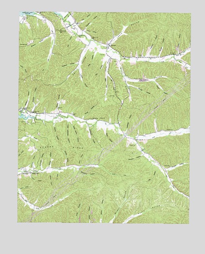
Pine View, TN USGS Topographic Map
Click on map above to begin viewing in our Map Viewer.

This topographic map contains these locations and features:
Feature Name Type Latitude Longitude GNIS ID View Map
Beakley HollowValleyN35.6901°W87.9893°1276527View Map
Bell HollowValleyN35.7245°W87.9358°1276931View Map
Bible Hill CemeteryCemeteryN35.7384°W87.9706°1277212View Map
Bridge HollowValleyN35.7239°W87.8982°1278347View Map
Bunker HillSummitN35.7301°W87.9970°1279007View Map
Carlton HollowValleyN35.6915°W87.9954°1279681View Map
Cave SpringSpringN35.6865°W87.9462°1279950View Map
Choate CemeteryCemeteryN35.6595°W87.8897°1280499View Map
Choate HollowValleyN35.6563°W87.8918°1280504View Map
Clayborne CemeteryCemeteryN35.7412°W87.9595°1280632View Map
Commissioner District 2CivilN35.6956°W87.9497°2463961View Map
Cotton HollowValleyN35.7259°W87.8838°1281359View Map
Daniel CemeteryCemeteryN35.7242°W87.9114°1282021View Map
Deer Creek School (historical)SchoolN35.7470°W87.9900°1308577View Map
Deerlick HollowValleyN35.6553°W87.9753°1282306View Map
Dickson HollowValleyN35.7362°W87.9768°1282460View Map
Dixon ChurchChurchN35.6870°W87.9409°1282522View Map
Forehand HollowValleyN35.6573°W87.9894°1284580View Map
Gamblin HollowValleyN35.6659°W87.9092°1285123View Map
Gean HollowValleyN35.7173°W87.9558°1285266View Map
George HollowValleyN35.7075°W87.9203°1285303View Map
Goblet HollowValleyN35.6578°W87.9774°1285555View Map
Gotthardt HollowValleyN35.6831°W87.9495°1285748View Map
Happy Hollow Church (historical)ChurchN35.7445°W87.9586°1308584View Map
Hatton HollowValleyN35.6444°W87.9987°1287150View Map
Hill HollowValleyN35.7429°W87.9573°1287801View Map
Hopkins HollowValleyN35.7238°W87.9052°1288334View Map
Horner HollowValleyN35.6588°W87.9650°1288369View Map
Horner HollowValleyN35.6899°W87.9724°1288370View Map
Horner HollowValleyN35.7235°W87.9329°1288371View Map
Hull HollowValleyN35.6553°W87.9702°1288689View Map
Ledbetter CemeteryCemeteryN35.6720°W87.9147°1290923View Map
Ledbetter HollowValleyN35.6786°W87.9225°1290927View Map
Left Fork Horner HollowValleyN35.7134°W87.9349°1290991View Map
Lewis HollowValleyN35.7307°W87.9356°1291085View Map
Lick Creek ChurchChurchN35.6753°W87.9153°1291222View Map
Lower Ledbetter HollowValleyN35.6849°W87.9639°1292221View Map
Madden HollowValleyN35.7391°W87.9535°1292469View Map
Marshall HollowValleyN35.7194°W87.9568°1292772View Map
McKnight HollowValleyN35.6563°W87.9835°1293395View Map
Mill HollowValleyN35.6581°W87.8970°1293871View Map
Myat HollowValleyN35.6818°W87.9374°1295178View Map
Nathan School (historical)SchoolN35.6912°W87.9917°1308595View Map
Nix HollowValleyN35.7372°W87.9599°1295769View Map
North Fork Lick CreekStreamN35.6756°W87.9164°1295895View Map
North Fork Toms CreekStreamN35.7242°W87.8875°1295918View Map
O'Guin HollowValleyN35.7382°W87.9518°1296037View Map
Owl HollowValleyN35.7297°W87.9496°1296600View Map
Owl Hollow BranchStreamN35.7334°W87.9495°1308601View Map
Pace CemeteryCemeteryN35.7248°W87.9378°1296634View Map
Patrey BranchStreamN35.7112°W87.9225°1308602View Map
Patrey HollowValleyN35.7104°W87.9208°1296913View Map
Pine ViewPopulated PlaceN35.7306°W87.9345°1297591View Map
Pineview School (historical)SchoolN35.7287°W87.9345°1320182View Map
Pineview Volunteer Fire DepartmentBuildingN35.7283°W87.9352°2653930View Map
Pitts HollowValleyN35.7272°W87.9441°1297766View Map
Porter HollowValleyN35.6870°W87.9531°1298265View Map
Right Fork Horner HollowValleyN35.7128°W87.9359°1299432View Map
Scary HollowValleyN35.6591°W87.9545°1300870View Map
Silvers HollowValleyN35.7098°W87.9013°1270285View Map
Smith CemeteryCemeteryN35.7003°W87.9306°1270610View Map
South Fork Toms CreekStreamN35.7240°W87.8875°1303726View Map
Sparks HollowValleyN35.6842°W87.9744°1270961View Map
Sparks RidgeRidgeN35.6706°W87.9723°1270962View Map
Spring CreekPopulated PlaceN35.6542°W87.9900°1271064View Map
Spring Creek Church (historical)ChurchN35.6598°W87.9431°1308617View Map
Spring Creek School (historical)SchoolN35.6548°W87.9861°1308618View Map
Strickland CemeteryCemeteryN35.6806°W87.8922°1271587View Map
Strickland HollowValleyN35.6573°W87.9561°1271589View Map
Sugar Camp HollowValleyN35.6853°W87.9620°1271646View Map
Tanner CemeteryCemeteryN35.6920°W87.9972°1272085View Map
Toms Creek FordCrossingN35.7226°W87.9253°1647074View Map
Twilley HollowValleyN35.6551°W87.9907°1273114View Map
Union ChurchChurchN35.6928°W87.9720°1273201View Map
Weems CemeteryCemeteryN35.6545°W87.9925°1304434View Map
Willsdorf BranchStreamN35.7242°W87.9261°1308626View Map
Wilsdorf HollowValleyN35.7214°W87.9266°1274783View Map

Note: Coordinates in the location and feature list above are referenced to NAD83 datum.


Copyright (C) 2008-2024 Ryan Niemi / Sunset Dynamics ... All Rights Reserved