TopoQuest Logo
Do you find TopoQuest useful?
Help keep TopoQuest running and adding new maps/features by donating!
Bitcoin:  19c7KJd3qBynnjoSw5npx9KScwjBe4ifkT
Litecoin:  LXs6TkuXGGXo1vDsWCkWVdjQX94eUKd6ui
Home View Maps Find Maps Find Places Resources & Links


Pine Ridge, Wyoming Topographic Map

USGS Map Title: Pine Ridge, WY
USGS Map MRC: 41106G2
DRG (GeoTIFF) Download: o41106g2.tif


Neighboring USGS Topographic Map Quads:


  Como East, WY  
41106H3
 

  Medicine Bow, WY  
41106H2
 

  Aurora Lake, WY  
41106H1
 

  Halfway Hill, WY  
41106G3
 

  Pine Ridge, WY  
41106G2
 

  Foote Creek Lake, WY  
41106G1
 

  T L Ranch, WY  
41106F3
 

  McFadden, WY  
41106F2
 

  Pierce Reservoir, WY  
41106F1


Map MRC Location:

N42°
W107°
N42°
W106°
H8 H7 H6 H5 H4 H3 H2 H1
G8 G7 G6 G5 G4 G3 G2 G1
F8 F7 F6 F5 F4 F3 F2 F1
E8 E7 E6 E5 E4 E3 E2 E1
D8 D7 D6 D5 D4 D3 D2 D1
C8 C7 C6 C5 C4 C3 C2 C1
B8 B7 B6 B5 B4 B3 B2 B1
A8 A7 A6 A5 A4 A3 A2 A1
N41°
W107°
N41°
W106°

Pine Ridge, WY USGS 1:24K Topographic Map Preview:
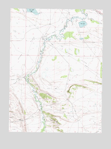
Pine Ridge, WY USGS Topographic Map
Click on map above to begin viewing in our Map Viewer.

This topographic map contains these locations and features:
Feature Name Type Latitude Longitude GNIS ID View Map
Alligator RockSummitN41.7622°W106.1906°1584799View Map
Bible RockSummitN41.7611°W106.1867°1585418View Map
Chace Number 1 DamDamN41.8750°W106.1256°1605839View Map
Chace Number 1 ReservoirReservoirN41.8750°W106.1256°1605840View Map
Chapman DrawValleyN41.8036°W106.2372°1586582View Map
Cronberg SpringSpringN41.7622°W106.2339°1587230View Map
East Allen LakeLakeN41.8749°W106.2274°1588014View Map
Foote CreekStreamN41.8672°W106.1470°1599788View Map
Horne FlatsFlatN41.8258°W106.1631°1589679View Map
Horne LakeLakeN41.8601°W106.1526°1589680View Map
Indian HillSummitN41.7916°W106.1700°1589907View Map
Pine RidgeRidgeN41.7911°W106.2061°1592799View Map
Second Sand CreekStreamN41.8066°W106.2283°1594077View Map
Spade FlatsFlatN41.8358°W106.2486°1594755View Map
Thornton DitchCanalN41.7525°W106.1289°1596970View Map

Note: Coordinates in the location and feature list above are referenced to NAD83 datum.


Copyright (C) 2008-2024 Ryan Niemi / Sunset Dynamics ... All Rights Reserved