TopoQuest Logo
Do you find TopoQuest useful?
Help keep TopoQuest running and adding new maps/features by donating!
Bitcoin:  19c7KJd3qBynnjoSw5npx9KScwjBe4ifkT
Litecoin:  LXs6TkuXGGXo1vDsWCkWVdjQX94eUKd6ui
Home View Maps Find Maps Find Places Resources & Links


Pine Flat, Idaho Topographic Map

USGS Map Title: Pine Flat, ID
USGS Map MRC: 44115A6
DRG (GeoTIFF) Download: o44115a6.tif


Neighboring USGS Topographic Map Quads:


  Lightning Ridge, ID  
44115B7
 

  Scott Creek, ID  
44115B6
 

  Miller Mountain West, ID  
44115B5
 

  Grimes Pass, ID  
44115A7
 

  Pine Flat, ID  
44115A6
 

  Lowman, ID  
44115A5
 

  Pioneerville, ID  
43115H7
 

  Sunset Mountain, ID  
43115H6
 

  Big Owl Creek, ID  
43115H5


Map MRC Location:

N45°
W116°
N45°
W115°
H8 H7 H6 H5 H4 H3 H2 H1
G8 G7 G6 G5 G4 G3 G2 G1
F8 F7 F6 F5 F4 F3 F2 F1
E8 E7 E6 E5 E4 E3 E2 E1
D8 D7 D6 D5 D4 D3 D2 D1
C8 C7 C6 C5 C4 C3 C2 C1
B8 B7 B6 B5 B4 B3 B2 B1
A8 A7 A6 A5 A4 A3 A2 A1
N44°
W116°
N44°
W115°

Pine Flat, ID USGS 1:24K Topographic Map Preview:
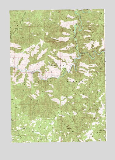
Pine Flat, ID USGS Topographic Map
Click on map above to begin viewing in our Map Viewer.

This topographic map contains these locations and features:
Feature Name Type Latitude Longitude GNIS ID View Map
Assay CreekStreamN44.0141°W115.6784°376762View Map
Big FallsFallsN44.0663°W115.7232°377519View Map
Birch CreekStreamN44.0716°W115.7415°377650View Map
Birch FlatFlatN44.0721°W115.7446°377669View Map
Burns RidgeRidgeN44.0360°W115.6871°378534View Map
Cooley CreekStreamN44.0671°W115.6773°379654View Map
Coulter GulchValleyN44.0105°W115.7407°379913View Map
Coulter SummitSummitN44.0018°W115.7479°396335View Map
Deadwood CampgroundLocaleN44.0810°W115.6587°380343View Map
Deadwood Jim CreekStreamN44.1202°W115.6601°380350View Map
Deadwood RiverStreamN44.0791°W115.6584°380355View Map
Fir CreekStreamN44.1005°W115.7484°381697View Map
Golden Chariot MineMineN44.0124°W115.6712°382408View Map
Golden Cycle MineMineN44.0138°W115.6640°382412View Map
Hole in the Wall CreekStreamN44.0588°W115.7023°383251View Map
Little Hole in the Wall CreekStreamN44.0682°W115.7293°384859View Map
Long GulchValleyN44.0693°W115.7304°386047View Map
Mammoth MineMineN44.0032°W115.7129°386418View Map
Monumental CreekStreamN44.0849°W115.6404°387121View Map
Oxbow BendBendN44.0707°W115.6643°388058View Map
Pidgeon FlatFlatN44.1107°W115.6643°397989View Map
Pine FlatFlatN44.0663°W115.6798°388510View Map
Pine Flat Access AreaLocaleN44.0730°W115.6779°401088View Map
Pine Flat CreekStreamN44.0657°W115.6790°397034View Map
Pine Flat Hot SpringsSpringN44.0622°W115.6856°388513View Map
Pine Flats CampgroundLocaleN44.0630°W115.6821°400504View Map
Rattlesnake GulchValleyN44.0616°W115.6979°389152View Map
Road Fork CreekStreamN44.0718°W115.6259°389417View Map
Rock CreekStreamN44.0846°W115.6273°389487View Map
Slaughterhouse CreekStreamN44.0982°W115.6665°390579View Map
Slim CreekStreamN44.1010°W115.6646°390626View Map
Sloper MineMineN44.0255°W115.6834°390638View Map
Stevens CreekStreamN44.1249°W115.6476°391440View Map
Timber PointCapeN44.0707°W115.7037°392158View Map
Windy PointCapeN44.0735°W115.7207°393582View Map

Note: Coordinates in the location and feature list above are referenced to NAD83 datum.


Copyright (C) 2008-2024 Ryan Niemi / Sunset Dynamics ... All Rights Reserved