TopoQuest Logo
Do you find TopoQuest useful?
Help keep TopoQuest running and adding new maps/features by donating!
Bitcoin:  19c7KJd3qBynnjoSw5npx9KScwjBe4ifkT
Litecoin:  LXs6TkuXGGXo1vDsWCkWVdjQX94eUKd6ui
Home View Maps Find Maps Find Places Resources & Links


Pilot Peak, Montana Topographic Map

USGS Map Title: Pilot Peak, MT
USGS Map MRC: 47113D2
DRG (GeoTIFF) Download: o47113d2.tif


Neighboring USGS Topographic Map Quads:


  Big Salmon Lake East, MT  
47113E3
 

  Haystack Mountain, MT  
47113E2
 

  Prairie Reef, MT  
47113E1
 

  Una Mountain, MT  
47113D3
 

  Pilot Peak, MT  
47113D2
 

  Trap Mountain, MT  
47113D1
 

  Crimson Peak, MT  
47113C3
 

  Hahn Creek Pass, MT  
47113C2
 

  Danaher Mountain, MT  
47113C1


Map MRC Location:

N48°
W114°
N48°
W113°
H8 H7 H6 H5 H4 H3 H2 H1
G8 G7 G6 G5 G4 G3 G2 G1
F8 F7 F6 F5 F4 F3 F2 F1
E8 E7 E6 E5 E4 E3 E2 E1
D8 D7 D6 D5 D4 D3 D2 D1
C8 C7 C6 C5 C4 C3 C2 C1
B8 B7 B6 B5 B4 B3 B2 B1
A8 A7 A6 A5 A4 A3 A2 A1
N47°
W114°
N47°
W113°

Pilot Peak, MT USGS 1:24K Topographic Map Preview:
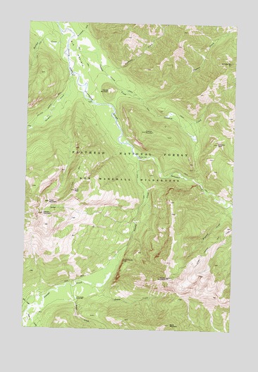
Pilot Peak, MT USGS Topographic Map
Click on map above to begin viewing in our Map Viewer.

This topographic map contains these locations and features:
Feature Name Type Latitude Longitude GNIS ID View Map
Big PrairieAreaN47.4886°W113.2226°779858View Map
Black MountainSummitN47.3772°W113.1626°780012View Map
Brownstone CreekStreamN47.4947°W113.2237°780471View Map
Butcher CreekStreamN47.4966°W113.2326°780676View Map
Cabin CreekStreamN47.3766°W113.2495°780733View Map
Catchem CreekStreamN47.4694°W113.1845°781058View Map
Catchem Creek TrailTrailN47.4736°W113.1937°781059View Map
Cayuse CreekStreamN47.4902°W113.2270°800573View Map
Cayuse MountainSummitN47.4722°W113.2023°781084View Map
Danaher CreekStreamN47.4455°W113.1834°800672View Map
Emerson PeakSummitN47.4513°W113.1362°783183View Map
Flatiron MountainSummitN47.4561°W113.1795°783524View Map
Fossil MountainSummitN47.4269°W113.2365°783626View Map
Francois CreekStreamN47.4822°W113.2064°783685View Map
Gordon CreekStreamN47.4786°W113.2248°784120View Map
Gordon MountainSummitN47.4219°W113.2403°784121View Map
Hahn CreekStreamN47.3922°W113.2209°784445View Map
Hahn Creek Guard StationLocaleN47.3874°W113.2187°798989View Map
Jumbo CreekStreamN47.3924°W113.2062°785591View Map
Jumbo Lookout TrailTrailN47.4105°W113.1373°801001View Map
Jumbo MountainSummitN47.3958°W113.1651°785599View Map
Kid CreekStreamN47.3838°W113.2465°785715View Map
Otter CreekStreamN47.3813°W113.2481°788513View Map
Pilot PeakSummitN47.4313°W113.2212°788866View Map
Scintilla MountainSummitN47.4844°W113.1281°790149View Map
Wigwam CreekStreamN47.4236°W113.1264°794635View Map
Youngs CreekStreamN47.4455°W113.1837°793622View Map
Youngs Creek FordLocaleN47.4455°W113.1837°793623View Map

Note: Coordinates in the location and feature list above are referenced to NAD83 datum.


Copyright (C) 2008-2024 Ryan Niemi / Sunset Dynamics ... All Rights Reserved