TopoQuest Logo
Do you find TopoQuest useful?
Help keep TopoQuest running and adding new maps/features by donating!
Bitcoin:  19c7KJd3qBynnjoSw5npx9KScwjBe4ifkT
Litecoin:  LXs6TkuXGGXo1vDsWCkWVdjQX94eUKd6ui
Home View Maps Find Maps Find Places Resources & Links


Pikes Point, California Topographic Map

USGS Map Title: Pikes Point, CA
USGS Map MRC: 40120E7
DRG (GeoTIFF) Download: o40120e7.tif


Neighboring USGS Topographic Map Quads:


  Champs Flat, CA  
40120F8
 

  Spalding Tract, CA  
40120F7
 

  Troxel Point, CA  
40120F6
 

  Antelope Mountain, CA  
40120E8
 

  Pikes Point, CA  
40120E7
 

  Gallatin Peak, CA  
40120E6
 

  Pegleg Mountain, CA  
40120D8
 

  Roop Mountain, CA  
40120D7
 

  Susanville, CA  
40120D6


Map MRC Location:

N41°
W121°
N41°
W120°
H8 H7 H6 H5 H4 H3 H2 H1
G8 G7 G6 G5 G4 G3 G2 G1
F8 F7 F6 F5 F4 F3 F2 F1
E8 E7 E6 E5 E4 E3 E2 E1
D8 D7 D6 D5 D4 D3 D2 D1
C8 C7 C6 C5 C4 C3 C2 C1
B8 B7 B6 B5 B4 B3 B2 B1
A8 A7 A6 A5 A4 A3 A2 A1
N40°
W121°
N40°
W120°

Pikes Point, CA USGS 1:24K Topographic Map Preview:
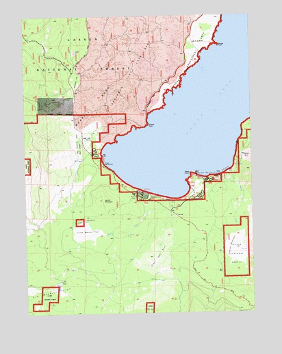
Pikes Point, CA USGS Topographic Map
Click on map above to begin viewing in our Map Viewer.

This topographic map contains these locations and features:
Feature Name Type Latitude Longitude GNIS ID View Map
Aspen Grove CampgroundLocaleN40.5554°W120.7722°277075View Map
Aspen Grove Picnic AreaLocaleN40.5557°W120.7722°1802894View Map
California Department of Forestry and Fire Protection Lassen Modoc Unit Eagle LakeBuildingN40.5418°W120.7950°2622000View Map
Christie Beach CampgroundLocaleN40.5679°W120.8375°277211View Map
Christie Day Use Area CampgroundLocaleN40.5627°W120.8347°277073View Map
Eagle CampgroundLocaleN40.5485°W120.7825°259651View Map
Eagle Lake BurnAreaN40.5257°W120.8044°259662View Map
Eagle Lake ResortLocaleN40.5724°W120.8408°259663View Map
Eagle LodgeLocaleN40.5502°W120.8163°259665View Map
Gallatin BeachBeachN40.5585°W120.7700°260463View Map
Gallatin HouseLocaleN40.5582°W120.7633°260465View Map
Gallatin Picnic AreaLocaleN40.5574°W120.7708°1802893View Map
Lake of the WoodsLocaleN40.6163°W120.7850°262278View Map
Little Merrill FlatFlatN40.5346°W120.8402°262669View Map
Lower Brockman FlatFlatN40.5716°W120.8469°1802895View Map
Merrill BurnAreaN40.5827°W120.8436°263461View Map
Merrill CampgroundLocaleN40.5496°W120.8119°1665889View Map
Merrill CreekStreamN40.5513°W120.8080°263463View Map
Merrill Information CenterLocaleN40.5493°W120.8080°1802889View Map
Merrill MountainSummitN40.5477°W120.8336°263464View Map
Miners BayBayN40.5838°W120.7525°263675View Map
Osprey Management AreaParkN40.6154°W120.7769°277078View Map
Papoose CreekStreamN40.5596°W120.7658°264498View Map
Papoose MeadowsFlatN40.5232°W120.7613°264502View Map
Pikes PointCapeN40.5582°W120.7863°264729View Map
Pikes Point Boat RampLocaleN40.5577°W120.7794°1802891View Map
Pikes Point Picnic AreaLocaleN40.5568°W120.7841°277076View Map
Pine Grove Picnic AreaLocaleN40.5577°W120.7833°1802892View Map
Roney CorralLocaleN40.5141°W120.8575°265559View Map
Slough PointCapeN40.6121°W120.7694°266304View Map
West Eagle Picnic AreaLocaleN40.5468°W120.7883°277072View Map
Wildcat PointCapeN40.5788°W120.8091°269097View Map

Note: Coordinates in the location and feature list above are referenced to NAD83 datum.


Copyright (C) 2008-2024 Ryan Niemi / Sunset Dynamics ... All Rights Reserved