TopoQuest Logo
Do you find TopoQuest useful?
Help keep TopoQuest running and adding new maps/features by donating!
Bitcoin:  19c7KJd3qBynnjoSw5npx9KScwjBe4ifkT
Litecoin:  LXs6TkuXGGXo1vDsWCkWVdjQX94eUKd6ui
Home View Maps Find Maps Find Places Resources & Links


Pikes Peak, Montana Topographic Map

USGS Map Title: Pikes Peak, MT
USGS Map MRC: 46113D1
DRG (GeoTIFF) Download: o46113d1.tif


Neighboring USGS Topographic Map Quads:


  Hall, MT  
46113E2
 

  Dunkleberg Creek, MT  
46113E1
 

  Griffin Creek, MT  
46112E8
 

  Maxville, MT  
46113D2
 

  Pikes Peak, MT  
46113D1
 

  Rock Creek Lake, MT  
46112D8
 

  Fred Burr Lake, MT  
46113C2
 

  Pozega Lakes, MT  
46113C1
 

  Mount Powell, MT  
46112C8


Map MRC Location:

N47°
W114°
N47°
W113°
H8 H7 H6 H5 H4 H3 H2 H1
G8 G7 G6 G5 G4 G3 G2 G1
F8 F7 F6 F5 F4 F3 F2 F1
E8 E7 E6 E5 E4 E3 E2 E1
D8 D7 D6 D5 D4 D3 D2 D1
C8 C7 C6 C5 C4 C3 C2 C1
B8 B7 B6 B5 B4 B3 B2 B1
A8 A7 A6 A5 A4 A3 A2 A1
N46°
W114°
N46°
W113°

Pikes Peak, MT USGS 1:24K Topographic Map Preview:
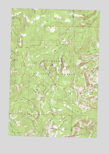
Pikes Peak, MT USGS Topographic Map
Click on map above to begin viewing in our Map Viewer.

This topographic map contains these locations and features:
Feature Name Type Latitude Longitude GNIS ID View Map
Altoona LakesLakeN46.3953°W113.0974°778991View Map
Altoona Lakes MineMineN46.3966°W113.0962°803092View Map
Bielenberg LakeLakeN46.4206°W113.0895°779753View Map
Bluebird MineMineN46.4194°W113.0856°803089View Map
Brooklyn MineMineN46.3908°W113.1209°780428View Map
Davidson CreekStreamN46.4891°W113.0148°782098View Map
Deerlodge BasinBasinN46.3971°W113.0912°782277View Map
East Goat MountainSummitN46.3846°W113.0250°782932View Map
Eureka RidgeRidgeN46.4496°W113.1089°783249View Map
Eureka Ridge MineMineN46.4266°W113.1195°803096View Map
Game PassGapN46.4266°W113.0628°783819View Map
Goat MountainSummitN46.3833°W113.0653°784017View Map
Goat Mountain LakesLakeN46.3791°W113.0575°784023View Map
Gold Creek LakesLakeN46.4413°W113.0587°784051View Map
Gold Creek MineMineN46.4644°W113.0573°784053View Map
Gold Creek Placer MineMineN46.4644°W113.0587°803123View Map
Gold Lake DamDamN46.4416°W113.0592°795987View Map
Granite CreekStreamN46.3783°W113.1176°784164View Map
Horseshoe BasinBasinN46.4660°W113.1137°785070View Map
Ivanhoe MineMineN46.4421°W113.0762°785363View Map
Ivanhoe MineMineN46.4421°W113.0767°803065View Map
Jones MountainSummitN46.4952°W113.0259°785564View Map
Master MineMineN46.4705°W113.0509°786923View Map
Master MineMineN46.4680°W113.0523°803014View Map
Master Mining CampLocaleN46.4660°W113.0531°786924View Map
Meadow LakesLakeN46.4016°W113.0535°787160View Map
Middle Fork MineMineN46.4966°W113.1067°803075View Map
NE Section 15 MineMineN46.4899°W113.0851°803122View Map
NE Section 23 MineMineN46.4360°W113.0620°803120View Map
North Gold CreekStreamN46.4880°W113.0278°788287View Map
NW Section 14 MineMineN46.4519°W113.0689°803121View Map
Pikes PeakSummitN46.4277°W113.0117°788855View Map
Pineau MineMineN46.4646°W113.0639°803021View Map
Pineau MineMineN46.4605°W113.0639°788902View Map
Port Royal MineMineN46.4116°W113.0953°803022View Map
Rainbow LakeLakeN46.4450°W113.0630°789336View Map
Rose MountainSummitN46.4444°W113.0489°789777View Map
Royal (historical)LocaleN46.4124°W113.0953°1781884View Map
Royal Post Office (historical)Post OfficeN46.4124°W113.0953°1781798View Map
Ryan MineMineN46.4519°W113.0295°805029View Map
Ryan MineMineN46.4533°W113.0264°789876View Map
SE Section 33 MineMineN46.3983°W113.1076°803090View Map
South Gold CreekStreamN46.4677°W113.0498°791099View Map
Thompson LakeLakeN46.3827°W113.0486°792095View Map
Thursday Friday MineMineN46.4494°W113.1209°792156View Map
Tibbets MineMineN46.4555°W113.0148°805028View Map
Tolean LakeLakeN46.4177°W113.0381°792237View Map
Wasa MineMineN46.4980°W113.0948°803029View Map

Note: Coordinates in the location and feature list above are referenced to NAD83 datum.


Copyright (C) 2008-2024 Ryan Niemi / Sunset Dynamics ... All Rights Reserved