TopoQuest Logo
Do you find TopoQuest useful?
Help keep TopoQuest running and adding new maps/features by donating!
Bitcoin:  19c7KJd3qBynnjoSw5npx9KScwjBe4ifkT
Litecoin:  LXs6TkuXGGXo1vDsWCkWVdjQX94eUKd6ui
Home View Maps Find Maps Find Places Resources & Links


Pike, California Topographic Map

USGS Map Title: Pike, CA
USGS Map MRC: 39120D8
DRG (GeoTIFF) Download: o39120d8.tif


Neighboring USGS Topographic Map Quads:


  Strawberry Valley, CA  
39121E1
 

  Goodyears Bar, CA  
39120E8
 

  Downieville, CA  
39120E7
 

  Camptonville, CA  
39121D1
 

  Pike, CA  
39120D8
 

  Alleghany, CA  
39120D7
 

  Nevada City, CA  
39121C1
 

  North Bloomfield, CA  
39120C8
 

  Washington, CA  
39120C7


Map MRC Location:

N40°
W121°
N40°
W120°
H8 H7 H6 H5 H4 H3 H2 H1
G8 G7 G6 G5 G4 G3 G2 G1
F8 F7 F6 F5 F4 F3 F2 F1
E8 E7 E6 E5 E4 E3 E2 E1
D8 D7 D6 D5 D4 D3 D2 D1
C8 C7 C6 C5 C4 C3 C2 C1
B8 B7 B6 B5 B4 B3 B2 B1
A8 A7 A6 A5 A4 A3 A2 A1
N39°
W121°
N39°
W120°

Pike, CA USGS 1:24K Topographic Map Preview:
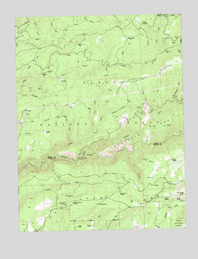
Pike, CA USGS Topographic Map
Click on map above to begin viewing in our Map Viewer.

This topographic map contains these locations and features:
Feature Name Type Latitude Longitude GNIS ID View Map
Alaska MineMineN39.4457°W120.9925°256148View Map
Backbone House (historical)LocaleN39.3907°W120.9047°1682837View Map
Beame MineMineN39.4577°W120.9811°256610View Map
Bear Trap SpringSpringN39.3969°W120.9238°256710View Map
Black Sand MineMineN39.3949°W120.9649°257162View Map
Bloody RunStreamN39.4202°W120.9136°257215View Map
Blue Grouse MineMineN39.4421°W120.9627°257242View Map
Blue RavineValleyN39.4402°W120.9013°257274View Map
Bope RavineValleyN39.4263°W120.9608°257359View Map
Brush CreekStreamN39.4768°W120.8919°257525View Map
Brush Creek RidgeRidgeN39.4866°W120.9030°257531View Map
Camp GleasonLocaleN39.4943°W120.9058°257878View Map
Chalk FlatFlatN39.4577°W120.9891°258181View Map
Chalk RidgeRidgeN39.4546°W120.9875°258185View Map
Chute Hill CampgroundLocaleN39.3796°W120.9011°1682861View Map
Clerkins RanchLocaleN39.4332°W120.9788°258454View Map
Cold SpringSpringN39.4597°W120.9131°1701206View Map
Cold Spring (historical)Populated PlaceN39.4607°W120.9122°1701205View Map
Columbia HillSummitN39.3907°W120.9663°258610View Map
Columbia Hill CDF Fire StationLocaleN39.3841°W120.9794°1662444View Map
Columbia Hill Ranger Station (historical)LocaleN39.3963°W120.9649°1682863View Map
Derbec SpringSpringN39.3918°W120.8797°259282View Map
Foote CrossingCrossingN39.4168°W120.9516°1658555View Map
Footes Crossing BridgeBridgeN39.4168°W120.9527°1733156View Map
Gale CreekStreamN39.4666°W120.9541°260456View Map
Gales OrchardLocaleN39.4838°W120.9522°260461View Map
Graveyard HillSummitN39.4877°W120.9369°1662447View Map
Grizzly Gulch (historical)Populated PlaceN39.4524°W120.9716°1701208View Map
Grouse CreekStreamN39.4346°W120.9419°260943View Map
Holden SpringsSpringN39.3900°W120.9408°261416View Map
Holley RavineValleyN39.4166°W120.9127°261423View Map
Indian CreekStreamN39.4188°W120.9713°261719View Map
Jackies Orchard SpringSpringN39.3910°W120.9602°261868View Map
Jenkins Ranch (historical)LocaleN39.4735°W120.9636°1733161View Map
Jersey RavineValleyN39.4805°W120.8802°266858View Map
Kanaka CreekStreamN39.4196°W120.9430°262071View Map
Kate Hardy MineMineN39.4782°W120.8880°262079View Map
Kimberley CreekStreamN39.4477°W120.8811°262176View Map
Kimberlin RavineValleyN39.4480°W120.8819°1733163View Map
Lafayette Ridge TrailTrailN39.4363°W120.8852°262267View Map
Lone GraveLocaleN39.4907°W120.9463°1662446View Map
Long Point TrailTrailN39.4516°W120.8949°262871View Map
Lucky Dog CreekStreamN39.4855°W120.8758°263061View Map
Marion CreekStreamN39.4635°W120.9916°263212View Map
Miller CreekStreamN39.4707°W120.9222°263627View Map
Miller RanchLocaleN39.4863°W120.9158°263639View Map
Miller SpringSpringN39.4866°W120.9161°1701210View Map
Mobley SpringSpringN39.4156°W120.8849°263716View Map
Mount Alta MineMineN39.4668°W120.9738°263887View Map
Negro TentLocaleN39.4871°W120.9508°1662445View Map
Nelson MillPopulated PlaceN39.4313°W120.9988°1701211View Map
Omega MineMineN39.4827°W120.8808°264352View Map
Orient MineMineN39.4871°W120.9866°264394View Map
Our House DamDamN39.4120°W120.9968°264415View Map
Phippen Sawmill (historical)LocaleN39.4893°W120.8891°1701212View Map
PikePopulated PlaceN39.4391°W120.9980°1659389View Map
Pike Census Designated PlaceCensusN39.4278°W120.9997°2583112View Map
Pleasant ViewLocaleN39.4668°W120.9802°264848View Map
Pliocene Forest Service StationLocaleN39.4727°W120.8752°275065View Map
Plum ValleyPopulated PlaceN39.4485°W120.9608°1701213View Map
Plum ValleyBasinN39.4471°W120.9600°264863View Map
Red Ledge MineMineN39.4449°W120.9080°265293View Map
Roman MineMineN39.4452°W120.9444°265556View Map
Shannon MineMineN39.4468°W120.9052°266043View Map
Shields CampLocaleN39.3774°W120.9563°266113View Map
Squirrel CreekStreamN39.4321°W120.9419°267642View Map
Tippecanoe (historical)Populated PlaceN39.4638°W120.9658°1701214View Map
Tippecanoe MineMineN39.4632°W120.9652°268298View Map
Trapper CampLocaleN39.4960°W120.9519°1662437View Map
Trestle RavineValleyN39.4252°W120.9049°268401View Map
True Grit MineMineN39.4713°W120.9513°268440View Map
Upper Derbec SpringSpringN39.3942°W120.8778°268604View Map
Walls FlatFlatN39.4049°W120.9011°268767View Map
Watsons Quartz MineMineN39.4974°W120.8908°1733190View Map
Willow SpringSpringN39.3930°W120.8913°269183View Map

Note: Coordinates in the location and feature list above are referenced to NAD83 datum.


Copyright (C) 2008-2024 Ryan Niemi / Sunset Dynamics ... All Rights Reserved