TopoQuest Logo
Do you find TopoQuest useful?
Help keep TopoQuest running and adding new maps/features by donating!
Bitcoin:  19c7KJd3qBynnjoSw5npx9KScwjBe4ifkT
Litecoin:  LXs6TkuXGGXo1vDsWCkWVdjQX94eUKd6ui
Home View Maps Find Maps Find Places Resources & Links


Petrolia, California Topographic Map

USGS Map Title: Petrolia, CA
USGS Map MRC: 40124C3
DRG (GeoTIFF) Download: o40124c3.tif


Neighboring USGS Topographic Map Quads:


  Cape Mendocino, CA  
40124D4
 

  Capetown, CA  
40124D3
 

  Taylor Peak, CA  
40124D2


  Petrolia, CA  
40124C3
 

  Buckeye Mountain, CA  
40124C2


  Cooskie Creek, CA  
40124B3
 

  Shubrick Peak, CA  
40124B2


Map MRC Location:

N41°
W125°
N41°
W124°
H8 H7 H6 H5 H4 H3 H2 H1
G8 G7 G6 G5 G4 G3 G2 G1
F8 F7 F6 F5 F4 F3 F2 F1
E8 E7 E6 E5 E4 E3 E2 E1
D8 D7 D6 D5 D4 D3 D2 D1
C8 C7 C6 C5 C4 C3 C2 C1
B8 B7 B6 B5 B4 B3 B2 B1
A8 A7 A6 A5 A4 A3 A2 A1
N40°
W125°
N40°
W124°

Petrolia, CA USGS 1:24K Topographic Map Preview:
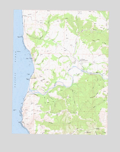
Petrolia, CA USGS Topographic Map
Click on map above to begin viewing in our Map Viewer.

This topographic map contains these locations and features:
Feature Name Type Latitude Longitude GNIS ID View Map
Apple Tree RidgeRidgeN40.3399°W124.2525°218319View Map
Bear CreekStreamN40.2893°W124.3356°218813View Map
Christmas RockIslandN40.2735°W124.3748°221091View Map
Clear CreekStreamN40.3110°W124.2673°221188View Map
Collins GulchValleyN40.2954°W124.3489°221393View Map
Collins PointCapeN40.3057°W124.3481°221394View Map
Collins SpringSpringN40.3036°W124.3396°221397View Map
Conical RockIslandN40.2612°W124.3648°221455View Map
Cooskie MountainSummitN40.2562°W124.2659°221529View Map
Domingo CreekStreamN40.3685°W124.3642°222481View Map
East Branch North Fork Mattole RiverStreamN40.3565°W124.2531°233815View Map
Fourmile CreekStreamN40.2562°W124.3575°223753View Map
Hair Seal RockIslandN40.3260°W124.3537°224785View Map
Jeffry GulchValleyN40.3212°W124.2992°226186View Map
Jim Goff GulchValleyN40.3060°W124.3206°226239View Map
Joel FlatLakeN40.3739°W124.2917°226255View Map
Johnny Jack RidgeRidgeN40.2504°W124.2964°226286View Map
La Rue GulchValleyN40.3204°W124.3476°226730View Map
Little Chaparral MountainSummitN40.2524°W124.2787°227218View Map
Mattole BeachBeachN40.2890°W124.3573°228236View Map
Mattole Elementary SchoolSchoolN40.3218°W124.2854°1682003View Map
Mattole PointCapeN40.3049°W124.3537°228237View Map
Mattole RiverStreamN40.3024°W124.3539°228238View Map
McNutt GulchValleyN40.3560°W124.3631°228445View Map
Mill CreekStreamN40.2979°W124.3064°228676View Map
Mill CreekStreamN40.3129°W124.2795°228699View Map
Moore HillSummitN40.3049°W124.3364°229024View Map
Mussel RockIslandN40.3474°W124.3673°229380View Map
North Fork Mattole RiverStreamN40.3179°W124.2920°229695View Map
Peter GulchValleyN40.3196°W124.3476°230560View Map
PetroliaPopulated PlaceN40.3254°W124.2870°1659378View Map
Petrolia CemeteryCemeteryN40.3203°W124.2880°2755371View Map
Petrolia Post OfficePost OfficeN40.3248°W124.2874°2760044View Map
Petrolia Volunteer Fire DepartmentBuildingN40.3250°W124.2875°2621886View Map
Prosper RidgeRidgeN40.2712°W124.3123°1654934View Map
Prosper Ridge Volunteer Fire DepartmentBuildingN40.2686°W124.3214°2622240View Map
Punta GordaCapeN40.2612°W124.3628°231095View Map
Sea Lion RockIslandN40.3096°W124.3537°253832View Map
Shenanigan RidgeRidgeN40.2879°W124.2673°232955View Map
Smith GulchValleyN40.2735°W124.3609°233336View Map
Stansberry CreekStreamN40.2893°W124.3348°235377View Map
State Historical Monument 543 First Oil FieldOilfieldN40.3243°W124.2870°277345View Map
Strawberry RockPillarN40.2807°W124.3514°235589View Map
The BrothersIslandN40.3326°W124.3659°236151View Map
The H JRidgeN40.2529°W124.3175°236176View Map
Three BrothersIslandN40.3260°W124.3584°236305View Map
Uncle TommySummitN40.2732°W124.3092°236776View Map

Note: Coordinates in the location and feature list above are referenced to NAD83 datum.


Copyright (C) 2008-2024 Ryan Niemi / Sunset Dynamics ... All Rights Reserved