TopoQuest Logo
Do you find TopoQuest useful?
Help keep TopoQuest running and adding new maps/features by donating!
Bitcoin:  19c7KJd3qBynnjoSw5npx9KScwjBe4ifkT
Litecoin:  LXs6TkuXGGXo1vDsWCkWVdjQX94eUKd6ui
Home View Maps Find Maps Find Places Resources & Links


Perryville, Arizona Topographic Map

USGS Map Title: Perryville, AZ
USGS Map MRC: 33112D4
DRG (GeoTIFF) Download: o33112d4.tif


Neighboring USGS Topographic Map Quads:


  White Tank Mountains, AZ  
33112E5
 

  Waddell, AZ  
33112E4
 

  El Mirage, AZ  
33112E3
 

  Valencia, AZ  
33112D5
 

  Perryville, AZ  
33112D4
 

  Tolleson, AZ  
33112D3
 

  Buckeye, AZ  
33112C5
 

  Avondale SW, AZ  
33112C4
 

  Avondale SE, AZ  
33112C3


Map MRC Location:

N34°
W113°
N34°
W112°
H8 H7 H6 H5 H4 H3 H2 H1
G8 G7 G6 G5 G4 G3 G2 G1
F8 F7 F6 F5 F4 F3 F2 F1
E8 E7 E6 E5 E4 E3 E2 E1
D8 D7 D6 D5 D4 D3 D2 D1
C8 C7 C6 C5 C4 C3 C2 C1
B8 B7 B6 B5 B4 B3 B2 B1
A8 A7 A6 A5 A4 A3 A2 A1
N33°
W113°
N33°
W112°

Perryville, AZ USGS 1:24K Topographic Map Preview:
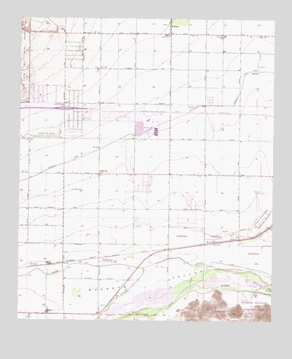
Perryville, AZ USGS Topographic Map
Click on map above to begin viewing in our Map Viewer.

This topographic map contains these locations and features:
Feature Name Type Latitude Longitude GNIS ID View Map
191st Avenue WashArroyoN33.4628°W112.4691°1699837View Map
Arizona State Prison Complex - PerryvilleBuildingN33.4706°W112.4359°2672322View Map
Avondale Goodyear Post OfficePost OfficeN33.4386°W112.3914°44839View Map
Bullard WashArroyoN33.3970°W112.3940°1699834View Map
Bulldozer WashArroyoN33.4650°W112.4966°1699833View Map
Centerra Mirage SchoolSchoolN33.4426°W112.3859°2517731View Map
Cold Water AcademySchoolN33.4945°W112.3771°2517730View Map
Compass ChurchChurchN33.4509°W112.4047°2670806View Map
Copper Trails Elementary SchoolSchoolN33.4427°W112.4214°2517828View Map
Desert Edge High SchoolSchoolN33.4380°W112.3989°2466701View Map
Desert Star SchoolSchoolN33.4273°W112.3967°2517829View Map
Desert Thunder SchoolSchoolN33.4565°W112.4190°2517830View Map
Destiny's Phoenix West Recreational Vehicle ResortLocaleN33.4509°W112.4472°2669956View Map
Eagles Nest Golf Club at Pebble CreekLocaleN33.4840°W112.4044°2669745View Map
Goodyear Fire Department Station 184BuildingN33.4345°W112.4066°2672512View Map
Goodyear Fire Department Station 185BuildingN33.4858°W112.3985°2672513View Map
GriggsLocaleN33.4931°W112.4293°23927View Map
Harvest Baptist ChurchChurchN33.4528°W112.4089°2671117View Map
Interchange 129CrossingN33.4586°W112.4106°2466948View Map
Interchange One Hundred Twenty OneCrossingN33.4625°W112.4785°14616View Map
Jackrabbit Trail WashArroyoN33.4539°W112.4835°1699828View Map
LibertyPopulated PlaceN33.3775°W112.4868°6992View Map
LibertyLocaleN33.3978°W112.4843°6993View Map
Liberty Elementary SchoolSchoolN33.3789°W112.4861°14677View Map
Liberty United Methodist ChurchChurchN33.3778°W112.4871°2671540View Map
Lifeway ChurchChurchN33.4599°W112.4683°2671545View Map
Marsh Airstrip (historical)AirportN33.4681°W112.4024°45387View Map
McMickenPopulated PlaceN33.4973°W112.4271°24512View Map
Millennium High SchoolSchoolN33.4945°W112.3772°2517634View Map
One Hundred Fifty-Seventh Avenue Water Treatment PlantLocaleN33.4004°W112.3986°2467107View Map
Osborn Road WashArroyoN33.4853°W112.4966°1699823View Map
PerryvillePopulated PlaceN33.4356°W112.4613°9336View Map
Perryville SubstationLocaleN33.4203°W112.4799°14902View Map
Phoenix Trotting ParkLocaleN33.4567°W112.4363°9385View Map
Pima SubstationLocaleN33.4798°W112.4257°14935View Map
Saint Thomas Lutheran Church of GoodyearChurchN33.4510°W112.4085°2671624View Map
Scott L Libby Elementary SchoolSchoolN33.4783°W112.4629°15015View Map
Sierra Estrella Golf CourseLocaleN33.3839°W112.3893°43211View Map
Skyway Church of the West ValleyChurchN33.4518°W112.3794°2671794View Map
The Church of Jesus Christ of Latter Day SaintsChurchN33.4419°W112.3917°2671903View Map
Tractor WashArroyoN33.4939°W112.4966°1699821View Map
Tuthill Dike WashArroyoN33.4517°W112.4957°1699820View Map
Verrado High SchoolSchoolN33.4948°W112.4911°2517729View Map
West Valley Free Will Baptist ChurchChurchN33.4652°W112.4891°2671460View Map
White Tank Dam Number FourDamN33.4500°W112.4857°15222View Map
White Tank Southern Baptist ChurchChurchN33.4635°W112.4727°2671472View Map
White Tanks Learning CenterSchoolN33.4788°W112.4653°2517860View Map
Wildflower SchoolSchoolN33.4434°W112.4072°2517466View Map

Note: Coordinates in the location and feature list above are referenced to NAD83 datum.


Copyright (C) 2008-2024 Ryan Niemi / Sunset Dynamics ... All Rights Reserved