TopoQuest Logo
Do you find TopoQuest useful?
Help keep TopoQuest running and adding new maps/features by donating!
Bitcoin:  19c7KJd3qBynnjoSw5npx9KScwjBe4ifkT
Litecoin:  LXs6TkuXGGXo1vDsWCkWVdjQX94eUKd6ui
Home View Maps Find Maps Find Places Resources & Links


Penoyar, California Topographic Map

USGS Map Title: Penoyar, CA
USGS Map MRC: 41122F1
DRG (GeoTIFF) Download: o41122f1.tif


Neighboring USGS Topographic Map Quads:


  Panther Rock, CA  
41122G2
 

  MacDoel, CA  
41122G1
 

  Sheep Mountain, CA  
41121G8
 

  Grass Lake, CA  
41122F2
 

  Penoyar, CA  
41122F1
 

  Bray, CA  
41121F8
 

  The Whaleback, CA  
41122E2
 

  West Haight Mountain, CA  
41122E1
 

  Tennant, CA  
41121E8


Map MRC Location:

N42°
W123°
N42°
W122°
H8 H7 H6 H5 H4 H3 H2 H1
G8 G7 G6 G5 G4 G3 G2 G1
F8 F7 F6 F5 F4 F3 F2 F1
E8 E7 E6 E5 E4 E3 E2 E1
D8 D7 D6 D5 D4 D3 D2 D1
C8 C7 C6 C5 C4 C3 C2 C1
B8 B7 B6 B5 B4 B3 B2 B1
A8 A7 A6 A5 A4 A3 A2 A1
N41°
W123°
N41°
W122°

Penoyar, CA USGS 1:24K Topographic Map Preview:
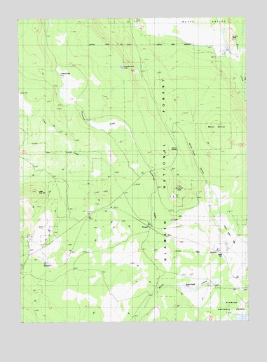
Penoyar, CA USGS Topographic Map
Click on map above to begin viewing in our Map Viewer.

This topographic map contains these locations and features:
Feature Name Type Latitude Longitude GNIS ID View Map
Dead Steer FlatFlatN41.6607°W122.0114°1657762View Map
Devils GateGapN41.6529°W122.0139°259313View Map
EricksonPopulated PlaceN41.6502°W122.1145°1658507View Map
First CreekStreamN41.6749°W122.0845°260129View Map
Harlan Davis CanyonValleyN41.6779°W122.0211°261095View Map
Hebron SummitGapN41.6993°W122.0414°1657778View Map
Hoffman MillLocaleN41.7268°W122.1056°261392View Map
Horsethief ButteSummitN41.6807°W122.0400°261538View Map
JeromePopulated PlaceN41.7315°W122.0003°1658859View Map
Jerome ButteSummitN41.7415°W122.0089°261929View Map
LeafPopulated PlaceN41.6421°W122.0020°262385View Map
Leaf CampLocaleN41.6379°W122.0083°262386View Map
Little Deer MountainSummitN41.6785°W122.1195°262585View Map
Mount HebronSummitN41.7038°W122.0178°261220View Map
Mount Hebron QuarryMineN41.7281°W122.0619°2680983View Map
Murphy WellWellN41.6713°W122.0911°263981View Map
PenoyarPopulated PlaceN41.6674°W122.0628°1659368View Map
Pumpkinseed LakeLakeN41.7297°W122.0692°265064View Map
Soule RanchLocaleN41.6399°W122.0370°267399View Map

Note: Coordinates in the location and feature list above are referenced to NAD83 datum.


Copyright (C) 2008-2024 Ryan Niemi / Sunset Dynamics ... All Rights Reserved