TopoQuest Logo
Do you find TopoQuest useful?
Help keep TopoQuest running and adding new maps/features by donating!
Bitcoin:  19c7KJd3qBynnjoSw5npx9KScwjBe4ifkT
Litecoin:  LXs6TkuXGGXo1vDsWCkWVdjQX94eUKd6ui
Home View Maps Find Maps Find Places Resources & Links


Pelletier Brook Lakes, Maine Topographic Map

USGS Map Title: Pelletier Brook Lakes, ME
USGS Map MRC: 47068A8
DRG (GeoTIFF) Download: o47068a8.tif


Neighboring USGS Topographic Map Quads:


  Falls Brook Lake, ME  
47069B1
 

  Saint Francis, ME  
47068B8
 

  Saint John, ME  
47068B7
 

  Allagash, ME  
47069A1
 

  Pelletier Brook Lakes, ME  
47068A8
 

  McLean Mountain, ME  
47068A7
 

  McKeen Lake, ME  
46069H1
 

  Gardner Pond, ME  
46068H8
 

  Deboullie Pond, ME  
46068H7


Map MRC Location:

N48°
W69°
N48°
W68°
H8 H7 H6 H5 H4 H3 H2 H1
G8 G7 G6 G5 G4 G3 G2 G1
F8 F7 F6 F5 F4 F3 F2 F1
E8 E7 E6 E5 E4 E3 E2 E1
D8 D7 D6 D5 D4 D3 D2 D1
C8 C7 C6 C5 C4 C3 C2 C1
B8 B7 B6 B5 B4 B3 B2 B1
A8 A7 A6 A5 A4 A3 A2 A1
N47°
W69°
N47°
W68°

Pelletier Brook Lakes, ME USGS 1:24K Topographic Map Preview:
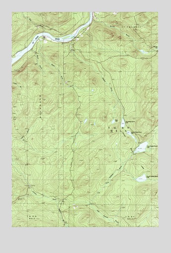
Pelletier Brook Lakes, ME USGS Topographic Map
Click on map above to begin viewing in our Map Viewer.

This topographic map contains these locations and features:
Feature Name Type Latitude Longitude GNIS ID View Map
Allagash Fire DepartmentBuildingN47.1097°W68.9711°2553231View Map
Bass BrookStreamN47.1134°W68.9723°581514View Map
Black LakeLakeN47.0613°W68.9134°581515View Map
Cross RockPopulated PlaceN47.1111°W68.9731°1910309View Map
Cross Rock RapidsRapidsN47.1111°W68.9662°581557View Map
Cross Rock SchoolSchoolN47.1100°W68.9673°581519View Map
Fifth Pelletier BrookStreamN47.0139°W68.9350°581520View Map
First Pelletier Brook LakeLakeN47.0602°W68.9053°581521View Map
Fourth Pelletier Brook LakeLakeN47.0282°W68.8893°581525View Map
Gardner BrookStreamN47.0150°W68.9620°581527View Map
Golden RapidsRapidsN47.1109°W68.9489°581528View Map
Jones CampLocaleN47.0014°W68.9525°581532View Map
McLean BrookStreamN47.1209°W68.9325°581541View Map
Pelletier Brook LakesLakeN47.0500°W68.8948°581545View Map
Second Pelletier Brook LakeLakeN47.0533°W68.8982°581549View Map
Soucier CampLocaleN47.0150°W68.9325°581550View Map
T16 R9 WELSCivilN47.0629°W68.8904°1987221View Map
Third Pelletier BrookStreamN47.0136°W68.9350°581552View Map
Third Pelletier Brook LakeLakeN47.0462°W68.8893°581551View Map
Wesley BrookStreamN47.1061°W68.9817°581554View Map
Wiggins BrookStreamN47.1092°W68.9492°581555View Map
Wyles BrookStreamN47.1106°W68.9759°581556View Map

Note: Coordinates in the location and feature list above are referenced to NAD83 datum.


Copyright (C) 2008-2024 Ryan Niemi / Sunset Dynamics ... All Rights Reserved