TopoQuest Logo
Do you find TopoQuest useful?
Help keep TopoQuest running and adding new maps/features by donating!
Bitcoin:  19c7KJd3qBynnjoSw5npx9KScwjBe4ifkT
Litecoin:  LXs6TkuXGGXo1vDsWCkWVdjQX94eUKd6ui
Home View Maps Find Maps Find Places Resources & Links


Peck Mountain, Idaho Topographic Map

USGS Map Title: Peck Mountain, ID
USGS Map MRC: 44116G5
DRG (GeoTIFF) Download: o44116g5.tif


Neighboring USGS Topographic Map Quads:


  Rocky Comfort Flat, ID  
44116H6
 

  Weasel Gulch, ID  
44116H5
 

  Tamarack, ID  
44116H4
 

  Crooked River Point, ID  
44116G6
 

  Peck Mountain, ID  
44116G5
 

  Fruitvale, ID  
44116G4
 

  Rush Peak, ID  
44116F6
 

  Goodrich, ID  
44116F5
 

  Council, ID  
44116F4


Map MRC Location:

N45°
W117°
N45°
W116°
H8 H7 H6 H5 H4 H3 H2 H1
G8 G7 G6 G5 G4 G3 G2 G1
F8 F7 F6 F5 F4 F3 F2 F1
E8 E7 E6 E5 E4 E3 E2 E1
D8 D7 D6 D5 D4 D3 D2 D1
C8 C7 C6 C5 C4 C3 C2 C1
B8 B7 B6 B5 B4 B3 B2 B1
A8 A7 A6 A5 A4 A3 A2 A1
N44°
W117°
N44°
W116°

Peck Mountain, ID USGS 1:24K Topographic Map Preview:
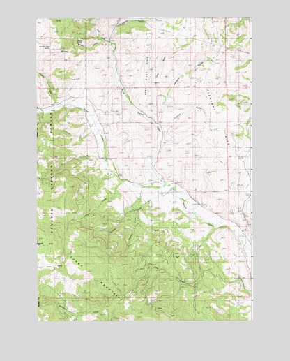
Peck Mountain, ID USGS Topographic Map
Click on map above to begin viewing in our Map Viewer.

This topographic map contains these locations and features:
Feature Name Type Latitude Longitude GNIS ID View Map
Badger GulchValleyN44.8652°W116.5879°376833View Map
Council DivisionCivilN44.8355°W116.5083°1936694View Map
Dry CreekStreamN44.8374°W116.6202°380826View Map
Ellsworth-Middle DamDamN44.8582°W116.5510°398925View Map
Fir CreekStreamN44.8157°W116.5843°381699View Map
Flying Y Ranch AirportAirportN44.7943°W116.5319°400800View Map
Grouse SpringSpringN44.8635°W116.6010°382759View Map
Hanson CreekStreamN44.8002°W116.5407°382876View Map
Horse FlatFlatN44.7754°W116.5538°383378View Map
Horse SpringSpringN44.8749°W116.6154°383403View Map
Lakey CreekStreamN44.8077°W116.5757°384391View Map
Left Fork North Hornet CreekStreamN44.8649°W116.5835°384538View Map
Long GulchValleyN44.8429°W116.5510°386049View Map
Long Gulch RidgeRidgeN44.8682°W116.5499°386058View Map
Mill CreekStreamN44.8374°W116.6213°386947View Map
North Hornet CreekStreamN44.8054°W116.5485°387819View Map
Pearl CreekStreamN44.8399°W116.6110°388305View Map
Peck MountainSummitN44.8621°W116.6118°397019View Map
Peck Mountain SpringSpringN44.8632°W116.6177°394899View Map
Pleasant RidgeRidgeN44.8354°W116.5179°388602View Map
Pole CreekStreamN44.7893°W116.5213°388682View Map
Ridge School (historical)SchoolN44.8179°W116.5093°389355View Map
Robison GulchValleyN44.8324°W116.5540°389462View Map
Skunk Cabbage FlatStreamN44.7532°W116.6010°390541View Map
Sonner CreekStreamN44.7963°W116.5663°395962View Map
Stony PointSummitN44.7752°W116.6132°397215View Map
Timber GulchValleyN44.8718°W116.5796°392154View Map
Traction GulchValleyN44.8299°W116.5518°392260View Map
Upper Dale SchoolLocaleN44.8160°W116.5826°392628View Map

Note: Coordinates in the location and feature list above are referenced to NAD83 datum.


Copyright (C) 2008-2024 Ryan Niemi / Sunset Dynamics ... All Rights Reserved