TopoQuest Logo
Do you find TopoQuest useful?
Help keep TopoQuest running and adding new maps/features by donating!
Bitcoin:  19c7KJd3qBynnjoSw5npx9KScwjBe4ifkT
Litecoin:  LXs6TkuXGGXo1vDsWCkWVdjQX94eUKd6ui
Home View Maps Find Maps Find Places Resources & Links


Pearsoll Peak, Oregon Topographic Map

USGS Map Title: Pearsoll Peak, OR
USGS Map MRC: 42123C7
DRG (GeoTIFF) Download: o42123c7.tif


Neighboring USGS Topographic Map Quads:


  Silver Peak, OR  
42123D8
 

  York Butte, OR  
42123D7
 

  Chrome Ridge, OR  
42123D6
 

  Tincup Peak, OR  
42123C8
 

  Pearsoll Peak, OR  
42123C7
 

  Eight Dollar Mountain, OR  
42123C6
 

  Chetco Peak, OR  
42123B8
 

  Josephine Mountain, OR  
42123B7
 

  Cave Junction, OR  
42123B6


Map MRC Location:

N43°
W124°
N43°
W123°
H8 H7 H6 H5 H4 H3 H2 H1
G8 G7 G6 G5 G4 G3 G2 G1
F8 F7 F6 F5 F4 F3 F2 F1
E8 E7 E6 E5 E4 E3 E2 E1
D8 D7 D6 D5 D4 D3 D2 D1
C8 C7 C6 C5 C4 C3 C2 C1
B8 B7 B6 B5 B4 B3 B2 B1
A8 A7 A6 A5 A4 A3 A2 A1
N42°
W124°
N42°
W123°

Pearsoll Peak, OR USGS 1:24K Topographic Map Preview:
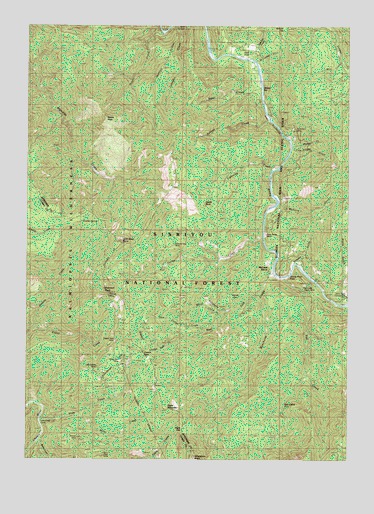
Pearsoll Peak, OR USGS Topographic Map
Click on map above to begin viewing in our Map Viewer.

This topographic map contains these locations and features:
Feature Name Type Latitude Longitude GNIS ID View Map
Albright Mine (historical)MineN42.2929°W123.7901°1154850View Map
Babyfoot CreekStreamN42.2551°W123.8726°1137374View Map
Baker CreekStreamN42.3590°W123.7865°1137426View Map
Bills GulchValleyN42.3096°W123.7776°1154856View Map
Bowser MineMineN42.2559°W123.8562°1138518View Map
Castle RockPillarN42.3238°W123.8071°1139444View Map
Chetco PassGapN42.2793°W123.8292°1139615View Map
Chetco Pass CreekStreamN42.2804°W123.8248°1154855View Map
Chrome King MineMineN42.3115°W123.8181°1139719View Map
Cox Mine (historical)MineN42.2748°W123.8054°1154849View Map
Crater CreekStreamN42.2871°W123.8742°1140390View Map
Dailey CreekStreamN42.3143°W123.7845°1140593View Map
Deep Gorge MineMineN42.3148°W123.7840°1155701View Map
Eagle GapGapN42.2587°W123.8156°1141477View Map
Eagle MountainSummitN42.2644°W123.8219°1141480View Map
Eagles Nest MineMineN42.2843°W123.8417°1155698View Map
Eureka MineMineN42.3426°W123.7501°1141915View Map
Fall CreekStreamN42.3023°W123.7756°1141978View Map
Fall Creek Copper MineMineN42.2998°W123.7692°1155700View Map
Five Finger GulchValleyN42.3387°W123.7704°1142192View Map
Gold Basin ButteSummitN42.3120°W123.8395°1142803View Map
Golden Dreams Mine (historical)MineN42.2790°W123.8359°1154860View Map
Golden Eagle Mine (historical)MineN42.2512°W123.8470°1154853View Map
Granite SpringSpringN42.3182°W123.8487°1142931View Map
Hall CabinLocaleN42.2668°W123.7745°1143220View Map
Horse FlatFlatN42.2959°W123.7959°1143761View Map
Hustis Mine (historical)MineN42.3457°W123.7637°1154852View Map
Knapke GulchValleyN42.3073°W123.7698°1144677View Map
Labrador CreekStreamN42.3743°W123.8195°1144730View Map
Lightning CreekStreamN42.3332°W123.7812°1144996View Map
Little Siberia MineMineN42.2763°W123.8486°1154851View Map
Marsh CreekStreamN42.2918°W123.8006°1145828View Map
McCaleb RanchLocaleN42.3048°W123.7826°1145915View Map
McGuire GulchValleyN42.3232°W123.7776°1145986View Map
Miami BarBarN42.3590°W123.7873°1155696View Map
Miami Bar Boat LaunchLocaleN42.3615°W123.7858°2668110View Map
Mill CreekStreamN42.3651°W123.7651°1154858View Map
Miller CreekStreamN42.2626°W123.8565°1146262View Map
Myrtle CreekStreamN42.3415°W123.7720°1154857View Map
Nome CreekStreamN42.3729°W123.8251°1146868View Map
Nome PeakSummitN42.3483°W123.8458°1146869View Map
O'Conner CreekStreamN42.3651°W123.7873°1154859View Map
Oak FlatFlatN42.3657°W123.7929°1147109View Map
Oak Flat CreekStreamN42.3651°W123.7873°1154846View Map
Pearsoll CreekStreamN42.2818°W123.8234°1154854View Map
Pearsoll MineMineN42.2976°W123.8442°1155697View Map
Pearsoll PeakSummitN42.2988°W123.8458°1147528View Map
Peck MineMineN42.2512°W123.8462°1155699View Map
Rancherie CreekStreamN42.3037°W123.7798°1158437View Map
Robertson MineMineN42.3446°W123.7717°1148540View Map
Salmon CreekStreamN42.3476°W123.7809°1148968View Map
School FlatFlatN42.3743°W123.7765°1149130View Map
Slide CreekStreamN42.2618°W123.8698°1149693View Map
Sourdough FlatFlatN42.2798°W123.8423°1149887View Map
Store GulchValleyN42.3021°W123.7537°1150456View Map
Store Gulch Guard StationLocaleN42.2979°W123.7526°1150457View Map
Store Gulch Recreation SiteLocaleN42.2973°W123.7517°1926259View Map
Telephone CreekStreamN42.2929°W123.7987°1150943View Map
Twin Cedars CreekStreamN42.2859°W123.8067°1132614View Map
Uncle Sam MineMineN42.2776°W123.8417°1151647View Map
West Fork Rancherie CreekStreamN42.2973°W123.7865°1152106View Map

Note: Coordinates in the location and feature list above are referenced to NAD83 datum.


Copyright (C) 2008-2024 Ryan Niemi / Sunset Dynamics ... All Rights Reserved