TopoQuest Logo
Do you find TopoQuest useful?
Help keep TopoQuest running and adding new maps/features by donating!
Bitcoin:  19c7KJd3qBynnjoSw5npx9KScwjBe4ifkT
Litecoin:  LXs6TkuXGGXo1vDsWCkWVdjQX94eUKd6ui
Home View Maps Find Maps Find Places Resources & Links


Payment, Michigan Topographic Map

USGS Map Title: Payment, MI
USGS Map MRC: 46084E2
DRG (GeoTIFF) Download: o46084e2.tif


Neighboring USGS Topographic Map Quads:


  Payment, MI  
46084E2


  Sault Ste. Marie South, MI  
46084D3
 

  Baie de Wasai, MI  
46084D2


Map MRC Location:

N47°
W85°
N47°
W84°
H8 H7 H6 H5 H4 H3 H2 H1
G8 G7 G6 G5 G4 G3 G2 G1
F8 F7 F6 F5 F4 F3 F2 F1
E8 E7 E6 E5 E4 E3 E2 E1
D8 D7 D6 D5 D4 D3 D2 D1
C8 C7 C6 C5 C4 C3 C2 C1
B8 B7 B6 B5 B4 B3 B2 B1
A8 A7 A6 A5 A4 A3 A2 A1
N46°
W85°
N46°
W84°

Payment, MI USGS 1:24K Topographic Map Preview:
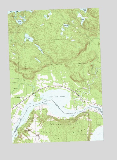
Payment, MI USGS Topographic Map
Click on map above to begin viewing in our Map Viewer.

This topographic map contains these locations and features:
Feature Name Type Latitude Longitude GNIS ID View Map
BrassarPopulated PlaceN46.5061°W84.2173°1617459View Map
Brassar PointCapeN46.5056°W84.2461°621904View Map
Brassar Post Office (historical)Post OfficeN46.5061°W84.2172°2356358View Map
Brasser Road CemeteryCemeteryN46.5056°W84.2361°2356456View Map
Holy Angel ChurchChurchN46.5270°W84.1509°628466View Map
Masta BayBayN46.5075°W84.2439°631726View Map
McFarland CreekStreamN46.5153°W84.2386°631893View Map
Old ChannelChannelN46.5264°W84.1803°1623081View Map
Palmers PointCapeN46.5359°W84.2042°634325View Map
PaymentPopulated PlaceN46.5303°W84.1403°634495View Map
Payment CemeteryCemeteryN46.5242°W84.1506°634496View Map
Payment Post Office (historical)Post OfficeN46.5303°W84.1403°2354349View Map
Point LewisCapeN46.5125°W84.2423°635188View Map
Sucker CreekStreamN46.5361°W84.2064°639000View Map

Note: Coordinates in the location and feature list above are referenced to NAD83 datum.


Copyright (C) 2008-2024 Ryan Niemi / Sunset Dynamics ... All Rights Reserved