TopoQuest Logo
Do you find TopoQuest useful?
Help keep TopoQuest running and adding new maps/features by donating!
Bitcoin:  19c7KJd3qBynnjoSw5npx9KScwjBe4ifkT
Litecoin:  LXs6TkuXGGXo1vDsWCkWVdjQX94eUKd6ui
Home View Maps Find Maps Find Places Resources & Links


Paulina, Oregon Topographic Map

USGS Map Title: Paulina, OR
USGS Map MRC: 44119B8
DRG (GeoTIFF) Download: o44119b8.tif


Neighboring USGS Topographic Map Quads:


  Keys Creek, OR  
44120C1
 

  Little Summit Prairie, OR  
44119C8
 

  Six Corners, OR  
44119C7
 

  Rabbit Valley, OR  
44120B1
 

  Paulina, OR  
44119B8
 

  Mud Spring, OR  
44119B7
 

  Liggett Table, OR  
44120A1
 

  Maupin Butte, OR  
44119A8
 

  Angell Butte, OR  
44119A7


Map MRC Location:

N45°
W120°
N45°
W119°
H8 H7 H6 H5 H4 H3 H2 H1
G8 G7 G6 G5 G4 G3 G2 G1
F8 F7 F6 F5 F4 F3 F2 F1
E8 E7 E6 E5 E4 E3 E2 E1
D8 D7 D6 D5 D4 D3 D2 D1
C8 C7 C6 C5 C4 C3 C2 C1
B8 B7 B6 B5 B4 B3 B2 B1
A8 A7 A6 A5 A4 A3 A2 A1
N44°
W120°
N44°
W119°

Paulina, OR USGS 1:24K Topographic Map Preview:
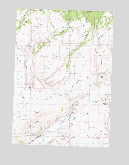
Paulina, OR USGS Topographic Map
Click on map above to begin viewing in our Map Viewer.

This topographic map contains these locations and features:
Feature Name Type Latitude Longitude GNIS ID View Map
Alkali CreekStreamN44.1404°W119.9391°1137133View Map
Antelope SpringSpringN44.2380°W119.9852°1157620View Map
Big Rattlesnake ButteSummitN44.2365°W119.9358°1157616View Map
Birdsong ButteSummitN44.1651°W119.8789°1157610View Map
Buck HollowValleyN44.2432°W119.9214°1138793View Map
Camp Dahlgren (historical)MilitaryN44.1333°W119.9500°1851657View Map
Claypool RidgeRidgeN44.1471°W119.8997°1157582View Map
Coggins FlatFlatN44.1471°W119.8997°1157583View Map
Congleton RanchLocaleN44.1532°W119.9266°1157611View Map
Dipping Vat CreekStreamN44.2171°W119.9325°1141045View Map
Dry Paulina CreekStreamN44.1707°W119.9475°1141349View Map
Faulkner ButteSummitN44.2154°W119.9817°1157615View Map
Ferian RanchLocaleN44.1762°W119.9858°1157614View Map
Geodetic ReservoirReservoirN44.2354°W119.9694°1157618View Map
Henry RimCliffN44.1263°W119.9386°1157621View Map
Hewed Log CreekStreamN44.2113°W119.9436°1143521View Map
Hewed Log HollowValleyN44.2179°W119.9428°1167457View Map
Lower PocketBasinN44.1804°W119.9247°1157622View Map
Mills ButteSummitN44.1895°W119.8886°1157438View Map
Mills ReservoirReservoirN44.1670°W119.8969°1157623View Map
Minifie RanchLocaleN44.2054°W119.9483°1157585View Map
Minifie RidgeRidgeN44.2201°W119.9150°1157586View Map
Moccasin RidgeRidgeN44.2290°W119.9469°1157584View Map
North Wolf CreekStreamN44.1893°W119.8939°1147076View Map
PaulinaPopulated PlaceN44.1338°W119.9628°1147497View Map
Paulina CreekStreamN44.1676°W119.9186°1147500View Map
Paulina Elementary SchoolSchoolN44.1320°W119.9668°2416272View Map
Paulina Post OfficePost OfficeN44.1327°W119.9639°1165768View Map
Paulina ValleyValleyN44.1682°W119.9266°1147509View Map
Remington RidgeRidgeN44.1451°W119.9241°1157612View Map
Ritch-Fayne ReservoirReservoirN44.1596°W119.9106°1157555View Map
Roundtree LakeReservoirN44.1550°W119.9709°1157613View Map
Ruby ButteSummitN44.2304°W119.9786°1157619View Map
Sartain RanchLocaleN44.1840°W119.8858°1157557View Map
Sheep Shooter Tree (historical)LocaleN44.1840°W119.9008°1851738View Map
Sheepshooter RidgeRidgeN44.2090°W119.8872°1157588View Map
Upper PocketBasinN44.2249°W119.9567°1157617View Map
Widow CreekStreamN44.2224°W119.8919°1152317View Map
Wolf CreekStreamN44.1726°W119.8972°1152581View Map
X X RidgeRidgeN44.1418°W119.9789°1157556View Map

Note: Coordinates in the location and feature list above are referenced to NAD83 datum.


Copyright (C) 2008-2024 Ryan Niemi / Sunset Dynamics ... All Rights Reserved