TopoQuest Logo
Do you find TopoQuest useful?
Help keep TopoQuest running and adding new maps/features by donating!
Bitcoin:  19c7KJd3qBynnjoSw5npx9KScwjBe4ifkT
Litecoin:  LXs6TkuXGGXo1vDsWCkWVdjQX94eUKd6ui
Home View Maps Find Maps Find Places Resources & Links


Parks, Arizona Topographic Map

USGS Map Title: Parks, AZ
USGS Map MRC: 35111C8
DRG (GeoTIFF) Download: o35111c8.tif


Neighboring USGS Topographic Map Quads:


  Squaw Mountain, AZ  
35112D1
 

  Moritz Ridge, AZ  
35111D8
 

  Kendrick Peak, AZ  
35111D7
 

  Sitgreaves Mountain, AZ  
35112C1
 

  Parks, AZ  
35111C8
 

  Wing Mountain, AZ  
35111C7
 

  Davenport Hill, AZ  
35112B1
 

  Garland Prairie, AZ  
35111B8
 

  Bellemont, AZ  
35111B7


Map MRC Location:

N36°
W112°
N36°
W111°
H8 H7 H6 H5 H4 H3 H2 H1
G8 G7 G6 G5 G4 G3 G2 G1
F8 F7 F6 F5 F4 F3 F2 F1
E8 E7 E6 E5 E4 E3 E2 E1
D8 D7 D6 D5 D4 D3 D2 D1
C8 C7 C6 C5 C4 C3 C2 C1
B8 B7 B6 B5 B4 B3 B2 B1
A8 A7 A6 A5 A4 A3 A2 A1
N35°
W112°
N35°
W111°

Parks, AZ USGS 1:24K Topographic Map Preview:
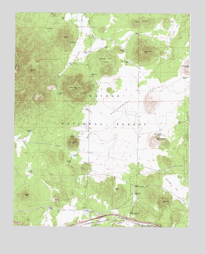
Parks, AZ USGS Topographic Map
Click on map above to begin viewing in our Map Viewer.

This topographic map contains these locations and features:
Feature Name Type Latitude Longitude GNIS ID View Map
Autry TankReservoirN35.3432°W111.9036°42050View Map
B B TankReservoirN35.3172°W111.9107°2089495View Map
Beale FlatFlatN35.3639°W111.9013°2089487View Map
Beale MountainSummitN35.3695°W111.9132°26052View Map
Beale SpringSpringN35.3624°W111.9118°26053View Map
Beale TankReservoirN35.3628°W111.9110°2089491View Map
Brannigan ParkFlatN35.2736°W111.8857°26725View Map
Brannigan TankReservoirN35.2852°W111.8849°37669View Map
C. Hart Merriam Base Camp SiteParkN35.3028°W111.9589°2500498View Map
Cross Country Ski TrailTrailN35.3667°W111.9668°45028View Map
Curry TankReservoirN35.3180°W111.9476°28219View Map
Dennis TankReservoirN35.2575°W111.9485°37743View Map
Divide TankReservoirN35.3645°W111.9210°2089492View Map
Eagle RockPillarN35.3411°W111.9863°28726View Map
Fortynine HillSummitN35.2650°W111.8943°29130View Map
Fortynine TankReservoirN35.2594°W111.8957°2089499View Map
Garland Prairie VistaLocaleN35.2586°W111.9924°42048View Map
Garland Prairie Vista Family Picnic GroundLocaleN35.2585°W111.9923°2669526View Map
Government HillSummitN35.3306°W111.9610°29441View Map
Government HoleReservoirN35.3467°W111.9188°29442View Map
Government MountainSummitN35.3520°W111.9082°29445View Map
Government PrairieFlatN35.3158°W111.9171°29446View Map
Government Prairie Trick TankReservoirN35.3246°W111.9011°2089496View Map
Hausman SpringSpringN35.3102°W111.9626°37827View Map
Horseshoe TankReservoirN35.3377°W111.8807°30202View Map
Jacks TankReservoirN35.3347°W111.9396°2089493View Map
Jerrys TankReservoirN35.3051°W111.9459°2089497View Map
Kaufman SpringSpringN35.3056°W111.9874°30709View Map
Kaufman TankReservoirN35.3005°W111.9949°42043View Map
Klostermeyer HillSummitN35.3017°W111.8991°30796View Map
Klostermeyer SpringSpringN35.3042°W111.8951°30798View Map
Klostermeyer Spring TankReservoirN35.3041°W111.8951°37882View Map
Little SpringSpringN35.3030°W111.9575°31129View Map
Lower McDermit SpringSpringN35.2581°W111.9174°31368View Map
MainePopulated PlaceN35.2531°W111.9385°31460View Map
Maine Consolidated SchoolSchoolN35.2620°W111.9498°2543695View Map
McDermit SpringSpringN35.2689°W111.9134°31649View Map
Mineral TankReservoirN35.2511°W111.9991°2089380View Map
NE SpringSpringN35.2820°W111.9871°32233View Map
NE TankReservoirN35.2786°W111.9891°42044View Map
Obsidian TankReservoirN35.3529°W111.9222°32476View Map
ParksPopulated PlaceN35.2606°W111.9488°32699View Map
Parks Census Designated PlaceCensusN35.2939°W111.9772°2409033View Map
Parks InterchangeCrossingN35.2556°W111.9391°37979View Map
Pine RidgeRidgeN35.3589°W111.8843°42051View Map
Prairie TankReservoirN35.3178°W111.9207°2089494View Map
Quakie TankReservoirN35.3546°W111.9369°33259View Map
R S HillSummitN35.3606°W111.9663°33298View Map
R S TankReservoirN35.3657°W111.9740°33299View Map
Rain Tank FlatFlatN35.3628°W111.8879°33336View Map
Rocky TankReservoirN35.2952°W111.9357°42049View Map
Saddle TankReservoirN35.2722°W111.9283°33937View Map
Sanderson PassGapN35.3392°W111.9460°34045View Map
Sawmill SpringSpringN35.2879°W111.9595°34113View Map
Sawmill TankReservoirN35.2915°W111.9587°34116View Map
Schultz PassGapN35.3275°W111.9691°34155View Map
Section HillSummitN35.3686°W111.9702°45027View Map
Sego TankReservoirN35.3716°W111.9650°34257View Map
Seven Anchor TankReservoirN35.3114°W111.8841°34270View Map
Shoot Em Up Dick TankReservoirN35.3447°W111.9611°2091529View Map
Soreye TankReservoirN35.3519°W111.9480°34641View Map
Spitz HillSummitN35.2681°W111.9921°34712View Map
Spitz SpringSpringN35.2608°W111.9744°34713View Map
Spitz TankReservoirN35.2714°W111.9711°2089498View Map
Spring Valley Guard StationLocaleN35.3572°W111.9571°34740View Map
Spring Valley KnollsSummitN35.3475°W111.9354°34741View Map
Spring Valley TankReservoirN35.3450°W111.9620°34742View Map
Upper McDermit SpringSpringN35.2735°W111.9141°35697View Map
Wright HillSummitN35.2992°W111.9593°36405View Map

Note: Coordinates in the location and feature list above are referenced to NAD83 datum.


Copyright (C) 2008-2024 Ryan Niemi / Sunset Dynamics ... All Rights Reserved