TopoQuest Logo
Do you find TopoQuest useful?
Help keep TopoQuest running and adding new maps/features by donating!
Bitcoin:  19c7KJd3qBynnjoSw5npx9KScwjBe4ifkT
Litecoin:  LXs6TkuXGGXo1vDsWCkWVdjQX94eUKd6ui
Home View Maps Find Maps Find Places Resources & Links


Parker Mountain, Oregon Topographic Map

USGS Map Title: Parker Mountain, OR
USGS Map MRC: 42122A3
DRG (GeoTIFF) Download: o42122a3.tif


Neighboring USGS Topographic Map Quads:


  Hyatt Reservoir, OR  
42122B4
 

  Little Chinquapin Mountain, OR  
42122B3
 

  Surveyor Mountain, OR  
42122B2
 

  Soda Mountain, OR  
42122A4
 

  Parker Mountain, OR  
42122A3
 

  Mule Hill, OR  
42122A2
 

  Iron Gate Reservoir, CA  
41122H4
 

  Copco, CA  
41122H3
 

  Secret Spring Mountain, CA  
41122H2


Map MRC Location:

N43°
W123°
N43°
W122°
H8 H7 H6 H5 H4 H3 H2 H1
G8 G7 G6 G5 G4 G3 G2 G1
F8 F7 F6 F5 F4 F3 F2 F1
E8 E7 E6 E5 E4 E3 E2 E1
D8 D7 D6 D5 D4 D3 D2 D1
C8 C7 C6 C5 C4 C3 C2 C1
B8 B7 B6 B5 B4 B3 B2 B1
A8 A7 A6 A5 A4 A3 A2 A1
N42°
W123°
N42°
W122°

Parker Mountain, OR USGS 1:24K Topographic Map Preview:
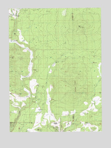
Parker Mountain, OR USGS Topographic Map
Click on map above to begin viewing in our Map Viewer.

This topographic map contains these locations and features:
Feature Name Type Latitude Longitude GNIS ID View Map
Beaver BasinBasinN42.0065°W122.2970°218942View Map
Beaver CreekStreamN42.1185°W122.3686°1137812View Map
Box D RanchLocaleN42.0918°W122.3689°1118010View Map
Box O RanchLocaleN42.0554°W122.3567°1160741View Map
Cascade SpringsSpringN42.0138°W122.2859°1132687View Map
Close ButteSummitN42.0021°W122.3361°233293View Map
Corral CreekStreamN42.1179°W122.3647°1119296View Map
Dixie (historical)LocaleN42.0304°W122.2625°1161344View Map
Dixie SpringSpringN42.0305°W122.2610°1132686View Map
Fall Creek RanchLocaleN42.0221°W122.3506°1160746View Map
Fall Creek ReservoirReservoirN42.0504°W122.3253°1160742View Map
Grizzly FlatFlatN42.0160°W122.2756°1121446View Map
Grizzly MountainSummitN42.0401°W122.2875°1121447View Map
Hartwell DrawValleyN42.0235°W122.3609°1132685View Map
Haymaker SpringSpringN42.1171°W122.3553°1160737View Map
Juniper GladeFlatN42.0671°W122.3159°1133231View Map
Juniper Glade PondReservoirN42.0701°W122.3142°1161680View Map
Keene CreekStreamN42.0915°W122.3678°1158307View Map
Leonard RanchLocaleN42.0313°W122.3220°1160745View Map
Ling ReservoirReservoirN42.0422°W122.3288°1160743View Map
Open Triangle Tee RanchLocaleN42.0118°W122.2931°1125008View Map
Oregon GulchValleyN42.0571°W122.3592°1125023View Map
Oregon Gulch Reservoir Number OneReservoirN42.0599°W122.3744°1160740View Map
Parker MountainSummitN42.1054°W122.2786°1125186View Map
PinehurstPopulated PlaceN42.1176°W122.3661°1125418View Map
Pinehurst Post Office (historical)Post OfficeN42.1176°W122.3661°1165789View Map
Potter ReservoirReservoirN42.0552°W122.2503°1125619View Map
Rattlesnake SpringSpringN42.0627°W122.3386°1125841View Map
Rim ReservoirReservoirN42.0918°W122.3546°1133230View Map
Rosebud MountainSummitN42.0745°W122.3731°1126297View Map
Rosebud ReservoirReservoirN42.0688°W122.3636°1160739View Map
Schoolhouse MeadowFlatN42.0301°W122.3381°1133233View Map
Shake (historical)LocaleN42.1235°W122.3581°1132690View Map
Shake Post Office (historical)Post OfficeN42.1235°W122.3581°1165933View Map
Shoal SpringSpringN42.0467°W122.3357°1126897View Map
Skookum CreekStreamN42.0229°W122.3609°1127032View Map
Sloan CreekStreamN42.0032°W122.2978°1160736View Map
Sloan SpringsSpringN42.0221°W122.3192°1132688View Map
Snow Post Office (historical)Post OfficeN42.0754°W122.2761°1164690View Map
Soda SpringSpringN42.0992°W122.3698°1127190View Map
Spring CreekStreamN42.0326°W122.3467°1133232View Map
Taylor RanchLocaleN42.0360°W122.3503°1160744View Map
Upper Potter ReservoirReservoirN42.0695°W122.2633°1128470View Map
Wallis SpringSpringN42.0554°W122.3442°1160738View Map
Wild Gal SpringSpringN42.0089°W122.2701°1129045View Map

Note: Coordinates in the location and feature list above are referenced to NAD83 datum.


Copyright (C) 2008-2024 Ryan Niemi / Sunset Dynamics ... All Rights Reserved