TopoQuest Logo
Do you find TopoQuest useful?
Help keep TopoQuest running and adding new maps/features by donating!
Bitcoin:  19c7KJd3qBynnjoSw5npx9KScwjBe4ifkT
Litecoin:  LXs6TkuXGGXo1vDsWCkWVdjQX94eUKd6ui
Home View Maps Find Maps Find Places Resources & Links


Parker, Pennsylvania Topographic Map

USGS Map Title: Parker, PA
USGS Map MRC: 41079A6
DRG (GeoTIFF) Download: o41079a6.tif


Neighboring USGS Topographic Map Quads:


  Eau Claire, PA  
41079B7
 

  Emlenton, PA  
41079B6
 

  Knox, PA  
41079B5
 

  Hilliards, PA  
41079A7
 

  Parker, PA  
41079A6
 

  Rimersburg, PA  
41079A5
 

  East Butler, PA  
40079H7
 

  Chicora, PA  
40079H6
 

  East Brady, PA  
40079H5


Map MRC Location:

N42°
W80°
N42°
W79°
H8 H7 H6 H5 H4 H3 H2 H1
G8 G7 G6 G5 G4 G3 G2 G1
F8 F7 F6 F5 F4 F3 F2 F1
E8 E7 E6 E5 E4 E3 E2 E1
D8 D7 D6 D5 D4 D3 D2 D1
C8 C7 C6 C5 C4 C3 C2 C1
B8 B7 B6 B5 B4 B3 B2 B1
A8 A7 A6 A5 A4 A3 A2 A1
N41°
W80°
N41°
W79°

Parker, PA USGS 1:24K Topographic Map Preview:
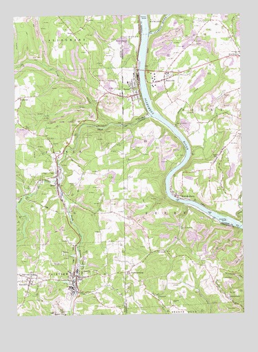
Parker, PA USGS Topographic Map
Click on map above to begin viewing in our Map Viewer.

This topographic map contains these locations and features:
Feature Name Type Latitude Longitude GNIS ID View Map
Allegheny ChurchChurchN41.1234°W79.7092°1168164View Map
Baldwin Post Office (historical)Post OfficeN41.0145°W79.7428°1214246View Map
Bear CreekStreamN41.0828°W79.6737°1192102View Map
Bear Creek CemeteryCemeteryN41.0218°W79.7277°1168868View Map
Binker ValleyValleyN41.0454°W79.6559°1201517View Map
Black Fox IslandIslandN41.0384°W79.6312°1169702View Map
Black Fox RunStreamN41.0376°W79.6264°1169703View Map
BonusPopulated PlaceN41.1176°W79.7164°1169985View Map
Borough of BruinCivilN41.0544°W79.7273°1214984View Map
Borough of FairviewCivilN41.0156°W79.7432°1214993View Map
Borough of PetroliaCivilN41.0216°W79.7168°1214999View Map
BruinPopulated PlaceN41.0548°W79.7267°1170428View Map
Bruin Elementary SchoolSchoolN41.0598°W79.7259°1211513View Map
Bruin Post OfficePost OfficeN41.0582°W79.7275°2772619View Map
Bruin Volunteer Fire Department Station 29BuildingN41.0550°W79.7279°2645389View Map
Church HillLocaleN41.0667°W79.6528°1205209View Map
City of ParkerCivilN41.0906°W79.6846°1214856View Map
Clarion IslandIslandN41.1209°W79.6770°1171902View Map
Clarion RiverStreamN41.1165°W79.6750°1213952View Map
Columbia HillSummitN41.1128°W79.7098°1201889View Map
Crawford CemeteryCemeteryN41.0056°W79.6634°1172648View Map
Criswell CityLocaleN41.0076°W79.6725°1206959View Map
Crozier HollowValleyN41.0354°W79.6265°1201516View Map
Donelly StationLocaleN41.0792°W79.6889°1206843View Map
Dunlap CreekStreamN41.0784°W79.6614°1173612View Map
Dutch HillPopulated PlaceN41.0651°W79.6378°1173651View Map
EldoradoPopulated PlaceN41.0915°W79.7470°1174084View Map
FairviewPopulated PlaceN41.0145°W79.7428°1174467View Map
FarrentownLocaleN41.0834°W79.6848°1206842View Map
Fletcher CemeteryCemeteryN41.0542°W79.7173°1174897View Map
FredericksburgPopulated PlaceN41.0181°W79.6878°1175194View Map
Grand Army of the Republic CemeteryCemeteryN41.0906°W79.6839°2775914View Map
Griswell ChurchChurchN41.0073°W79.6714°1176256View Map
Happy RetreatLocaleN41.1123°W79.6873°1206841View Map
LawrenceburgPopulated PlaceN41.0912°W79.6848°1201892View Map
Millers EddyPopulated PlaceN41.0398°W79.6425°1212465View Map
MontereyPopulated PlaceN41.0509°W79.6637°1201515View Map
North Branch Bear CreekStreamN41.0801°W79.6970°1193030View Map
Number Three ReservoirReservoirN41.0217°W79.7114°1195205View Map
ParkerPopulated PlaceN41.0959°W79.6825°1183311View Map
Parker City Volunteer Fire Department Station 39BuildingN41.0908°W79.6823°2644926View Map
Parker Elementary SchoolSchoolN41.0973°W79.6889°1211514View Map
Parker Post OfficePost OfficeN41.0919°W79.6826°2779641View Map
Parker Presbyterian CemeteryCemeteryN41.0922°W79.6856°2775949View Map
Parkers CornersPopulated PlaceN41.0926°W79.6973°1201891View Map
Parkers LandingLocaleN41.1023°W79.6623°1212159View Map
PerryvillePopulated PlaceN41.0981°W79.6667°1183610View Map
PetroliaPopulated PlaceN41.0167°W79.7175°1183643View Map
Petrolia Post OfficePost OfficeN41.0170°W79.7175°2772904View Map
Petrolia Volunteer Fire Department Station 28BuildingN41.0158°W79.7172°2645714View Map
Pollock Post Office (historical)Post OfficeN41.0981°W79.6667°1214245View Map
QueenstownPopulated PlaceN41.0065°W79.6320°1184547View Map
Robinson Memorial ChapelChurchN41.1145°W79.6862°1185228View Map
Saints Peter and Paul CemeteryCemeteryN41.0108°W79.6320°2775971View Map
Shakley CemeteryCemeteryN41.0401°W79.6884°1187334View Map
Silver CreekStreamN41.0351°W79.7453°1187673View Map
South Branch Bear CreekStreamN41.0562°W79.7253°1188013View Map
StonehouseLocaleN41.0731°W79.7189°1201518View Map
Thoms RunStreamN41.1059°W79.6814°1201890View Map
Township of ParkerCivilN41.0666°W79.7388°1216064View Map
Township of PerryCivilN41.0328°W79.6564°1215854View Map
Township of PerryCivilN41.0958°W79.6273°1216216View Map
Union Furnace QuarryMineN41.1142°W79.6900°2724968View Map
Walley CemeteryCemeteryN41.0363°W79.6457°2775987View Map
West MontereyPopulated PlaceN41.0487°W79.6614°1191074View Map

Note: Coordinates in the location and feature list above are referenced to NAD83 datum.


Copyright (C) 2008-2024 Ryan Niemi / Sunset Dynamics ... All Rights Reserved