TopoQuest Logo
Do you find TopoQuest useful?
Help keep TopoQuest running and adding new maps/features by donating!
Bitcoin:  19c7KJd3qBynnjoSw5npx9KScwjBe4ifkT
Litecoin:  LXs6TkuXGGXo1vDsWCkWVdjQX94eUKd6ui
Home View Maps Find Maps Find Places Resources & Links


Panguitch NW, Utah Topographic Map

USGS Map Title: Panguitch NW, UT
USGS Map MRC: 37112H4
DRG (GeoTIFF) Download: o37112h4.tif


Neighboring USGS Topographic Map Quads:


  Burnt Peak, UT  
38112A5
 

  Fremont Pass, UT  
38112A4
 

  Bull Rush Peak, UT  
38112A3
 

  Little Creek Peak, UT  
37112H5
 

  Panguitch NW, UT  
37112H4
 

  Blind Spring Mountain, UT  
37112H3
 

  Fivemile Ridge, UT  
37112G5
 

  Panguitch, UT  
37112G4
 

  Casto Canyon, UT  
37112G3


Map MRC Location:

N38°
W113°
N38°
W112°
H8 H7 H6 H5 H4 H3 H2 H1
G8 G7 G6 G5 G4 G3 G2 G1
F8 F7 F6 F5 F4 F3 F2 F1
E8 E7 E6 E5 E4 E3 E2 E1
D8 D7 D6 D5 D4 D3 D2 D1
C8 C7 C6 C5 C4 C3 C2 C1
B8 B7 B6 B5 B4 B3 B2 B1
A8 A7 A6 A5 A4 A3 A2 A1
N37°
W113°
N37°
W112°

Panguitch NW, UT USGS 1:24K Topographic Map Preview:
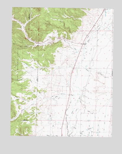
Panguitch NW, UT USGS Topographic Map
Click on map above to begin viewing in our Map Viewer.

This topographic map contains these locations and features:
Feature Name Type Latitude Longitude GNIS ID View Map
Barton Tebbs LaFevre CanalCanalN37.9028°W112.4291°1438408View Map
Bear CreekStreamN37.9608°W112.4110°1438458View Map
Bear Valley JunctionPopulated PlaceN37.9653°W112.4124°1438501View Map
Chokecherry CreekStreamN37.9128°W112.4638°1439711View Map
Marshall DitchCanalN37.9778°W112.3999°1443204View Map
McEwen DitchCanalN37.9447°W112.4041°1443251View Map
Old State DitchCanalN37.8930°W112.3833°1444078View Map
Panguitch CanalCanalN37.8964°W112.4516°1444171View Map
Sand WashValleyN37.8839°W112.4252°1445316View Map
Sandy CreekStreamN37.9161°W112.4149°1445320View Map
Sanford CreekStreamN37.9444°W112.4163°1445323View Map
SpryLocaleN37.9203°W112.4263°1451357View Map
Spry CemeteryCemeteryN37.9182°W112.4364°1449897View Map
Tebbs HollowValleyN37.9416°W112.4563°1446365View Map
Three CreeksStreamN37.9647°W112.4641°1446558View Map
Wide HollowValleyN37.9083°W112.4785°1447318View Map

Note: Coordinates in the location and feature list above are referenced to NAD83 datum.


Copyright (C) 2008-2024 Ryan Niemi / Sunset Dynamics ... All Rights Reserved