TopoQuest Logo
Do you find TopoQuest useful?
Help keep TopoQuest running and adding new maps/features by donating!
Bitcoin:  19c7KJd3qBynnjoSw5npx9KScwjBe4ifkT
Litecoin:  LXs6TkuXGGXo1vDsWCkWVdjQX94eUKd6ui
Home View Maps Find Maps Find Places Resources & Links


Palito Blanco, Texas Topographic Map

USGS Map Title: Palito Blanco, TX
USGS Map MRC: 27098E2
DRG (GeoTIFF) Download: o27098e2.tif


Neighboring USGS Topographic Map Quads:


  Benavides NE, TX  
27098F3
 

  Ben Bolt NW, TX  
27098F2
 

  Alice South, TX  
27098F1
 

  San Jose, TX  
27098E3
 

  Palito Blanco, TX  
27098E2
 

  Ben Bolt SE, TX  
27098E1
 

  Concepcion, TX  
27098D3
 

  Seeligson Ranch, TX  
27098D2
 

  Ella, TX  
27098D1


Map MRC Location:

N28°
W99°
N28°
W98°
H8 H7 H6 H5 H4 H3 H2 H1
G8 G7 G6 G5 G4 G3 G2 G1
F8 F7 F6 F5 F4 F3 F2 F1
E8 E7 E6 E5 E4 E3 E2 E1
D8 D7 D6 D5 D4 D3 D2 D1
C8 C7 C6 C5 C4 C3 C2 C1
B8 B7 B6 B5 B4 B3 B2 B1
A8 A7 A6 A5 A4 A3 A2 A1
N27°
W99°
N27°
W98°

Palito Blanco, TX USGS 1:24K Topographic Map Preview:
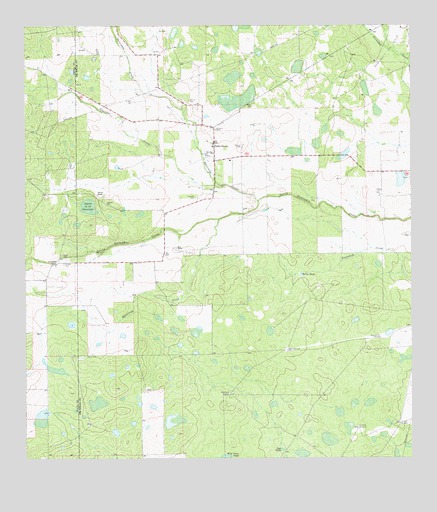
Palito Blanco, TX USGS Topographic Map
Click on map above to begin viewing in our Map Viewer.

This topographic map contains these locations and features:
Feature Name Type Latitude Longitude GNIS ID View Map
Barrera CemeteryCemeteryN27.6036°W98.1969°1330080View Map
Cadenas CemeteryCemeteryN27.5756°W98.1950°1331838View Map
Gonzales CemeteryCemeteryN27.5878°W98.1906°1336675View Map
Guajillo CreekStreamN27.5792°W98.1861°1337078View Map
Hinojosa CemeteryCemeteryN27.5950°W98.1883°1337834View Map
Javalina WindmillLocaleN27.5100°W98.1292°1338658View Map
La Bandera RanchLocaleN27.5570°W98.2395°1339273View Map
La Coma WindmillLocaleN27.5086°W98.1431°1339301View Map
Laguna de los EncueradosSwampN27.5731°W98.2297°1339453View Map
Lucero WindmillLocaleN27.5350°W98.1375°1340719View Map
Moos RanchLocaleN27.5606°W98.2014°1341889View Map
Narciseno CreekStreamN27.5745°W98.1744°1342368View Map
Nopaleras CreekStreamN27.5692°W98.1875°1342663View Map
Palito BlancoPopulated PlaceN27.5917°W98.1892°1343457View Map
Perez CemeteryCemeteryN27.5589°W98.2381°1343850View Map
Pila Blanca WindmillLocaleN27.5186°W98.1842°1343997View Map
Rosita TankReservoirN27.5537°W98.1610°1345607View Map
Rosita WindmillLocaleN27.5314°W98.1656°1345609View Map
Rye TankReservoirN27.5029°W98.1672°1345790View Map
Saltiero CemeteryCemeteryN27.5742°W98.2239°1346253View Map
Saltiero RanchLocaleN27.5767°W98.2270°1346254View Map
San Jose ChurchChurchN27.5881°W98.1892°1346383View Map
Valadez CemeteryCemeteryN27.5567°W98.2378°1349148View Map

Note: Coordinates in the location and feature list above are referenced to NAD83 datum.


Copyright (C) 2008-2024 Ryan Niemi / Sunset Dynamics ... All Rights Reserved