TopoQuest Logo
Do you find TopoQuest useful?
Help keep TopoQuest running and adding new maps/features by donating!
Bitcoin:  19c7KJd3qBynnjoSw5npx9KScwjBe4ifkT
Litecoin:  LXs6TkuXGGXo1vDsWCkWVdjQX94eUKd6ui
Home View Maps Find Maps Find Places Resources & Links


Painter, Alabama Topographic Map

USGS Map Title: Painter, AL
USGS Map MRC: 34086C1
DRG (GeoTIFF) Download: o34086c1.tif


Neighboring USGS Topographic Map Quads:


  Columbus City, AL  
34086D2
 

  Grove Oak, AL  
34086D1
 

  Fyffe, AL  
34085D8
 

  Albertville, AL  
34086C2
 

  Painter, AL  
34086C1
 

  Crossville, AL  
34085C8
 

  Boaz, AL  
34086B2
 

  Rodentown, AL  
34086B1
 

  Keener, AL  
34085B8


Map MRC Location:

N35°
W87°
N35°
W86°
H8 H7 H6 H5 H4 H3 H2 H1
G8 G7 G6 G5 G4 G3 G2 G1
F8 F7 F6 F5 F4 F3 F2 F1
E8 E7 E6 E5 E4 E3 E2 E1
D8 D7 D6 D5 D4 D3 D2 D1
C8 C7 C6 C5 C4 C3 C2 C1
B8 B7 B6 B5 B4 B3 B2 B1
A8 A7 A6 A5 A4 A3 A2 A1
N34°
W87°
N34°
W86°

Painter, AL USGS 1:24K Topographic Map Preview:
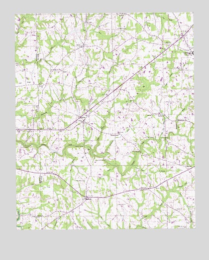
Painter, AL USGS Topographic Map
Click on map above to begin viewing in our Map Viewer.

This topographic map contains these locations and features:
Feature Name Type Latitude Longitude GNIS ID View Map
B and B FarmsLocaleN34.3350°W86.0989°2711264View Map
Baker BranchStreamN34.2865°W86.0439°150080View Map
Beth Haven Baptist ChurchChurchN34.2806°W86.0683°158266View Map
Bethel ChurchChurchN34.3454°W86.0436°150090View Map
Big BranchStreamN34.2951°W86.0919°150101View Map
Blessing CemeteryCemeteryN34.2576°W86.1102°147464View Map
Blessing Church of ChristChurchN34.2576°W86.1108°114493View Map
Blessing School (historical)SchoolN34.2601°W86.1203°1700368View Map
Blessing School (historical)SchoolN34.2929°W86.1186°139339View Map
Bray CreekStreamN34.2518°W86.0378°150123View Map
Broomstraw BranchStreamN34.2940°W86.0619°150126View Map
Campground ChurchChurchN34.3559°W86.0550°162054View Map
Carter BranchStreamN34.2715°W86.0172°150148View Map
Chastain CreekStreamN34.2715°W86.0175°150150View Map
Clark CemeteryCemeteryN34.2826°W86.1019°150157View Map
Clayton FordCrossingN34.3023°W86.0283°1700291View Map
Clayton Ford BridgeBridgeN34.3023°W86.0283°150159View Map
Colvin BridgeBridgeN34.2984°W86.1161°116462View Map
Concord Baptist ChurchChurchN34.3068°W86.1128°116500View Map
Concord CemeteryCemeteryN34.3073°W86.1127°147470View Map
Crossville DivisionCivilN34.2570°W86.0280°165750View Map
Dalrymple CemeteryCemeteryN34.3656°W86.0530°150182View Map
Evergreen CemeteryCemeteryN34.3356°W86.0200°139762View Map
Fall BranchStreamN34.2873°W86.0566°150223View Map
Five ForksPopulated PlaceN34.3698°W86.0758°158829View Map
Flat BridgeBridgeN34.2948°W86.0964°150228View Map
Forester CemeteryCemeteryN34.2645°W86.0547°150234View Map
Freeman ChurchChurchN34.3081°W86.0997°150241View Map
Garvin BridgeBridgeN34.2945°W86.0380°150248View Map
GeraldinePopulated PlaceN34.3515°W86.0008°150249View Map
Geraldine DivisionCivilN34.3518°W86.0013°165753View Map
Geraldine Police DepartmentBuildingN34.3622°W86.0054°2751739View Map
Geraldine Post OfficePost OfficeN34.3585°W86.0122°168407View Map
Geraldine SchoolSchoolN34.3515°W86.0028°150696View Map
Geraldine Volunteer Fire DepartmentBuildingN34.3508°W86.0009°2682650View Map
Gilbreath ChapelChurchN34.3048°W86.0525°150254View Map
Green FordCrossingN34.2893°W86.0619°1700293View Map
Green Ford BridgeBridgeN34.2901°W86.0625°150265View Map
HopewellPopulated PlaceN34.3745°W86.0475°156496View Map
Hopewell Baptist ChurchChurchN34.3745°W86.0480°155543View Map
Joey Baker Poultry FarmLocaleN34.3553°W86.1131°2516614View Map
KilpatrickPopulated PlaceN34.2681°W86.0764°150317View Map
Kilpatrick ChurchChurchN34.2676°W86.0783°158284View Map
Kilpatrick Junior High School (historical)SchoolN34.2673°W86.0783°150824View Map
Kilpatrick Volunteer Fire DepartmentBuildingN34.2681°W86.0706°2683229View Map
Kirby BridgeBridgeN34.3026°W86.0203°150319View Map
LathamvillePopulated PlaceN34.2734°W86.0333°151998View Map
Liberty CemeteryCemeteryN34.3098°W86.0783°1730396View Map
Liberty ChurchChurchN34.3120°W86.0780°150333View Map
Little Scarham CreekStreamN34.2954°W86.0725°150345View Map
Little Shoal CreekStreamN34.3479°W86.1247°150346View Map
Little Whippoorwill CreekStreamN34.3270°W86.0833°150347View Map
Lowrey CemeteryCemeteryN34.3159°W86.0250°150358View Map
Luther BridgeBridgeN34.2984°W86.0778°150360View Map
Macedonia BranchStreamN34.3045°W86.0116°150363View Map
Macedonia ChurchChurchN34.3426°W86.0091°150364View Map
Marvin CemeteryCemeteryN34.2740°W86.0666°150718View Map
Marvin ChurchChurchN34.2740°W86.0272°150371View Map
McCrellis Bridge (historical)BridgeN34.2923°W86.0633°1700300View Map
McKendree CemeteryCemeteryN34.3681°W86.0227°161966View Map
McKinley ChapelChurchN34.3693°W86.0389°161967View Map
New Canaan CemeteryCemeteryN34.3415°W86.0997°1730311View Map
New Canaan ChurchChurchN34.3420°W86.1000°150420View Map
New Home ChurchChurchN34.2781°W86.0775°150423View Map
New Hope ChurchChurchN34.2723°W86.0380°150425View Map
Oak HillPopulated PlaceN34.3159°W86.0294°150434View Map
Oak Hill BranchStreamN34.3023°W86.0236°150435View Map
Oak Hill ChurchChurchN34.3156°W86.0208°150436View Map
Old Macedonia ChurchChurchN34.3129°W86.0122°158891View Map
PainterPopulated PlaceN34.3129°W86.0775°150442View Map
PendergrassPopulated PlaceN34.3334°W86.0833°154302View Map
Peters (historical)Populated PlaceN34.3654°W86.1161°139459View Map
Rains (historical)Populated PlaceN34.2598°W86.0861°150737View Map
RogersPopulated PlaceN34.3415°W86.0914°150496View Map
Salem United Methodist ChurchChurchN34.3573°W86.0164°150499View Map
Sand MountainRangeN34.3348°W86.0657°342355View Map
Santlin School (historical)SchoolN34.3590°W86.0447°161977View Map
Sunrise FarmsLocaleN34.3703°W86.1217°2516613View Map
Swan BranchStreamN34.2515°W86.0378°150543View Map
The Way of Truth ChurchChurchN34.2670°W86.0505°158301View Map
Tidwells Store (historical)LocaleN34.2590°W86.1203°139493View Map
Town of GeraldineCivilN34.3577°W86.0037°2406561View Map
Turnover CemeteryCemeteryN34.3270°W86.0036°161980View Map
Wallace BranchStreamN34.2618°W86.0047°150574View Map
WhitonPopulated PlaceN34.3556°W86.0786°155307View Map
Whiton Junior High School (historical)SchoolN34.3554°W86.0783°150826View Map
Whiton United Methodist ChurchChurchN34.3559°W86.0794°158303View Map

Note: Coordinates in the location and feature list above are referenced to NAD83 datum.


Copyright (C) 2008-2024 Ryan Niemi / Sunset Dynamics ... All Rights Reserved