TopoQuest Logo
Do you find TopoQuest useful?
Help keep TopoQuest running and adding new maps/features by donating!
Bitcoin:  19c7KJd3qBynnjoSw5npx9KScwjBe4ifkT
Litecoin:  LXs6TkuXGGXo1vDsWCkWVdjQX94eUKd6ui
Home View Maps Find Maps Find Places Resources & Links


Owyhee, Nevada Topographic Map

USGS Map Title: Owyhee, NV
USGS Map MRC: 41116H1
DRG (GeoTIFF) Download: o41116h1.tif


Neighboring USGS Topographic Map Quads:


  Mountain View Lake, ID  
42116A2
 

  Three Forks, ID  
42116A1
 

  Indian Hay Meadows, ID  
42115A8
 

  The Point, NV  
41116H2
 

  Owyhee, NV  
41116H1
 

  Winter Ridge, NV  
41115H8
 

  Dry Creek Reservoir, NV  
41116G2
 

  Ungina Wongo, NV  
41116G1
 

  Mountain City, NV  
41115G8


Map MRC Location:

N42°
W117°
N42°
W116°
H8 H7 H6 H5 H4 H3 H2 H1
G8 G7 G6 G5 G4 G3 G2 G1
F8 F7 F6 F5 F4 F3 F2 F1
E8 E7 E6 E5 E4 E3 E2 E1
D8 D7 D6 D5 D4 D3 D2 D1
C8 C7 C6 C5 C4 C3 C2 C1
B8 B7 B6 B5 B4 B3 B2 B1
A8 A7 A6 A5 A4 A3 A2 A1
N41°
W117°
N41°
W116°

Owyhee, NV USGS 1:24K Topographic Map Preview:
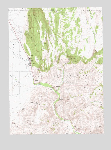
Owyhee, NV USGS Topographic Map
Click on map above to begin viewing in our Map Viewer.

This topographic map contains these locations and features:
Feature Name Type Latitude Longitude GNIS ID View Map
Agency CanalCanalN41.9641°W116.1107°838389View Map
Bahm Basa PondReservoirN41.9657°W116.0817°838564View Map
Cavanaugh SpringSpringN41.9086°W116.0598°839363View Map
China DamDamN41.9243°W116.0870°839485View Map
Cleveland TrailTrailN41.9685°W116.0951°839566View Map
Cow CreekStreamN41.9063°W116.0084°857948View Map
East Fork Skull CreekStreamN41.9249°W116.0379°840269View Map
Fawn CreekStreamN41.8846°W116.0445°859700View Map
George Washington CemeteryCemeteryN41.9684°W116.1133°840629View Map
Great Basin College Owyhee Satellite CenterSchoolN41.9478°W116.0986°2087572View Map
Jones FlatFlatN41.8755°W116.0312°860228View Map
Main CanalCanalN41.9274°W116.1137°841913View Map
New CemeteryCemeteryN41.9701°W116.1101°842439View Map
North Fork Skull CreekStreamN41.9252°W116.0557°842522View Map
OttawanahSummitN41.9221°W116.0651°845591View Map
OwyheePopulated PlaceN41.9477°W116.0987°842663View Map
Owyhee Combined SchoolSchoolN41.9432°W116.0976°855094View Map
Owyhee Community Health FacilityHospitalN41.9500°W116.0977°2060073View Map
Owyhee Elementary SchoolSchoolN41.9427°W116.0970°855095View Map
Owyhee Post OfficePost OfficeN41.9418°W116.0959°864838View Map
Paradise PointCapeN41.9257°W116.0918°842720View Map
Prentice CanyonValleyN41.9124°W116.1104°842975View Map
Prentice HillSummitN41.9124°W116.0857°842976View Map
Quarry HillSummitN41.8860°W116.1207°843025View Map
Reed CreekStreamN41.8955°W116.0637°858661View Map
Sagebrush SpringSpringN41.9008°W116.1096°843439View Map
Shoshone - Paiute Tribes Fire StationBuildingN41.9764°W116.1150°2581398View Map
Skull CreekStreamN41.9168°W116.0640°843745View Map
South Fork Boyle CreekStreamN41.9985°W116.1137°375144View Map
Summit CreekStreamN41.8885°W116.0559°861627View Map
The CraterCraterN41.9393°W116.0859°844247View Map
Timber PointCapeN41.9846°W116.0243°844322View Map
Willis MeadowsFlatN41.9852°W116.0168°844890View Map
Yellow RockSummitN41.9082°W116.0462°845752View Map

Note: Coordinates in the location and feature list above are referenced to NAD83 datum.


Copyright (C) 2008-2024 Ryan Niemi / Sunset Dynamics ... All Rights Reserved