TopoQuest Logo
Do you find TopoQuest useful?
Help keep TopoQuest running and adding new maps/features by donating!
Bitcoin:  19c7KJd3qBynnjoSw5npx9KScwjBe4ifkT
Litecoin:  LXs6TkuXGGXo1vDsWCkWVdjQX94eUKd6ui
Home View Maps Find Maps Find Places Resources & Links


Oshoto, Wyoming Topographic Map

USGS Map Title: Oshoto, WY
USGS Map MRC: 44104E8
DRG (GeoTIFF) Download: o44104e8.tif


Neighboring USGS Topographic Map Quads:


  Brislawn School, WY  
44105F1
 

  Garland Hill, WY  
44104F8
 

  New Haven, WY  
44104F7
 

  Flag Butte, WY  
44105E1
 

  Oshoto, WY  
44104E8
 

  Missouri Buttes, WY  
44104E7
 

  Rozet NE, WY  
44105D1
 

  Edith Creek, WY  
44104D8
 

  Carlile, WY  
44104D7


Map MRC Location:

N45°
W105°
N45°
W104°
H8 H7 H6 H5 H4 H3 H2 H1
G8 G7 G6 G5 G4 G3 G2 G1
F8 F7 F6 F5 F4 F3 F2 F1
E8 E7 E6 E5 E4 E3 E2 E1
D8 D7 D6 D5 D4 D3 D2 D1
C8 C7 C6 C5 C4 C3 C2 C1
B8 B7 B6 B5 B4 B3 B2 B1
A8 A7 A6 A5 A4 A3 A2 A1
N44°
W105°
N44°
W104°

Oshoto, WY USGS 1:24K Topographic Map Preview:
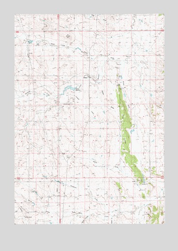
Oshoto, WY USGS Topographic Map
Click on map above to begin viewing in our Map Viewer.

This topographic map contains these locations and features:
Feature Name Type Latitude Longitude GNIS ID View Map
Ash DrawValleyN44.6242°W104.9122°1584968View Map
Berger HillSummitN44.6108°W104.9547°1585388View Map
Brosa DrawValleyN44.5894°W104.9103°1585959View Map
Cabin Creek Four MineMineN44.5066°W104.8894°1726353View Map
Cabin Creek Seven MineMineN44.5066°W104.8894°1726354View Map
Deadman CreekStreamN44.5755°W104.9622°1599161View Map
Good Lad CreekStreamN44.5992°W104.9216°1599978View Map
North DrawValleyN44.5161°W104.8903°1592140View Map
OshotoPopulated PlaceN44.5875°W104.9378°1597448View Map
Oshoto DamDamN44.5800°W104.9505°1607412View Map
Oshoto ReservoirReservoirN44.5806°W104.9555°1592492View Map
Oshoto SchoolSchoolN44.5853°W104.9153°1592493View Map
Pine Grove CemeteryCemeteryN44.5595°W104.9022°2774537View Map
Pine Grove ChapelChurchN44.5583°W104.9033°1592779View Map
Pine RidgeRidgeN44.5519°W104.9078°1592804View Map
Sidner DrawValleyN44.5811°W104.9303°1594314View Map
Sidner FlatsFlatN44.5691°W104.9411°1594315View Map

Note: Coordinates in the location and feature list above are referenced to NAD83 datum.


Copyright (C) 2008-2024 Ryan Niemi / Sunset Dynamics ... All Rights Reserved