TopoQuest Logo
Do you find TopoQuest useful?
Help keep TopoQuest running and adding new maps/features by donating!
Bitcoin:  19c7KJd3qBynnjoSw5npx9KScwjBe4ifkT
Litecoin:  LXs6TkuXGGXo1vDsWCkWVdjQX94eUKd6ui
Home View Maps Find Maps Find Places Resources & Links


Oretta, Louisiana Topographic Map

USGS Map Title: Oretta, LA
USGS Map MRC: 30093E4
DRG (GeoTIFF) Download: o30093e4.tif


Neighboring USGS Topographic Map Quads:


  Merryville South, LA  
30093F5
 

  Singer, LA  
30093F4
 

  Mach Branch, LA  
30093F3
 

  Fields, LA  
30093E5
 

  Oretta, LA  
30093E4
 

  Kernan, LA  
30093E3
 

  Clark Hollow, LA  
30093D5
 

  DeQuincy, LA  
30093D4
 

  Gordon, LA  
30093D3


Map MRC Location:

N31°
W94°
N31°
W93°
H8 H7 H6 H5 H4 H3 H2 H1
G8 G7 G6 G5 G4 G3 G2 G1
F8 F7 F6 F5 F4 F3 F2 F1
E8 E7 E6 E5 E4 E3 E2 E1
D8 D7 D6 D5 D4 D3 D2 D1
C8 C7 C6 C5 C4 C3 C2 C1
B8 B7 B6 B5 B4 B3 B2 B1
A8 A7 A6 A5 A4 A3 A2 A1
N30°
W94°
N30°
W93°

Oretta, LA USGS 1:24K Topographic Map Preview:
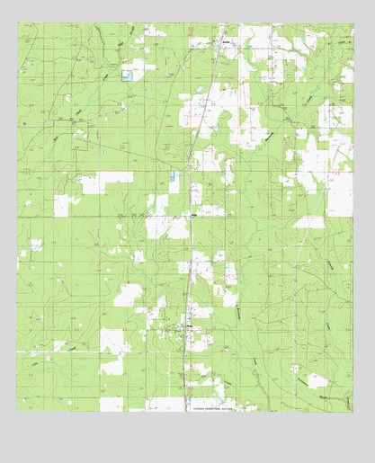
Oretta, LA USGS Topographic Map
Click on map above to begin viewing in our Map Viewer.

This topographic map contains these locations and features:
Feature Name Type Latitude Longitude GNIS ID View Map
Acengys Pond DamDamN30.5952°W93.4335°556935View Map
Beauregard Parish Police JuryBuildingN30.6179°W93.4255°2334228View Map
Canerdays Pond DamDamN30.5919°W93.4268°556936View Map
Dry BayouStreamN30.5421°W93.4502°557079View Map
Dry CreekStreamN30.5058°W93.4110°534603View Map
Good Hope Baptist ChurchChurchN30.6108°W93.4388°554548View Map
Good Hope CemeteryCemeteryN30.6107°W93.4385°544762View Map
Gum SloughStreamN30.6063°W93.4643°535462View Map
JuanitaPopulated PlaceN30.6185°W93.4252°543347View Map
North Oretta Oil FieldOilfieldN30.5341°W93.4652°544760View Map
OrettaPopulated PlaceN30.5260°W93.4374°543559View Map
Oretta CemeteryCemeteryN30.5335°W93.4518°537899View Map
Oretta Census Designated PlaceCensusN30.5289°W93.4391°2586698View Map
Oretta Oil and Gas FieldOilfieldN30.5016°W93.4527°544766View Map
Oretta Volunteer Fire Department District 1BuildingN30.5267°W93.4368°2691665View Map
Persimmon MarshStreamN30.5052°W93.3768°538080View Map
Poley BranchStreamN30.6180°W93.3835°538317View Map
SealePopulated PlaceN30.5619°W93.4360°541186View Map
Singer Oil FieldOilfieldN30.5849°W93.4474°544761View Map
Smoky Cove ChurchChurchN30.6038°W93.4066°539450View Map

Note: Coordinates in the location and feature list above are referenced to NAD83 datum.


Copyright (C) 2008-2024 Ryan Niemi / Sunset Dynamics ... All Rights Reserved