TopoQuest Logo
Do you find TopoQuest useful?
Help keep TopoQuest running and adding new maps/features by donating!
Bitcoin:  19c7KJd3qBynnjoSw5npx9KScwjBe4ifkT
Litecoin:  LXs6TkuXGGXo1vDsWCkWVdjQX94eUKd6ui
Home View Maps Find Maps Find Places Resources & Links


Orangeburg, Kentucky Topographic Map

USGS Map Title: Orangeburg, KY
USGS Map MRC: 38083E6
DRG (GeoTIFF) Download: o38083e6.tif


Neighboring USGS Topographic Map Quads:


  Maysville West, KY  
38083F7
 

  Maysville East, KY  
38083F6
 

  Manchester Islands, KY  
38083F5
 

  Mays Lick, KY  
38083E7
 

  Orangeburg, KY  
38083E6
 

  Tollesboro, KY  
38083E5
 

  Elizaville, KY  
38083D7
 

  Flemingsburg, KY  
38083D6
 

  Burtonville, KY  
38083D5


Map MRC Location:

N39°
W84°
N39°
W83°
H8 H7 H6 H5 H4 H3 H2 H1
G8 G7 G6 G5 G4 G3 G2 G1
F8 F7 F6 F5 F4 F3 F2 F1
E8 E7 E6 E5 E4 E3 E2 E1
D8 D7 D6 D5 D4 D3 D2 D1
C8 C7 C6 C5 C4 C3 C2 C1
B8 B7 B6 B5 B4 B3 B2 B1
A8 A7 A6 A5 A4 A3 A2 A1
N38°
W84°
N38°
W83°

Orangeburg, KY USGS 1:24K Topographic Map Preview:
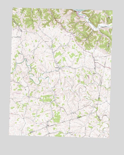
Orangeburg, KY USGS Topographic Map
Click on map above to begin viewing in our Map Viewer.

This topographic map contains these locations and features:
Feature Name Type Latitude Longitude GNIS ID View Map
Antioch ChurchChurchN38.5384°W83.7258°485998View Map
Bairds RunStreamN38.6150°W83.6550°2362877View Map
Bernard Post Office (historical)Post OfficeN38.6220°W83.7027°2362880View Map
Bethany Church of ChristChurchN38.6084°W83.6385°486941View Map
Cabin CreekStreamN38.6240°W83.6638°488566View Map
Camp Spring HollowValleyN38.6061°W83.6496°488718View Map
Farrows CreekStreamN38.5256°W83.6419°491999View Map
Farrows Mill Post Office (historical)Post OfficeN38.5525°W83.6394°2362895View Map
Fleming-Mason AirportAirportN38.5418°W83.7434°517375View Map
Grant LakeReservoirN38.5801°W83.7376°493118View Map
Indian RunStreamN38.5498°W83.6991°494982View Map
Middle RunStreamN38.5695°W83.7271°498148View Map
Mount GileadPopulated PlaceN38.5109°W83.7030°508643View Map
Mount Gilead Post Office (historical)Post OfficeN38.5670°W83.6887°2362913View Map
Mount Olivet ChurchChurchN38.5620°W83.6471°498808View Map
Nash CemeteryCemeteryN38.5396°W83.6308°2363034View Map
Oak Woods ChurchChurchN38.5242°W83.6713°499726View Map
OrangeburgPopulated PlaceN38.5676°W83.6888°499971View Map
Orangeburg Volunteer Fire DepartmentBuildingN38.5844°W83.6976°2636915View Map
Owl HollowValleyN38.6056°W83.6415°500087View Map
Phillips CreekStreamN38.5517°W83.6594°500539View Map
Plaineview ChurchChurchN38.5870°W83.6601°2362919View Map
PlumvillePopulated PlaceN38.6015°W83.6744°500980View Map
Plumville Post Office (historical)Post OfficeN38.6017°W83.6785°2362921View Map
Poplar GrovePopulated PlaceN38.5037°W83.6774°508854View Map
RectorvillePopulated PlaceN38.5765°W83.6460°501641View Map
Rectorville Elementary SchoolSchoolN38.5779°W83.6489°2362922View Map
Rectorville Post Office (historical)Post OfficeN38.5761°W83.6462°2362923View Map
SomoPopulated PlaceN38.5967°W83.7424°515534View Map
SpringdalePopulated PlaceN38.6229°W83.6688°509112View Map
Springdale Post Office (historical)Post OfficeN38.6224°W83.6688°2362938View Map
Stewart Church (historical)ChurchN38.6220°W83.7021°2362939View Map
Stone Lick Baptist ChurchChurchN38.5929°W83.7077°504460View Map
Stone Lick BranchStreamN38.5573°W83.7099°504459View Map
Sycamore HillSummitN38.6186°W83.6739°2362942View Map
Taylors Mill (historical)Populated PlaceN38.5751°W83.7324°2362943View Map
The Dead FallLocaleN38.6235°W83.6647°2362945View Map
Turkey RunStreamN38.5070°W83.6296°505633View Map
Williamsburg-Orangeburg Historical MarkerParkN38.5845°W83.6987°2744591View Map

Note: Coordinates in the location and feature list above are referenced to NAD83 datum.


Copyright (C) 2008-2024 Ryan Niemi / Sunset Dynamics ... All Rights Reserved