TopoQuest Logo
Do you find TopoQuest useful?
Help keep TopoQuest running and adding new maps/features by donating!
Bitcoin:  19c7KJd3qBynnjoSw5npx9KScwjBe4ifkT
Litecoin:  LXs6TkuXGGXo1vDsWCkWVdjQX94eUKd6ui
Home View Maps Find Maps Find Places Resources & Links


Akron, Indiana Topographic Map

USGS Map Title: Akron, IN
USGS Map MRC: 41086A1
DRG (GeoTIFF) Download: o41086a1.tif


Neighboring USGS Topographic Map Quads:


  Argos, IN  
41086B2
 

  Mentone, IN  
41086B1
 

  Burket, IN  
41085B8
 

  Rochester, IN  
41086A2
 

  Akron, IN  
41086A1
 

  Silver Lake, IN  
41085A8
 

  Macy, IN  
40086H2
 

  Deedsville, IN  
40086H1
 

  Roann, IN  
40085H8


Map MRC Location:

N42°
W87°
N42°
W86°
H8 H7 H6 H5 H4 H3 H2 H1
G8 G7 G6 G5 G4 G3 G2 G1
F8 F7 F6 F5 F4 F3 F2 F1
E8 E7 E6 E5 E4 E3 E2 E1
D8 D7 D6 D5 D4 D3 D2 D1
C8 C7 C6 C5 C4 C3 C2 C1
B8 B7 B6 B5 B4 B3 B2 B1
A8 A7 A6 A5 A4 A3 A2 A1
N41°
W87°
N41°
W86°

Akron, IN USGS 1:24K Topographic Map Preview:
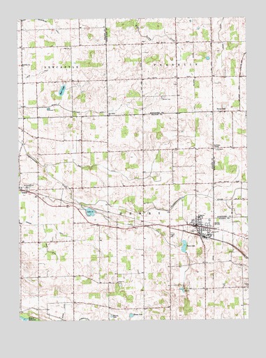
Akron, IN USGS Topographic Map
Click on map above to begin viewing in our Map Viewer.

This topographic map contains these locations and features:
Feature Name Type Latitude Longitude GNIS ID View Map
AkronPopulated PlaceN41.0384°W86.0281°430038View Map
Akron Elementary SchoolSchoolN41.0425°W86.0269°447463View Map
Akron Police DepartmentBuildingN41.0393°W86.0301°2758285View Map
Barr LakeLakeN41.0955°W86.1006°430521View Map
Beaver DamPopulated PlaceN41.0862°W86.0133°430677View Map
Bethlehem ChurchChurchN41.1050°W86.1228°430986View Map
Bryant Leininger DitchCanalN41.0856°W86.0894°431704View Map
Curtis DitchCanalN41.0395°W86.0572°433259View Map
Gast DitchCanalN41.0595°W86.0675°434987View Map
Graham DitchCanalN41.0398°W86.1178°435284View Map
Henry Township Fire DepartmentBuildingN41.0394°W86.0301°2625575View Map
Hoovers CemeteryCemeteryN41.0547°W86.1206°439577View Map
Independent Order of Odd Fellows CemeteryCemeteryN41.0353°W86.0414°436695View Map
Keesey LakeLakeN41.0019°W86.0643°437192View Map
L LakeLakeN41.0128°W86.0366°437487View Map
Lake SixteenLakeN41.0449°W86.0858°443569View Map
Lowman CornerPopulated PlaceN41.0706°W86.0183°438379View Map
Millark MillpondReservoirN41.0014°W86.1243°439174View Map
Nichols CemeteryCemeteryN41.0909°W86.0464°440159View Map
Olive Bethel ChurchChurchN41.0845°W86.0756°440633View Map
Omega ChurchChurchN41.0150°W86.0711°440662View Map
Rickle DitchCanalN41.1228°W86.0131°441983View Map
Rowe DitchCanalN41.0314°W86.1103°442366View Map
Stinson LakeLakeN41.0016°W86.0749°444174View Map
Town LakeLakeN41.0305°W86.0350°444829View Map
Town of AkronCivilN41.0388°W86.0249°2397420View Map
Township of FranklinCivilN41.1192°W86.0262°453307View Map
Township of HenryCivilN41.0361°W86.0517°453406View Map
Woodcock AirportAirportN41.0707°W86.0651°2677026View Map

Note: Coordinates in the location and feature list above are referenced to NAD83 datum.


Copyright (C) 2008-2024 Ryan Niemi / Sunset Dynamics ... All Rights Reserved