TopoQuest Logo
Do you find TopoQuest useful?
Help keep TopoQuest running and adding new maps/features by donating!
Bitcoin:  19c7KJd3qBynnjoSw5npx9KScwjBe4ifkT
Litecoin:  LXs6TkuXGGXo1vDsWCkWVdjQX94eUKd6ui
Home View Maps Find Maps Find Places Resources & Links


Olmito, Texas Topographic Map

USGS Map Title: Olmito, TX
USGS Map MRC: 26097A5
DRG (GeoTIFF) Download: o26097a5.tif


Neighboring USGS Topographic Map Quads:


  Harlingen, TX  
26097B6
 

  Rio Hondo, TX  
26097B5
 

  Laguna Atascosa, TX  
26097B4
 

  La Paloma, TX  
26097A6
 

  Olmito, TX  
26097A5
 

  Los Fresnos, TX  
26097A4


  West Brownsville, TX  
25097H5
 

  East Brownsville, TX  
25097H4


Map MRC Location:

N27°
W98°
N27°
W97°
H8 H7 H6 H5 H4 H3 H2 H1
G8 G7 G6 G5 G4 G3 G2 G1
F8 F7 F6 F5 F4 F3 F2 F1
E8 E7 E6 E5 E4 E3 E2 E1
D8 D7 D6 D5 D4 D3 D2 D1
C8 C7 C6 C5 C4 C3 C2 C1
B8 B7 B6 B5 B4 B3 B2 B1
A8 A7 A6 A5 A4 A3 A2 A1
N26°
W98°
N26°
W97°

Olmito, TX USGS 1:24K Topographic Map Preview:
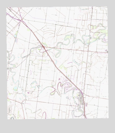
Olmito, TX USGS Topographic Map
Click on map above to begin viewing in our Map Viewer.

This topographic map contains these locations and features:
Feature Name Type Latitude Longitude GNIS ID View Map
AG-Air Incorporated Airport (historical)AirportN26.0734°W97.5375°1386302View Map
Cameron County Sheriff's OfficeBuildingN26.0175°W97.5114°2335076View Map
Cameron County Sheriff's OfficeBuildingN26.0174°W97.5114°2335104View Map
Cameron County Sheriff's OfficeBuildingN26.0758°W97.5122°2335045View Map
Cameron County Wid 16 Dam ADamN26.0533°W97.6183°1862206View Map
Cameron County Wid 16 ReservoirReservoirN26.0533°W97.6183°1862207View Map
Casa del Rey ColoniaPopulated PlaceN26.1084°W97.5042°2010332View Map
CavazosPopulated PlaceN26.0187°W97.6078°2034727View Map
East Stenger Street ColoniaPopulated PlaceN26.1192°W97.6122°2010348View Map
Expressway 83-77 ColoniaPopulated PlaceN26.1142°W97.6133°2010253View Map
Graham ColoniaPopulated PlaceN26.1065°W97.6092°2010259View Map
Green Valley FarmsPopulated PlaceN26.1220°W97.5605°1852710View Map
Green Valley Farms Census Designated PlaceCensusN26.1219°W97.5610°2408331View Map
Green Valley Farms ColoniaPopulated PlaceN26.1215°W97.5622°2010261View Map
Indian LakePopulated PlaceN26.0892°W97.5025°1388581View Map
Indian Lake Town OfficesBuildingN26.0866°W97.5067°2753966View Map
LagoPopulated PlaceN26.0887°W97.6136°1852718View Map
Lago Census Designated PlaceCensusN26.0885°W97.6132°2408522View Map
Lago ColoniaPopulated PlaceN26.0892°W97.6133°2010277View Map
Los Cuates Middle SchoolSchoolN26.0743°W97.5007°2434296View Map
Main Supply CanalCanalN26.0301°W97.5305°1374783View Map
OlmitoPopulated PlaceN26.0217°W97.5342°1375292View Map
Olmito BranchCanalN26.0248°W97.5067°1375293View Map
Olmito Census Designated PlaceCensusN26.0231°W97.5379°2408989View Map
Olmito LakeLakeN26.0260°W97.5356°1375294View Map
Olmito Post OfficePost OfficeN26.0284°W97.5337°2731473View Map
Rancho ViejoPopulated PlaceN26.0395°W97.5564°1388590View Map
Rancho Viejo Chief of PoliceBuildingN26.0450°W97.5526°2334493View Map
Rancho Viejo DamDamN26.0720°W97.5969°1862214View Map
Rancho Viejo Dam Site DDamN26.0304°W97.6053°1862204View Map
Rancho Viejo Police DepartmentBuildingN26.0451°W97.5526°2335052View Map
Rancho Viejo Town HallBuildingN26.0461°W97.5530°2753896View Map
Rancho Viejo Volunteer Fire DepartmentBuildingN26.0454°W97.5515°2334657View Map
Raul Garza Jr Elementary SchoolSchoolN26.1161°W97.6243°2003720View Map
Resaca de las FloresLakeN26.0629°W97.5397°1375697View Map
Resaca de Los Cuates ReservoirReservoirN26.0737°W97.5978°1862215View Map
Resaca del JardinLakeN26.0370°W97.5951°1375699View Map
Resaca del Rancho ViejoLakeN26.0315°W97.5493°1375707View Map
Resaca Del Rancho Viejo ReservoirReservoirN26.0315°W97.6063°1862205View Map
Rio Grande Marine InstituteSchoolN26.0882°W97.5033°2434397View Map
Roos Dam ADamN26.0437°W97.6119°1862210View Map
Roos Dam CDamN26.0354°W97.6119°1862212View Map
Roos ReservoirReservoirN26.0408°W97.6153°1862211View Map
Roos Reservoir CReservoirN26.0357°W97.6091°1862213View Map
Russel Dam 1DamN26.0937°W97.5453°1862208View Map
Russel Lake 1ReservoirN26.0935°W97.5497°1862209View Map
RusselltownPopulated PlaceN26.0829°W97.5819°1380910View Map
Tahuachal Banco Number 9LeveeN26.0109°W97.6222°1376369View Map
Town of Indian LakeCivilN26.0876°W97.5032°2412792View Map
Town of Rancho ViejoCivilN26.0361°W97.5567°2412526View Map
Villa CavazosPopulated PlaceN26.0181°W97.6083°1376590View Map
Villa Cavazos ColoniaPopulated PlaceN26.0173°W97.6072°2010236View Map
Villareal Elementary SchoolSchoolN26.0236°W97.5348°2434569View Map
Wardner RanchLocaleN26.0840°W97.5297°1376642View Map

Note: Coordinates in the location and feature list above are referenced to NAD83 datum.


Copyright (C) 2008-2024 Ryan Niemi / Sunset Dynamics ... All Rights Reserved