TopoQuest Logo
Do you find TopoQuest useful?
Help keep TopoQuest running and adding new maps/features by donating!
Bitcoin:  19c7KJd3qBynnjoSw5npx9KScwjBe4ifkT
Litecoin:  LXs6TkuXGGXo1vDsWCkWVdjQX94eUKd6ui
Home View Maps Find Maps Find Places Resources & Links


Odessa South, Missouri Topographic Map

USGS Map Title: Odessa South, MO
USGS Map MRC: 38093H8
DRG (GeoTIFF) Download: o38093h8.tif


Neighboring USGS Topographic Map Quads:


  Bates City, MO  
39094A1
 

  Odessa North, MO  
39093A8
 

  Mayview, MO  
39093A7
 

  Chapel Hill, MO  
38094H1
 

  Odessa South, MO  
38093H8
 

  Fayetteville, MO  
38093H7
 

  Elm, MO  
38094G1
 

  Pittsville, MO  
38093G8
 

  Warrensburg West, MO  
38093G7


Map MRC Location:

N39°
W94°
N39°
W93°
H8 H7 H6 H5 H4 H3 H2 H1
G8 G7 G6 G5 G4 G3 G2 G1
F8 F7 F6 F5 F4 F3 F2 F1
E8 E7 E6 E5 E4 E3 E2 E1
D8 D7 D6 D5 D4 D3 D2 D1
C8 C7 C6 C5 C4 C3 C2 C1
B8 B7 B6 B5 B4 B3 B2 B1
A8 A7 A6 A5 A4 A3 A2 A1
N38°
W94°
N38°
W93°

Odessa South, MO USGS 1:24K Topographic Map Preview:
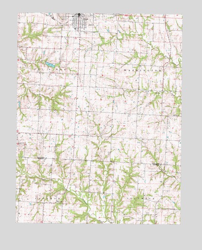
Odessa South, MO USGS Topographic Map
Click on map above to begin viewing in our Map Viewer.

This topographic map contains these locations and features:
Feature Name Type Latitude Longitude GNIS ID View Map
Barker School (historical)SchoolN38.9642°W93.9777°747154View Map
Bartlett Lake DamDamN38.9717°W93.8969°762681View Map
City of Lake LafayetteCivilN38.9487°W93.9714°2395592View Map
City of OdessaCivilN38.9988°W93.9665°2395299View Map
Cox School (historical)SchoolN38.9859°W93.9801°747153View Map
Highland School (historical)SchoolN38.8853°W93.9386°745492View Map
Lake LafayettePopulated PlaceN38.9458°W93.9713°1669612View Map
Lake LafayetteReservoirN38.9492°W93.9737°763312View Map
Lake Lafayette DamDamN38.9517°W93.9802°763311View Map
Mary K McQuerry Elementary SchoolSchoolN38.9904°W93.9567°2545466View Map
McKendree ChurchChurchN38.9222°W93.9980°722136View Map
Mount Tabor ChurchChurchN38.9400°W93.8813°722901View Map
OdessaPopulated PlaceN38.9992°W93.9536°723697View Map
Odessa DamDamN38.9717°W93.9902°762885View Map
Odessa Fire and Rescue Protection DistrictBuildingN38.9984°W93.9559°2620346View Map
Odessa High SchoolSchoolN38.9883°W93.9573°2545234View Map
Odessa LakeReservoirN38.9694°W93.9763°762819View Map
Odessa LakeReservoirN38.9717°W93.9902°762886View Map
Odessa Middle SchoolSchoolN38.9902°W93.9595°2545364View Map
Odessa Old Reservoir DamDamN38.9700°W93.9786°762818View Map
Odessa Post OfficePost OfficeN38.9982°W93.9520°2779529View Map
Odessa ReservoirReservoirN38.9692°W93.9752°737852View Map
Odessa Upper Elementary SchoolSchoolN38.9846°W93.9732°2744009View Map
Odessa Upper Elementary School (historical)SchoolN38.9970°W93.9517°2545216View Map
Payne School (historical)SchoolN38.8882°W93.8919°745491View Map
Robbins AirportAirportN38.9478°W93.9644°758834View Map
Rocky Ford School (historical)SchoolN38.8903°W93.9680°745490View Map
Shaw School (historical)SchoolN38.9333°W93.9102°747158View Map
Sheik-Ollie Lake DamDamN38.9533°W93.9819°762682View Map
Starr School (historical)SchoolN38.9770°W93.9205°747157View Map
Wagon KnobSummitN38.9447°W93.9605°739643View Map
Wagon Knob School (historical)SchoolN38.9278°W93.9594°747156View Map
Woods ChapelChurchN38.8881°W93.9694°729121View Map

Note: Coordinates in the location and feature list above are referenced to NAD83 datum.


Copyright (C) 2008-2024 Ryan Niemi / Sunset Dynamics ... All Rights Reserved