TopoQuest Logo
Do you find TopoQuest useful?
Help keep TopoQuest running and adding new maps/features by donating!
Bitcoin:  19c7KJd3qBynnjoSw5npx9KScwjBe4ifkT
Litecoin:  LXs6TkuXGGXo1vDsWCkWVdjQX94eUKd6ui
Home View Maps Find Maps Find Places Resources & Links


Oak Grove, Arkansas Topographic Map

USGS Map Title: Oak Grove, AR
USGS Map MRC: 34091H8
DRG (GeoTIFF) Download: o34091h8.tif


Neighboring USGS Topographic Map Quads:


  Mountain Springs, AR  
35092A1
 

  Beebe, AR  
35091A8
 

  McRae, AR  
35091A7
 

  Cabot, AR  
34092H1
 

  Oak Grove, AR  
34091H8
 

  Wattensaw, AR  
34091H7
 

  Jacksonville, AR  
34092G1
 

  Lonoke, AR  
34091G8
 

  Pocket Prairie, AR  
34091G7


Map MRC Location:

N35°
W92°
N35°
W91°
H8 H7 H6 H5 H4 H3 H2 H1
G8 G7 G6 G5 G4 G3 G2 G1
F8 F7 F6 F5 F4 F3 F2 F1
E8 E7 E6 E5 E4 E3 E2 E1
D8 D7 D6 D5 D4 D3 D2 D1
C8 C7 C6 C5 C4 C3 C2 C1
B8 B7 B6 B5 B4 B3 B2 B1
A8 A7 A6 A5 A4 A3 A2 A1
N34°
W92°
N34°
W91°

Oak Grove, AR USGS 1:24K Topographic Map Preview:
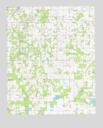
Oak Grove, AR USGS Topographic Map
Click on map above to begin viewing in our Map Viewer.

This topographic map contains these locations and features:
Feature Name Type Latitude Longitude GNIS ID View Map
Allison CemeteryCemeteryN34.9817°W91.9393°59096View Map
Anthony Schmidt Memorial County ParkParkN34.9459°W91.9815°61291View Map
Arkansas Holiness EncampmentLocaleN34.9159°W91.9996°59093View Map
Arkansas Noname Five DamDamN34.9384°W91.9401°79600View Map
AustinPopulated PlaceN34.9984°W91.9838°45979View Map
Austin Fire Department Station 1BuildingN34.9977°W91.9844°2116102View Map
Austin Fire Department Station 2BuildingN34.9980°W91.9824°2116103View Map
Austin Police DepartmentBuildingN34.9976°W91.9842°2118770View Map
Austin Post OfficePost OfficeN34.9997°W91.9826°2781831View Map
Bell HillSummitN34.9987°W91.9054°59097View Map
Cabot Middle School NorthSchoolN34.9827°W91.9974°2039196View Map
Camp Nelson Confederate CemeteryCemeteryN34.9465°W91.9812°47330View Map
Campground ChurchChurchN34.9523°W91.9813°47358View Map
Campground School (historical)SchoolN34.9556°W91.9774°61365View Map
Campground Sylvania and Mount Zion Volunteer Fire Department 1BuildingN34.9525°W91.9575°2116228View Map
Campground Sylvania and Mount Zion Volunteer Fire Department 2BuildingN34.9082°W91.9429°2116229View Map
Cedar Hills EstatesPopulated PlaceN34.9334°W91.9640°61285View Map
Center Point School (historical)SchoolN34.9012°W91.9563°61363View Map
Cinnamon AcresPopulated PlaceN34.9229°W91.9529°61308View Map
Circle B AdditionPopulated PlaceN34.9945°W91.9571°61306View Map
Confederate PlacePopulated PlaceN34.9556°W91.9799°61294View Map
Cooper AdditionPopulated PlaceN34.9690°W91.9690°61296View Map
Davis LakeReservoirN34.9818°W91.8918°81284View Map
Davis Lake DamDamN34.9818°W91.8918°81283View Map
Dogwood MeadowsPopulated PlaceN34.9479°W91.9668°61292View Map
Evans CemeteryCemeteryN34.9629°W91.9907°77020View Map
Evergreen PlacePopulated PlaceN34.9420°W91.9851°61289View Map
Fairmont SchoolLocaleN34.9512°W91.9615°48961View Map
Fulmer Field EstatesPopulated PlaceN34.9490°W91.9557°61311View Map
Glover CemeteryCemeteryN34.8804°W91.9571°49455View Map
Goods Store (historical)LocaleN34.8826°W91.8885°61318View Map
Hicks CemeteryCemeteryN34.9084°W91.9346°50087View Map
Hidden OaksPopulated PlaceN34.9018°W91.9699°61282View Map
Hill School (historical)SchoolN34.9204°W91.8921°61316View Map
Kelly AdditionPopulated PlaceN34.8979°W91.9590°61283View Map
Lake LemayReservoirN34.9394°W91.9426°79601View Map
Leaning PinesPopulated PlaceN34.9779°W91.9724°61297View Map
Lincoln TerracePopulated PlaceN34.9265°W91.9535°61309View Map
Locust CreekStreamN34.8931°W91.9013°51367View Map
McCollum School (historical)SchoolN34.9370°W91.9376°61364View Map
Midway SchoolSchoolN34.9162°W91.9996°51953View Map
Mintons LakeReservoirN34.9787°W91.9307°81286View Map
Mintons Lake DamDamN34.9784°W91.9301°81285View Map
Monk CemeteryCemeteryN34.9965°W91.9393°77782View Map
Mount Carmel EstatesPopulated PlaceN34.9381°W91.9299°61314View Map
Mount Springs EstatesPopulated PlaceN34.9718°W91.9063°61321View Map
Mount Zion ChurchChurchN34.9079°W91.9435°52475View Map
Oak ForestPopulated PlaceN34.9501°W91.9576°61310View Map
Oak GrovePopulated PlaceN34.9306°W91.9118°58289View Map
Oak Grove CemeteryCemeteryN34.9315°W91.9126°61315View Map
Old AustinPopulated PlaceN34.9868°W91.9640°52983View Map
Old Austin CemeteryCemeteryN34.9901°W91.9612°76213View Map
Pershing AdditionPopulated PlaceN34.9923°W91.9868°61302View Map
Pine Hill EstatesPopulated PlaceN34.9106°W91.9501°61307View Map
Pleasant Hill Baptist ChurchChurchN34.8879°W91.9968°78047View Map
Pleasant Hill CemeteryCemeteryN34.8873°W91.9962°61279View Map
Poage AdditionPopulated PlaceN34.9501°W91.9643°61293View Map
Ralph Fulmer FieldAirportN34.9179°W91.9177°83650View Map
Richmond PondReservoirN34.9664°W91.9660°81288View Map
Richmond Pond DamDamN34.9651°W91.9651°81287View Map
Robinson Store (historical)LocaleN34.8948°W91.9965°61281View Map
Rolling Hills Country ClubLocaleN34.9343°W91.9804°59094View Map
Russ CemeteryCemeteryN34.9812°W91.9568°59095View Map
Russell ChapelChurchN34.9023°W91.9965°59091View Map
Sellers AdditionPopulated PlaceN34.9648°W91.9451°61319View Map
Shadow Oaks AdditionPopulated PlaceN34.9556°W91.9476°61312View Map
Shady Grove EstatesPopulated PlaceN34.9798°W91.9654°61303View Map
Smith MountainSummitN34.9159°W91.9749°58643View Map
Smyrna ChurchChurchN34.8790°W91.9049°54969View Map
Southwood AdditionPopulated PlaceN34.9201°W91.9751°61284View Map
Stagecoach AdditionPopulated PlaceN34.9709°W91.9757°61299View Map
Sweetwater EstatesPopulated PlaceN34.9881°W91.9624°61304View Map
SylvaniaPopulated PlaceN34.9723°W91.9285°55413View Map
Sylvania CemeteryCemeteryN34.9737°W91.9279°61320View Map
Talbot AdditionPopulated PlaceN34.9645°W91.9965°61295View Map
The OaksPopulated PlaceN34.9362°W91.9899°61288View Map
Tower Hill AdditionPopulated PlaceN34.8787°W91.9849°61278View Map
Township of CarolineCivilN34.9907°W91.9707°68812View Map
Township of EagleCivilN34.8930°W91.9446°68816View Map
Township of Oak GroveCivilN34.9335°W91.9235°68828View Map
Trailwood AdditionPopulated PlaceN34.9759°W91.9593°61305View Map
Tri - Community Volunteer Fire Department Main StationBuildingN34.9372°W91.8886°2117220View Map
Vise AdditionPopulated PlaceN34.9787°W91.9921°61300View Map
Walls CemeteryCemeteryN34.8812°W91.9987°78671View Map
Wattensaw CemeteryCemeteryN34.8856°W91.8760°61317View Map
Whispering Pines AdditionPopulated PlaceN34.9515°W91.9385°61313View Map
WhisperwoodPopulated PlaceN34.9384°W91.9732°61286View Map
Windwood CirclePopulated PlaceN34.9326°W91.9963°61287View Map
Windwood HeightsPopulated PlaceN34.9437°W91.9807°61290View Map
Woodiel AcresPopulated PlaceN34.9784°W91.9824°61301View Map
Woodlawn EstatesPopulated PlaceN34.9229°W91.9990°61280View Map

Note: Coordinates in the location and feature list above are referenced to NAD83 datum.


Copyright (C) 2008-2024 Ryan Niemi / Sunset Dynamics ... All Rights Reserved