TopoQuest Logo
Do you find TopoQuest useful?
Help keep TopoQuest running and adding new maps/features by donating!
Bitcoin:  19c7KJd3qBynnjoSw5npx9KScwjBe4ifkT
Litecoin:  LXs6TkuXGGXo1vDsWCkWVdjQX94eUKd6ui
Home View Maps Find Maps Find Places Resources & Links


Oak Forest, Pennsylvania Topographic Map

USGS Map Title: Oak Forest, PA
USGS Map MRC: 39080G2
DRG (GeoTIFF) Download: o39080g2.tif


Neighboring USGS Topographic Map Quads:


  Rogersville, PA  
39080H3
 

  Waynesburg, PA  
39080H2
 

  Mather, PA  
39080H1
 

  Holbrook, PA  
39080G3
 

  Oak Forest, PA  
39080G2
 

  Garards Fort, PA  
39080G1
 

  Wadestown, WV  
39080F3
 

  Blacksville, WV  
39080F2
 

  Osage, WV  
39080F1


Map MRC Location:

N40°
W81°
N40°
W80°
H8 H7 H6 H5 H4 H3 H2 H1
G8 G7 G6 G5 G4 G3 G2 G1
F8 F7 F6 F5 F4 F3 F2 F1
E8 E7 E6 E5 E4 E3 E2 E1
D8 D7 D6 D5 D4 D3 D2 D1
C8 C7 C6 C5 C4 C3 C2 C1
B8 B7 B6 B5 B4 B3 B2 B1
A8 A7 A6 A5 A4 A3 A2 A1
N39°
W81°
N39°
W80°

Oak Forest, PA USGS 1:24K Topographic Map Preview:
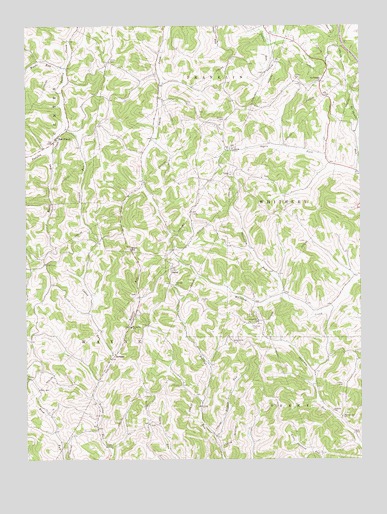
Oak Forest, PA USGS Topographic Map
Click on map above to begin viewing in our Map Viewer.

This topographic map contains these locations and features:
Feature Name Type Latitude Longitude GNIS ID View Map
Brant HillPopulated PlaceN39.8117°W80.2067°1203141View Map
Calico RunStreamN39.7804°W80.2184°1170882View Map
Claughton CemeteryCemeteryN39.7898°W80.1631°1171937View Map
Dulaney SchoolSchoolN39.7640°W80.1353°1173588View Map
Fairall ChurchChurchN39.8320°W80.1734°1174414View Map
Fairview CemeteryCemeteryN39.7887°W80.1656°1174473View Map
Gordon CemeteryCemeteryN39.8478°W80.1756°1175835View Map
Gordon CemeteryCemeteryN39.8598°W80.1489°1175836View Map
Greene CountyCivilN39.8538°W80.2229°1214033View Map
GumpPopulated PlaceN39.8056°W80.1953°1176317View Map
Haynes RunStreamN39.7565°W80.1801°1176694View Map
Lemley CemeteryCemeteryN39.7715°W80.1319°1179187View Map
Maple RunStreamN39.8387°W80.2403°1180361View Map
Mount Phoebe RunStreamN39.8323°W80.1265°1181790View Map
Mount Pleasant ChurchChurchN39.8590°W80.1395°1181809View Map
Oak ForestPopulated PlaceN39.8420°W80.2390°1182731View Map
Patterson RunStreamN39.7967°W80.1534°1183375View Map
Phillips CemeteryCemeteryN39.7730°W80.2497°1183669View Map
Pin Oak ChurchChurchN39.8006°W80.1940°1183751View Map
Shannon Run SchoolSchoolN39.7626°W80.1320°1187361View Map
SpraggsPopulated PlaceN39.7806°W80.2162°1204702View Map
Spraggs Post OfficePost OfficeN39.7800°W80.2183°2772985View Map
Stewart RunStreamN39.8451°W80.2345°1188648View Map
Township of WayneCivilN39.7685°W80.2398°1216499View Map
Township of WhiteleyCivilN39.8211°W80.1288°1216500View Map
WANB-AM (Waynesburg)TowerN39.8698°W80.1337°1200337View Map
White CemeteryCemeteryN39.8648°W80.2181°1191253View Map
Woods RunStreamN39.8629°W80.2342°1191766View Map

Note: Coordinates in the location and feature list above are referenced to NAD83 datum.


Copyright (C) 2008-2024 Ryan Niemi / Sunset Dynamics ... All Rights Reserved