TopoQuest Logo
Do you find TopoQuest useful?
Help keep TopoQuest running and adding new maps/features by donating!
Bitcoin:  19c7KJd3qBynnjoSw5npx9KScwjBe4ifkT
Litecoin:  LXs6TkuXGGXo1vDsWCkWVdjQX94eUKd6ui
Home View Maps Find Maps Find Places Resources & Links


Norway, Michigan Topographic Map

USGS Map Title: Norway, MI
USGS Map MRC: 45087G8
DRG (GeoTIFF) Download: o45087g8.tif


Neighboring USGS Topographic Map Quads:


  Randville, MI  
45088H1
 

  Carney Lake, MI  
45087H8
 

  Felch, MI  
45087H7
 

  Iron Mountain, MI  
45088G1
 

  Norway, MI  
45087G8
 

  Vulcan, MI  
45087G7
 

  Dunbar NE, WI  
45088F1
 

  Pembine, WI  
45087F8
 

  Faithorn, MI  
45087F7


Map MRC Location:

N46°
W88°
N46°
W87°
H8 H7 H6 H5 H4 H3 H2 H1
G8 G7 G6 G5 G4 G3 G2 G1
F8 F7 F6 F5 F4 F3 F2 F1
E8 E7 E6 E5 E4 E3 E2 E1
D8 D7 D6 D5 D4 D3 D2 D1
C8 C7 C6 C5 C4 C3 C2 C1
B8 B7 B6 B5 B4 B3 B2 B1
A8 A7 A6 A5 A4 A3 A2 A1
N45°
W88°
N45°
W87°

Norway, MI USGS 1:24K Topographic Map Preview:
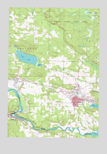
Norway, MI USGS Topographic Map
Click on map above to begin viewing in our Map Viewer.

This topographic map contains these locations and features:
Feature Name Type Latitude Longitude GNIS ID View Map
Anderson Medical CenterHospitalN45.7839°W87.9069°2128880View Map
Aragon MineMineN45.7930°W87.9046°620188View Map
Bethany Lutheran ChurchChurchN45.7886°W87.9047°2128870View Map
Breitung Charter Township Fire DepartmentBuildingN45.8044°W87.9914°2128862View Map
Breitung Township Fire Department Station 1BuildingN45.8051°W87.9910°2626759View Map
Calvary Lutheran ChurchChurchN45.8028°W87.9897°2128861View Map
Christ Temple ChurchChurchN45.8050°W87.9850°2128860View Map
City of NiagaraCivilN45.7802°W87.9992°1583819View Map
City of NorwayCivilN45.8019°W87.9132°1626821View Map
Community Bible ChurchChurchN45.7911°W87.9089°2128872View Map
Cundy MineMineN45.8066°W87.9904°624215View Map
Curry MineMineN45.7888°W87.8987°624225View Map
Cyclops MineMineN45.7972°W87.9071°624263View Map
Dickinson County FairgroundsLocaleN45.7728°W87.9083°2128878View Map
Dickinson County LibraryBuildingN45.7869°W87.9033°2128877View Map
Evangelical Covenant ChurchChurchN45.7883°W87.9097°2128865View Map
Family Health CenterHospitalN45.7889°W87.9169°2128866View Map
Fern CreekStreamN45.8180°W87.8751°625908View Map
First Baptist ChurchChurchN45.7847°W87.9064°2128874View Map
Fumee CreekStreamN45.7944°W87.9873°626570View Map
Fumee FallsFallsN45.8069°W87.9783°2128900View Map
Fumee LakeLakeN45.8264°W87.9747°626571View Map
Grace United Methodist ChurchChurchN45.7881°W87.9081°2128868View Map
Gustafson LakeLakeN45.8707°W87.8920°627548View Map
Hanbury LakeLakeN45.7809°W87.8806°627708View Map
Hanbury Lake ParkParkN45.7828°W87.8861°2127811View Map
Holy Spirit Central SchoolSchoolN45.7808°W87.9134°2128881View Map
Indiana MineMineN45.8375°W87.9915°629024View Map
Iron HillSummitN45.8130°W87.8968°629075View Map
Jake Menghini MuseumBuildingN45.7889°W87.9042°2128863View Map
Kimberly Clark Lookout TowerTowerN45.7736°W87.9712°1623463View Map
Lake MaryLakeN45.7850°W87.9019°2127813View Map
Lake ViewLakeN45.7842°W87.8975°2127812View Map
Little Fumee LakeLakeN45.8198°W87.9572°630624View Map
Little Quinnesec FallsFallsN45.7736°W87.9893°1568374View Map
Little Quinnesec Falls DamDamN45.7733°W87.9885°1792985View Map
Little Quinnesec Falls Flowage 2ReservoirN45.7733°W87.9885°1792986View Map
Marion ParkParkN45.7730°W87.9151°631563View Map
Marquette General HospitalHospitalN45.7853°W87.9069°2128879View Map
McKinley SchoolSchoolN45.7841°W87.9040°631962View Map
Menominee Iron Range Historical MarkerParkN45.8042°W87.9683°2128909View Map
Michigan Department of Natural Resources Norway Field OfficeBuildingN45.7906°W87.9194°2626986View Map
Miller LakeLakeN45.8701°W87.8821°632382View Map
Morosini BridgeBridgeN45.7594°W87.9173°1623518View Map
Morosini BridgeBridgeN45.7594°W87.9173°1569745View Map
NiagaraPopulated PlaceN45.7713°W87.9948°1570272View Map
Niagara CemeteryCemeteryN45.7843°W87.9999°2781242View Map
Niagara Hospital (historical)HospitalN45.7705°W87.9929°1845604View Map
North Alert Ambulance AuthorityBuildingN45.7881°W87.8904°2662080View Map
NorwayPopulated PlaceN45.7869°W87.9037°633751View Map
Norway Baptist ChurchChurchN45.7886°W87.9094°2128871View Map
Norway CemeteryCemeteryN45.7655°W87.9012°633752View Map
Norway Elementary SchoolSchoolN45.7826°W87.9024°633763View Map
Norway Medical CenturyHospitalN45.7694°W87.9100°2128867View Map
Norway MineMineN45.7988°W87.9057°633759View Map
Norway Police DepartmentBuildingN45.7893°W87.9078°2128884View Map
Norway Post OfficePost OfficeN45.7857°W87.9072°2128882View Map
Norway SpeedwayLocaleN45.7708°W87.9075°2128864View Map
Norway Spring Historical MarkerParkN45.7917°W87.9167°2128907View Map
Norway StationLocaleN45.7911°W87.9078°2128875View Map
Norway Volunteer Fire DepartmentBuildingN45.7881°W87.8905°2128883View Map
Oak Crest Golf CourseLocaleN45.7722°W87.9167°2128876View Map
Piers Gorge FallsFallsN45.7578°W87.9442°2128908View Map
QuinnesecPopulated PlaceN45.8063°W87.9885°635571View Map
Quinnesec Census Designated PlaceCensusN45.8030°W87.9959°2393200View Map
Quinnesec MineMineN45.8105°W87.9921°635572View Map
Quinnesec ParkParkN45.8022°W87.9944°2128562View Map
Quinnesec Post OfficePost OfficeN45.8060°W87.9882°2128858View Map
Quinnesec StationLocaleN45.8053°W87.9881°2128857View Map
Quinnesec United Methodist ChurchChurchN45.8006°W87.9958°2128859View Map
Richardsburg Post Office (historical)Post OfficeN45.8383°W87.9931°2128835View Map
Saint Anthony CemeteryCemeteryN45.7847°W87.9998°1572842View Map
Saint Anthonys Roman Catholic ChurchChurchN45.7691°W87.9926°1845628View Map
Saint Mary Catholic ChurchChurchN45.7842°W87.9078°2128873View Map
Sand Portage FallsFallsN45.7600°W87.9646°637203View Map
Seiberts CreekStreamN45.8750°W87.9543°637557View Map
Shattuck Public School (historical)SchoolN45.7663°W87.9829°1845637View Map
Strawberry LakeLakeN45.7931°W87.9042°2127814View Map
Strawberry Lake ParkParkN45.7917°W87.9028°2127815View Map
Township of NorwayCivilN45.8714°W87.8957°1626822View Map
Union Protestant ChurchChurchN45.7700°W87.9932°1845647View Map
United Pentecostal ChurchChurchN45.7886°W87.9081°2128869View Map
Verso Paper Quinnesec Mill Warehouse Ambulance Emergency ServicesBuildingN45.8027°W87.9636°2662076View Map
West Vulcan MineMineN45.7888°W87.8868°1616190View Map

Note: Coordinates in the location and feature list above are referenced to NAD83 datum.


Copyright (C) 2008-2024 Ryan Niemi / Sunset Dynamics ... All Rights Reserved