TopoQuest Logo
Do you find TopoQuest useful?
Help keep TopoQuest running and adding new maps/features by donating!
Bitcoin:  19c7KJd3qBynnjoSw5npx9KScwjBe4ifkT
Litecoin:  LXs6TkuXGGXo1vDsWCkWVdjQX94eUKd6ui
Home View Maps Find Maps Find Places Resources & Links


North Osceola, New York Topographic Map

USGS Map Title: North Osceola, NY
USGS Map MRC: 43075E6
DRG (GeoTIFF) Download: o43075e6.tif


Neighboring USGS Topographic Map Quads:


  Worth Center, NY  
43075F7
 

  Sears Pond, NY  
43075F6
 

  Page, NY  
43075F5
 

  Redfield, NY  
43075E7
 

  North Osceola, NY  
43075E6
 

  High Market, NY  
43075E5
 

  Westdale, NY  
43075D7
 

  Florence, NY  
43075D6
 

  Point Rock, NY  
43075D5


Map MRC Location:

N44°
W76°
N44°
W75°
H8 H7 H6 H5 H4 H3 H2 H1
G8 G7 G6 G5 G4 G3 G2 G1
F8 F7 F6 F5 F4 F3 F2 F1
E8 E7 E6 E5 E4 E3 E2 E1
D8 D7 D6 D5 D4 D3 D2 D1
C8 C7 C6 C5 C4 C3 C2 C1
B8 B7 B6 B5 B4 B3 B2 B1
A8 A7 A6 A5 A4 A3 A2 A1
N43°
W76°
N43°
W75°

North Osceola, NY USGS 1:24K Topographic Map Preview:
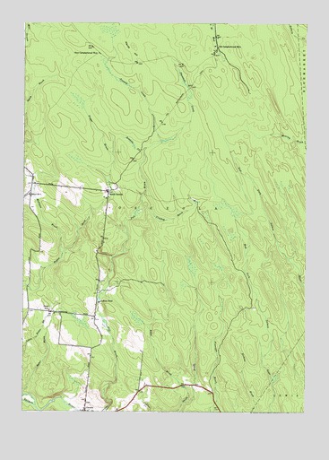
North Osceola, NY USGS Topographic Map
Click on map above to begin viewing in our Map Viewer.

This topographic map contains these locations and features:
Feature Name Type Latitude Longitude GNIS ID View Map
Baker BrookStreamN43.5053°W75.7488°942816View Map
Crooked BrookStreamN43.5645°W75.6996°947775View Map
Keese BrookStreamN43.5028°W75.6788°954438View Map
Mulligan BrookStreamN43.5506°W75.7324°958152View Map
New Campbellwood WyePopulated PlaceN43.6153°W75.7171°972833View Map
North OsceolaPopulated PlaceN43.5709°W75.7124°972871View Map
Old Campbellwood WyePopulated PlaceN43.6170°W75.6644°972891View Map
Onemile CreekStreamN43.5834°W75.6971°959378View Map
OsceolaPopulated PlaceN43.5001°W75.7221°959510View Map
Osceola Public LibraryBuildingN43.5011°W75.7221°2617379View Map
School Number 3 (historical)SchoolN43.5323°W75.7380°975289View Map
School Number 4 (historical)SchoolN43.5706°W75.7125°2353111View Map
School Number 7 (historical)SchoolN43.5695°W75.7471°975568View Map
Stone PondReservoirN43.5351°W75.7160°966512View Map
Threemile CreekStreamN43.5867°W75.6888°967469View Map
Town of OsceolaCivilN43.5628°W75.6919°979321View Map
Twomile CreekStreamN43.5867°W75.6888°968088View Map
Wards HillSummitN43.6170°W75.7021°968794View Map

Note: Coordinates in the location and feature list above are referenced to NAD83 datum.


Copyright (C) 2008-2024 Ryan Niemi / Sunset Dynamics ... All Rights Reserved