TopoQuest Logo
Do you find TopoQuest useful?
Help keep TopoQuest running and adding new maps/features by donating!
Bitcoin:  19c7KJd3qBynnjoSw5npx9KScwjBe4ifkT
Litecoin:  LXs6TkuXGGXo1vDsWCkWVdjQX94eUKd6ui
Home View Maps Find Maps Find Places Resources & Links


North Judson SE, Indiana Topographic Map

USGS Map Title: North Judson SE, IN
USGS Map MRC: 41086A7
DRG (GeoTIFF) Download: o41086a7.tif


Neighboring USGS Topographic Map Quads:


  San Pierre, IN  
41086B8
 

  North Judson, IN  
41086B7
 

  Denham, IN  
41086B6
 

  Medaryville, IN  
41086A8
 

  North Judson SE, IN  
41086A7
 

  Ripley, IN  
41086A6
 

  Francesville, IN  
40086H8
 

  Monon NE, IN  
40086H7
 

  Buffalo, IN  
40086H6


Map MRC Location:

N42°
W87°
N42°
W86°
H8 H7 H6 H5 H4 H3 H2 H1
G8 G7 G6 G5 G4 G3 G2 G1
F8 F7 F6 F5 F4 F3 F2 F1
E8 E7 E6 E5 E4 E3 E2 E1
D8 D7 D6 D5 D4 D3 D2 D1
C8 C7 C6 C5 C4 C3 C2 C1
B8 B7 B6 B5 B4 B3 B2 B1
A8 A7 A6 A5 A4 A3 A2 A1
N41°
W87°
N41°
W86°

North Judson SE, IN USGS 1:24K Topographic Map Preview:
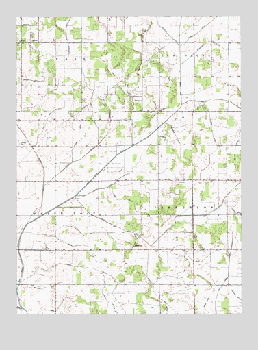
North Judson SE, IN USGS Topographic Map
Click on map above to begin viewing in our Map Viewer.

This topographic map contains these locations and features:
Feature Name Type Latitude Longitude GNIS ID View Map
Amore DitchCanalN41.0762°W86.8375°430144View Map
Antrim DitchCanalN41.0606°W86.8597°430222View Map
Bowman CemeteryCemeteryN41.0247°W86.8338°431410View Map
Circle DitchCanalN41.0003°W86.8197°432525View Map
Dunker DitchCanalN41.0684°W86.8345°433784View Map
Ender DitchCanalN41.0953°W86.8170°434194View Map
Fritz DitchCanalN41.0242°W86.7795°434876View Map
Guild DitchCanalN41.0481°W86.8136°435548View Map
Hubbell DitchCanalN41.0017°W86.8525°436561View Map
Idle CemeteryCemeteryN41.0327°W86.7765°436704View Map
Koepke DitchCanalN41.0762°W86.7656°437419View Map
Kosters CemeteryCemeteryN41.0318°W86.8086°437447View Map
Lincoln DitchCanalN41.0409°W86.7861°437909View Map
Little Alva ChurchChurchN41.1142°W86.8734°437983View Map
Lizenby DitchCanalN41.0595°W86.8114°438190View Map
Malchow DitchCanalN41.0112°W86.8589°438497View Map
Mohler DitchCanalN41.0114°W86.7989°439312View Map
Olds DitchCanalN41.0095°W86.8275°440625View Map
Pleasant Ridge ChurchChurchN41.0284°W86.8103°441303View Map
Saint Johns ChurchChurchN41.1145°W86.8661°442596View Map
Scheffer DitchCanalN41.0742°W86.7853°443064View Map
Segal DitchCanalN41.0014°W86.7695°443206View Map
Shedrow DitchCanalN41.0889°W86.8245°443327View Map
Stein DitchCanalN41.0195°W86.8370°444116View Map
Stelter DitchCanalN41.0675°W86.7528°444121View Map
Stout Hodge DitchCanalN41.0131°W86.7595°444248View Map
Sutton CemeteryCemeteryN41.0902°W86.8385°444445View Map
Tiede DitchCanalN41.0317°W86.8517°444755View Map
Township of JeffersonCivilN41.0414°W86.7571°453496View Map
Township of White PostCivilN41.0416°W86.8729°454052View Map
Wacknitz DitchCanalN41.1206°W86.8672°445336View Map
Wills DitchCanalN41.0862°W86.8328°446114View Map

Note: Coordinates in the location and feature list above are referenced to NAD83 datum.


Copyright (C) 2008-2024 Ryan Niemi / Sunset Dynamics ... All Rights Reserved