TopoQuest Logo
Do you find TopoQuest useful?
Help keep TopoQuest running and adding new maps/features by donating!
Bitcoin:  19c7KJd3qBynnjoSw5npx9KScwjBe4ifkT
Litecoin:  LXs6TkuXGGXo1vDsWCkWVdjQX94eUKd6ui
Home View Maps Find Maps Find Places Resources & Links


North East Carry, Maine Topographic Map

USGS Map Title: North East Carry, ME
USGS Map MRC: 45069G6
DRG (GeoTIFF) Download: o45069g6.tif


Neighboring USGS Topographic Map Quads:


  Seboomook Lake East, ME  
45069H7
 

  Seboomook, ME  
45069H6
 

  Penobscot Farm, ME  
45069H5
 

  Socatean Bay, ME  
45069G7
 

  North East Carry, ME  
45069G6
 

  Lobster Mountain, ME  
45069G5
 

  Brassua Lake East, ME  
45069F7
 

  Mount Kineo, ME  
45069F6
 

  Spencer Bay, ME  
45069F5


Map MRC Location:

N46°
W70°
N46°
W69°
H8 H7 H6 H5 H4 H3 H2 H1
G8 G7 G6 G5 G4 G3 G2 G1
F8 F7 F6 F5 F4 F3 F2 F1
E8 E7 E6 E5 E4 E3 E2 E1
D8 D7 D6 D5 D4 D3 D2 D1
C8 C7 C6 C5 C4 C3 C2 C1
B8 B7 B6 B5 B4 B3 B2 B1
A8 A7 A6 A5 A4 A3 A2 A1
N45°
W70°
N45°
W69°

North East Carry, ME USGS 1:24K Topographic Map Preview:
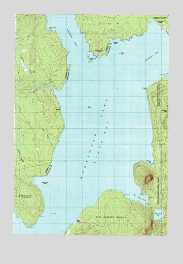
North East Carry, ME USGS Topographic Map
Click on map above to begin viewing in our Map Viewer.

This topographic map contains these locations and features:
Feature Name Type Latitude Longitude GNIS ID View Map
Big Duck CoveBayN45.7717°W69.6506°562159View Map
Big Duck PondLakeN45.7621°W69.6322°562160View Map
Big W TownshipCivilN45.8377°W69.7423°1987399View Map
Bigney CoveBayN45.8567°W69.6673°562257View Map
Center IslandIslandN45.8220°W69.6906°563757View Map
Drummond CoveBayN45.8698°W69.7220°565303View Map
Eagle MountainSummitN45.7826°W69.6396°565502View Map
Folsom FarmLocaleN45.7581°W69.6976°566364View Map
Green IslandIslandN45.8525°W69.6637°567227View Map
Little Baker BrookStreamN45.7987°W69.7170°569662View Map
Little Duck CoveBayN45.7917°W69.6403°569753View Map
Little W TownshipCivilN45.8732°W69.6747°1987422View Map
Moose BrookStreamN45.7823°W69.7376°571580View Map
Moose Brook IslandsIslandN45.7781°W69.7214°571586View Map
Norcross BrookStreamN45.8414°W69.6259°572225View Map
Norcross PointCapeN45.8328°W69.6409°572228View Map
North BayBayN45.7500°W69.7495°572250View Map
North East CarryPopulated PlaceN45.8664°W69.6264°572328View Map
Northeast CoveBayN45.8492°W69.6378°572439View Map
Northwest CoveBayN45.8637°W69.7059°572473View Map
OgontzPopulated PlaceN45.8203°W69.7131°579585View Map
Seboomook IslandIslandN45.8481°W69.6881°575180View Map
Seboomook PointCapeN45.8523°W69.6803°575183View Map
Seboomook Wilderness CampgroundLocaleN45.8517°W69.6837°1908742View Map
Toe of the BootCapeN45.7548°W69.7367°577152View Map
Williams BrookStreamN45.8337°W69.7256°578512View Map

Note: Coordinates in the location and feature list above are referenced to NAD83 datum.


Copyright (C) 2008-2024 Ryan Niemi / Sunset Dynamics ... All Rights Reserved