TopoQuest Logo
Do you find TopoQuest useful?
Help keep TopoQuest running and adding new maps/features by donating!
Bitcoin:  19c7KJd3qBynnjoSw5npx9KScwjBe4ifkT
Litecoin:  LXs6TkuXGGXo1vDsWCkWVdjQX94eUKd6ui
Home View Maps Find Maps Find Places Resources & Links


North Cape, Wisconsin Topographic Map

USGS Map Title: North Cape, WI
USGS Map MRC: 42088G1
DRG (GeoTIFF) Download: o42088g1.tif


Neighboring USGS Topographic Map Quads:


  Muskego, WI  
42088H2
 

  Hales Corners, WI  
42088H1
 

  Greendale, WI  
42087H8
 

  Waterford, WI  
42088G2
 

  North Cape, WI  
42088G1
 

  Franksville, WI  
42087G8
 

  Rochester, WI  
42088F2
 

  Union Grove, WI  
42088F1
 

  Sturtevant, WI  
42087F8


Map MRC Location:

N43°
W89°
N43°
W88°
H8 H7 H6 H5 H4 H3 H2 H1
G8 G7 G6 G5 G4 G3 G2 G1
F8 F7 F6 F5 F4 F3 F2 F1
E8 E7 E6 E5 E4 E3 E2 E1
D8 D7 D6 D5 D4 D3 D2 D1
C8 C7 C6 C5 C4 C3 C2 C1
B8 B7 B6 B5 B4 B3 B2 B1
A8 A7 A6 A5 A4 A3 A2 A1
N42°
W89°
N42°
W88°

North Cape, WI USGS 1:24K Topographic Map Preview:
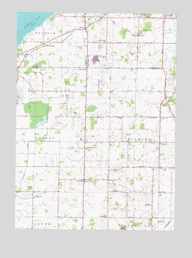
North Cape, WI USGS Topographic Map
Click on map above to begin viewing in our Map Viewer.

This topographic map contains these locations and features:
Feature Name Type Latitude Longitude GNIS ID View Map
Aero Estates AirportAirportN42.8407°W88.0649°1582171View Map
Aero Estates Landing FieldAirportN42.8558°W88.0759°1850206View Map
Apple SchoolSchoolN42.7695°W88.1079°1560912View Map
Bethlehem Lutheran ChurchChurchN42.8642°W88.0709°1850214View Map
Cindy Guntly Memorial AirportAirportN42.8136°W88.0945°1581985View Map
Deremer SchoolSchoolN42.8153°W88.0418°1563911View Map
Drought Elementary SchoolSchoolN42.8299°W88.0715°1850934View Map
DurhamPopulated PlaceN42.8664°W88.0706°1564198View Map
Durham Hill NurseryBuildingN42.8642°W88.0736°2629074View Map
East Cape SchoolSchoolN42.7789°W88.0518°1564306View Map
Franklin Park Savanna State Natural AreaParkN42.8636°W88.0428°2093522View Map
Garfield SchoolSchoolN42.7720°W88.0129°1565415View Map
Goose Lake Branch CanalCanalN42.8106°W88.1059°1565664View Map
KneelandPopulated PlaceN42.8267°W88.0084°1567568View Map
Luther Parker CemeteryCemeteryN42.8725°W88.0725°2096603View Map
McPherson CemeteryCemeteryN42.7856°W88.0070°1569273View Map
Muskego Lakes County ClubLocaleN42.8708°W88.0926°1850290View Map
North CapePopulated PlaceN42.7786°W88.0709°1570404View Map
North Cape Elementary SchoolSchoolN42.7795°W88.0673°1850974View Map
North Cape Lutheran ChurchChurchN42.7975°W88.0690°1570405View Map
Oak Grove CemeteryCemeteryN42.8150°W88.0116°1570608View Map
Oak Grove SchoolSchoolN42.8567°W88.1018°1570620View Map
Rainbow Airport (historical)AirportN42.8645°W88.0062°1582083View Map
RaymondPopulated PlaceN42.8009°W88.0126°1572111View Map
Raymond Baptist ChurchChurchN42.7867°W88.0284°1572114View Map
Raymond Fire and Rescue DepartmentBuildingN42.8050°W88.0131°2697925View Map
Raymond SchoolSchoolN42.7980°W88.0141°1850989View Map
Raymond Seventh Day Adventist ChurchChurchN42.7575°W88.0529°1572113View Map
Raymond Town HallBuildingN42.7995°W88.0131°1850990View Map
Raymond United Church of ChristChurchN42.8153°W88.0201°1572115View Map
Salem CemeteryCemeteryN42.8431°W88.0509°1573612View Map
Tess Corners Volunteer Fire Department Station 2BuildingN42.8634°W88.0830°2697496View Map
Town of RaymondCivilN42.8004°W88.0120°1583999View Map
Union ChurchPopulated PlaceN42.8436°W88.0693°1575900View Map
Valhalla AirportAirportN42.7613°W88.0426°1582114View Map
WBZN-FM (Racine)TowerN42.8050°W88.0484°1582621View Map
Willow Edge SchoolSchoolN42.8589°W88.0540°1576788View Map
WISN-AM (Milwaukee)TowerN42.7550°W88.0815°1582562View Map

Note: Coordinates in the location and feature list above are referenced to NAD83 datum.


Copyright (C) 2008-2024 Ryan Niemi / Sunset Dynamics ... All Rights Reserved