TopoQuest Logo
Do you find TopoQuest useful?
Help keep TopoQuest running and adding new maps/features by donating!
Bitcoin:  19c7KJd3qBynnjoSw5npx9KScwjBe4ifkT
Litecoin:  LXs6TkuXGGXo1vDsWCkWVdjQX94eUKd6ui
Home View Maps Find Maps Find Places Resources & Links


New Site, Alabama Topographic Map

USGS Map Title: New Site, AL
USGS Map MRC: 33085A7
DRG (GeoTIFF) Download: o33085a7.tif


Neighboring USGS Topographic Map Quads:


  Millerville, AL  
33085B8
 

  Gibsonville, AL  
33085B7
 

  Mellow Valley, AL  
33085B6
 

  Hackneyville, AL  
33085A8
 

  New Site, AL  
33085A7
 

  Daviston, AL  
33085A6
 

  Alexander City, AL  
32085H8
 

  Jacksons Gap, AL  
32085H7
 

  Buttston, AL  
32085H6


Map MRC Location:

N34°
W86°
N34°
W85°
H8 H7 H6 H5 H4 H3 H2 H1
G8 G7 G6 G5 G4 G3 G2 G1
F8 F7 F6 F5 F4 F3 F2 F1
E8 E7 E6 E5 E4 E3 E2 E1
D8 D7 D6 D5 D4 D3 D2 D1
C8 C7 C6 C5 C4 C3 C2 C1
B8 B7 B6 B5 B4 B3 B2 B1
A8 A7 A6 A5 A4 A3 A2 A1
N33°
W86°
N33°
W85°

New Site, AL USGS 1:24K Topographic Map Preview:
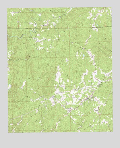
New Site, AL USGS Topographic Map
Click on map above to begin viewing in our Map Viewer.

This topographic map contains these locations and features:
Feature Name Type Latitude Longitude GNIS ID View Map
Barnes Memorial ParkParkN33.0318°W85.7819°113496View Map
Bethel CemeteryCemeteryN33.1157°W85.8125°1805371View Map
Bethel ChurchChurchN33.1162°W85.8114°114026View Map
Bethleham (historical)Populated PlaceN33.0482°W85.7636°137371View Map
Bethlehem CemeteryCemeteryN33.0451°W85.7672°158680View Map
Bethlehem ChurchChurchN33.0454°W85.7669°114115View Map
Blairs Store (historical)LocaleN33.1098°W85.8166°151037View Map
Brewer CreekStreamN33.1160°W85.8347°114866View Map
Cotney Lot CreekStreamN33.0735°W85.7513°116672View Map
CowpensPopulated PlaceN33.0354°W85.8227°116772View Map
Dewberry BranchStreamN33.0421°W85.7994°117263View Map
GoldvillePopulated PlaceN33.0837°W85.7838°156414View Map
Hands Store (historical)LocaleN33.1085°W85.7713°139670View Map
Harlan (historical)LocaleN33.1201°W85.7658°139671View Map
Harmony (historical)Populated PlaceN33.0236°W85.7667°137446View Map
Harmony CemeteryCemeteryN33.0218°W85.7672°137447View Map
Harmony ChurchChurchN33.0348°W85.7738°119749View Map
Harmony Presbyterian ChurchChurchN33.0212°W85.7672°152777View Map
Hog MountainSummitN33.0760°W85.8497°120197View Map
Hog Mountain GoldmineMineN33.0726°W85.8514°137455View Map
Hutchinson CemeteryCemeteryN33.0157°W85.7647°137458View Map
Jones CreekStreamN33.0951°W85.8572°121006View Map
Jones Vane CreekStreamN33.0835°W85.7552°121032View Map
Kennedy BranchStreamN33.1243°W85.8277°121147View Map
McClendon CemeteryCemeteryN33.0183°W85.7560°157339View Map
Mount Godfrey ChurchChurchN33.0068°W85.7555°123198View Map
Mount Zion ChurchChurchN33.0529°W85.7536°123435View Map
New Hope CemeteryCemeteryN33.0896°W85.8527°123785View Map
New Salem Baptist ChurchChurchN33.0471°W85.7661°158886View Map
New SitePopulated PlaceN33.0373°W85.7741°155177View Map
New Site High SchoolSchoolN33.0340°W85.7800°137485View Map
New Site Volunteer Fire and Ambulance ServiceBuildingN33.0339°W85.7804°2691292View Map
Old Salem CemeteryCemeteryN33.0059°W85.7755°124243View Map
Osborn CreekStreamN33.1012°W85.8405°152822View Map
Parishs Store (historical)LocaleN33.1218°W85.7616°139681View Map
Patterson DamDamN33.0768°W85.7833°131191View Map
Patterson LakeReservoirN33.0768°W85.7839°131192View Map
PerryvillePopulated PlaceN33.0212°W85.8013°124627View Map
Perryville Baptist ChurchChurchN33.0218°W85.8011°1959594View Map
Piedmont UplandAreaN33.0835°W85.8333°148952View Map
Poe BranchStreamN33.0382°W85.7969°125073View Map
Reedy SpringSpringN33.0812°W85.8366°146544View Map
Rocky CreekStreamN33.0435°W85.8733°125844View Map
Rocky Creek ChurchChurchN33.0368°W85.8322°150011View Map
Rotton CreekStreamN33.0451°W85.8594°125963View Map
Town of GoldvilleCivilN33.0841°W85.7831°2406586View Map
Town of New SiteCivilN33.0282°W85.7801°2406980View Map
Valley Grove CemeteryCemeteryN33.0946°W85.8433°137545View Map
Valley Grove ChurchChurchN33.0948°W85.8447°128392View Map
Valley Grove School (historical)SchoolN33.0948°W85.8447°158712View Map
Whatley DamDamN33.0218°W85.8400°131157View Map
Whatley PondReservoirN33.0218°W85.8400°131158View Map
Zion Hill School (historical)SchoolN33.1201°W85.8594°139688View Map

Note: Coordinates in the location and feature list above are referenced to NAD83 datum.


Copyright (C) 2008-2024 Ryan Niemi / Sunset Dynamics ... All Rights Reserved