TopoQuest Logo
Do you find TopoQuest useful?
Help keep TopoQuest running and adding new maps/features by donating!
Bitcoin:  19c7KJd3qBynnjoSw5npx9KScwjBe4ifkT
Litecoin:  LXs6TkuXGGXo1vDsWCkWVdjQX94eUKd6ui
Home View Maps Find Maps Find Places Resources & Links


New Albin, Iowa Topographic Map

USGS Map Title: New Albin, IA
USGS Map MRC: 43091D3
DRG (GeoTIFF) Download: o43091d3.tif


Neighboring USGS Topographic Map Quads:


  Eitzen, MN  
43091E4
 

  Reno, MN  
43091E3
 

  Genoa, WI  
43091E2
 

  Waukon NW, IA  
43091D4
 

  New Albin, IA  
43091D3
 

  De Soto, WI  
43091D2
 

  Waukon, IA  
43091C4
 

  Church, IA  
43091C3
 

  Lansing, IA  
43091C2


Map MRC Location:

N44°
W92°
N44°
W91°
H8 H7 H6 H5 H4 H3 H2 H1
G8 G7 G6 G5 G4 G3 G2 G1
F8 F7 F6 F5 F4 F3 F2 F1
E8 E7 E6 E5 E4 E3 E2 E1
D8 D7 D6 D5 D4 D3 D2 D1
C8 C7 C6 C5 C4 C3 C2 C1
B8 B7 B6 B5 B4 B3 B2 B1
A8 A7 A6 A5 A4 A3 A2 A1
N43°
W92°
N43°
W91°

New Albin, IA USGS 1:24K Topographic Map Preview:
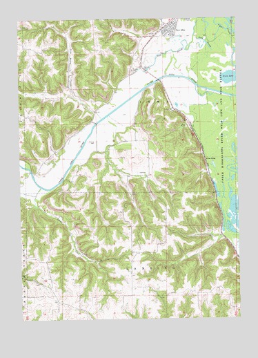
New Albin, IA USGS Topographic Map
Click on map above to begin viewing in our Map Viewer.

This topographic map contains these locations and features:
Feature Name Type Latitude Longitude GNIS ID View Map
Blackhawk Point Wildlife Management AreaParkN43.4639°W91.2974°1948786View Map
City of New AlbinCivilN43.4970°W91.2882°2395183View Map
Clark CreekStreamN43.4303°W91.3635°455431View Map
Duck LakeLakeN43.4764°W91.2534°456046View Map
Fish Farms Mounds Wildlife Management AreaParkN43.4478°W91.2824°463774View Map
Grace United Methodist ChurchChurchN43.4966°W91.2896°1948840View Map
Hayes Lake Roadside ParkParkN43.4789°W91.3029°1948857View Map
Holy Cross CemeteryCemeteryN43.4633°W91.3298°1948938View Map
Irish Hollow CreekStreamN43.4583°W91.3279°457851View Map
Kains Lake Wildlife Management AreaParkN43.4583°W91.2765°1948785View Map
Kains SidingLocaleN43.4408°W91.2687°458016View Map
Lansing Wildlife Management AreaParkN43.3972°W91.2701°1948784View Map
New AlbinLocaleN43.4972°W91.2885°1948843View Map
New AlbinPopulated PlaceN43.4966°W91.2896°459464View Map
New Albin Big Lake Public Hunting AreaAreaN43.4764°W91.2601°464351View Map
New Albin Big Lake Wildlife Management AreaParkN43.4805°W91.2612°1948787View Map
New Albin Elementary SchoolSchoolN43.4931°W91.2880°1948842View Map
New Albin Municipal BuildingBuildingN43.4966°W91.2896°1948839View Map
New Albin Police DepartmentBuildingN43.4966°W91.2896°1948836View Map
New Albin Post OfficePost OfficeN43.4966°W91.2896°1948838View Map
New Albin Volunteer Fire DepartmentBuildingN43.4961°W91.2882°1948837View Map
Pool SloughGutN43.4858°W91.2887°460359View Map
Pool Slough Wildlife Management AreaParkN43.4958°W91.2779°1948788View Map
Saint Josephs Catholic ChurchChurchN43.4966°W91.2896°1948841View Map
Saint Peters CemeteryCemeteryN43.4858°W91.3085°1948936View Map
Township of IowaCivilN43.4645°W91.2953°468076View Map
Township of LansingCivilN43.3844°W91.2856°468192View Map
Wood SloughGutN43.4894°W91.2674°463179View Map

Note: Coordinates in the location and feature list above are referenced to NAD83 datum.


Copyright (C) 2008-2024 Ryan Niemi / Sunset Dynamics ... All Rights Reserved